فهرست میراث جهانی در آسیای شرقی

از ویکی‌پدیا، دانشنامهٔ آزاد

فهرست میراث جهانی در آسیای شرقی شامل ۷۱ میراث جهانی در ۵ کشور چین، مغولستان، کره شمالی، کره جنوبی و ژاپن می‌شود.[۱][۲]

در این منطقه از آسیا چین با ۴۱ میراث ثبت شده در یونسکو بیشتر میراث جهانی را دارد.[۳] دیوار بزرگ چین، کوه تای، زوکودیان ٬لشکر سفالین، شهر ممنوعه، قصر موکدن و غار موگای نخستین مکان‌هایی بودند که در ۱۹۸۷ در این منطقه در فهرست میراث جهانی ثبت شدند.[۴]

میراث‌ها با شش معیار برای میراث فرهنگی و چهار معیار برای میراث طبیعی مشخص می‌شوند.[۵] در آسیای شرقی از ۷۱ میراث ثبت شده تا سال ۲۰۱۱ ۵۳ میراث فرهنگی، ۱۴ میراث طبیعی و ۴ میراث ترکیبی بوده‌است..[۳] تا کنون هیچ یک از میراث ثبت شده در این منطقه در فهرست میراث در خطر قرار نگرفته‌اند. [۶]

کشورها[ویرایش]

# کشورها تعداد میراث فرهنگی طبیعی ترکیبی در خطر توضیحات تاریخ پیوستن به یونسکو منبع
۱ چین چین ۴۱ ۲۹ ۸ ۴ ۰ سومین کشور در جهان و ۱۶ نوامبر ۱۹۷۲ [۷]
۲ ژاپن ژاپن ۱۶ ۱۲ ۴ ۰ ۰ - ۱۶ نوامبر ۱۹۷۲ [۸]
۳ کره جنوبی کره جنوبی
۴ کره شمالی کره شمالی
۵ مغولستان مغولستان

شرح[ویرایش]

نمایش مختصات در نقشهٔ: اوپن‌استریت‌مپ 
بارگیری مختصات: KML
نام; توسط کمیته میراث جهانی فهرست شده اند[۹]
مکان; شهر ٬استان یا نام کشور، با مختصات [nb ۱]
معیارها; ذکر شده برای میراث
مساحت; برپایه هکتار
سال; سالی که در فهرست میراث جهانی ثبت شده‌است.
خطر; سال قرار گرفتن فهرست میراث جهانی در معرض خطر
دلیل;تهدید مورد نظر

فهرست میراث[ویرایش]

  * در کنار مرزهای ملی قرار دارند.
منطقه تصویر موقعیت معیارها مساحت
هکتار(جریب)
سال توضیحات منابع
کوهستان وودانگ A complex of interconnected traditional houses with tile roofs and red walls. Danjiangkou, هوبئی,  چین
۳۲°۲۸′۰″ شمالی ۱۱۱°۰′۰″ شرقی / ۳۲٫۴۶۶۶۷°شمالی ۱۱۱٫۰۰۰۰۰°شرقی / 32.46667; 111.00000 (Ancient Building Complex in the Wudang Mountains)
فرهنگی:
(i)(ii)(vi)
۱۹۹۴ [۱۰]
پینگ یائو A street lined by traditional houses with red lampions leading to a multi-storied gate. پینگ یائو, شانشی,  چین
۳۷°۱۲′۵″ شمالی ۱۱۲°۹′۱۶″ شرقی / ۳۷٫۲۰۱۳۹°شمالی ۱۱۲٫۱۵۴۴۴°شرقی / 37.20139; 112.15444 (Ancient City of Ping Yao)
فرهنگی:
(ii)(iii)(iv)
۱۹۹۷ [۱۱]
زیدی (روستا) و هانگکن Small street lined by white houses with tile roofs. هوانگشان, Yi County, آن‌هوئی,  چین
۲۹°۵۴′۱۶″ شمالی ۱۱۷°۵۹′۱۵″ شرقی / ۲۹٫۹۰۴۴۴°شمالی ۱۱۷٫۹۸۷۵۰°شرقی / 29.90444; 117.98750 (Ancient Villages in Southern Anhui – Xidi and Hongcun)
فرهنگی:
(iii)(iv)(v)
۵۲ (۱۳۰); buffer zone ۷۳۰ (۱٬۸۰۰) ۲۰۰۰ [۱۲]
کوههای بودایی هوریو جی A two-storied wooden gate and a pagoda in the background. استان نارا,  ژاپن
۳۴°۳۷′۰″ شمالی ۱۳۵°۴۴′۰″ شرقی / ۳۴٫۶۱۶۶۷°شمالی ۱۳۵٫۷۳۳۳۳°شرقی / 34.61667; 135.73333 (Buddhist Monuments in the Horyu-ji Area)
فرهنگی:
(i)(ii)(iv)(vi)
۱۵ (۳۷); buffer zone ۵۷۱ (۱٬۴۱۰) ۱۹۹۳ [۱۳]
پایتخت و آرامگاه‌های پادشاهی کوگوریو Ruins of a low step-pyramid like structure. Huanren Manchu Autonomous County, لیائونینگ and Ji'an, جی‌لین,  چین
۴۱°۹′۲۵″ شمالی ۱۲۶°۱۱′۱۴″ شرقی / ۴۱٫۱۵۶۹۴°شمالی ۱۲۶٫۱۸۷۲۲°شرقی / 41.15694; 126.18722 (Capital Cities and Tombs of the Ancient Koguryo Kingdom)
فرهنگی:
(i)(ii)(iii)(iv)(v)
۴٬۱۶۵ (۱۰٬۲۹۰); buffer zone ۱۴٬۱۴۲ (۳۴٬۹۵۰) ۲۰۰۴ [۱۴]
چانگ دیوک گونگ Two storied traditional building with tile roof and walls decorated in red, green and yellow. سئول,  کره جنوبی
۳۷°۳۳′۰″ شمالی ۱۲۶°۵۹′۰″ شرقی / ۳۷٫۵۵۰۰۰°شمالی ۱۲۶٫۹۸۳۳۳°شرقی / 37.55000; 126.98333 (Changdeokgung Palace Complex)
فرهنگی:
(ii)(iii)(iv)
۱۹۹۷ [۱۵]
دان‌شیای چین
Red rock face.
فوجیان, هونان, گوانگ‌دونگ, جیانگشی, چجیانگ and گوئیژو,  چین
۲۸°۲۵′۱۹″ شمالی ۱۰۶°۲′۳۳″ شرقی / ۲۸٫۴۲۱۹۴°شمالی ۱۰۶٫۰۴۲۵۰°شرقی / 28.42194; 106.04250 (China Danxia)
طبیعی:
(vii)(viii)
۸۲٬۱۵۱ (۲۰۳٬۰۰۰); buffer zone ۲۱۸٬۳۵۷ (۵۳۹٬۵۷۰) ۲۰۱۰ [۱۶]
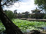
باغ سوژو Chinese style pavillion near a pond with lotuses. سوژو, جیانگسو,  چین
۳۱°۱۹′۰″ شمالی ۱۲۰°۲۷′۰″ شرقی / ۳۱٫۳۱۶۶۷°شمالی ۱۲۰٫۴۵۰۰۰°شرقی / 31.31667; 120.45000 (Classical Gardens of Suzhou)
فرهنگی:
(i)(ii)(iii)(iv)(v)
۱۲ (۳۰); buffer zone ۲۷ (۶۷) ۱۹۹۷[nb ۲] [۱۷]
مجموعه آرامگاه‌های گوگوریو Mural of men on horses with bows and arrows shooting deer. پیونگ‌یانگ and نامپو,  کره شمالی
۳۸°۵۱′۴۷″ شمالی ۱۲۵°۲۴′۵۴″ شرقی / ۳۸٫۸۶۳۰۶°شمالی ۱۲۵٫۴۱۵۰۰°شرقی / 38.86306; 125.41500 (Complex of Koguryo Tombs)
فرهنگی:
(i)(ii)(iii)(iv)
۲۳۳ (۵۸۰); buffer zone ۱٬۷۰۱ (۴٬۲۰۰) ۲۰۰۴ [۱۸]
سنگ‌نگاره‌های دازو Stone sculptures of people interacting with each other and in the background a row of much larger seated buddha sculptures. چونگ‌کینگ,  چین
۲۹°۴۲′۴″ شمالی ۱۰۵°۴۲′۱۸″ شرقی / ۲۹٫۷۰۱۱۱°شمالی ۱۰۵٫۷۰۵۰۰°شرقی / 29.70111; 105.70500 (Dazu Rock Carvings)
فرهنگی:
(i)(ii)(iii)
۲۰ (۴۹); buffer zone ۲۱۱ (۵۲۰) ۱۹۹۹ [۱۹]
فوجیان تالو A number of circular buildings with an interior courtyard. There are only few and small windows to the outside and balconies on the inner courtyard side. فوجیان,  چین
۲۵°۱′۲۳″ شمالی ۱۱۷°۴۱′۹″ شرقی / ۲۵٫۰۲۳۰۶°شمالی ۱۱۷٫۶۸۵۸۳°شرقی / 25.02306; 117.68583 (Fujian Tulou)
فرهنگی:
(iii)(iv)(v)
۱۵۳ (۳۸۰); buffer zone ۹۳۵ (۲٬۳۱۰) ۲۰۰۸ [۲۰]
Gochang, Hwasun and Ganghwa Dolmen Sites A tall dolmen consisting of two standing stones carrying one horizontal stone on top. Gochang, جئولابوک-دو; Hwasun, جئولانام-دو and Ganghwa, اینچئون,  کره جنوبی
۳۴°۵۸′۰″ شمالی ۱۲۶°۵۵′۴۵″ شرقی / ۳۴٫۹۶۶۶۷°شمالی ۱۲۶٫۹۲۹۱۷°شرقی / 34.96667; 126.92917 (Gochang, Hwasun and Ganghwa Dolmen Sites)
فرهنگی:
(iii)
۵۲ (۱۳۰); buffer zone ۳۱۵ (۷۸۰) ۲۰۰۰ [۲۱]
سرزمین‌های گوسوکو و دارائی‌های پادشاهی ریوکیو Complex of traditional houses with red tile roofs and a grey wall. استان اوکیناوا,  ژاپن
۲۶°۱۲′۳۱″ شمالی ۱۲۷°۴۰′۵۸″ شرقی / ۲۶٫۲۰۸۶۱°شمالی ۱۲۷٫۶۸۲۷۸°شرقی / 26.20861; 127.68278 (Gusuku Sites and Related Properties of the Kingdom of Ryukyu)
فرهنگی:
(ii)(iii)(vi)
۵۵ (۱۴۰); buffer zone ۵۶۰ (۱٬۴۰۰) ۲۰۰۰ [۲۲]
گیونگجو Several grass covered mounds. گیونگجو, جئونسانگبوک-دو,  کره جنوبی
۳۵°۴۷′۲۰″ شمالی ۱۲۹°۱۳′۳۶″ شرقی / ۳۵٫۷۸۸۸۹°شمالی ۱۲۹٫۲۲۶۶۷°شرقی / 35.78889; 129.22667 (Gyeongju Historic Areas)
فرهنگی:
(ii)(iii)
۲٬۸۸۰ (۷٬۱۰۰); buffer zone ۳۵۰ (۸۶۰) ۲۰۰۰ [۲۳]
معبد هائینسا و معبد هائینسا, تریپیتاکا کوریانا A very long bookshelf with identically looking books in a corridor.  کره جنوبی
۳۵°۴۸′۰″ شمالی ۱۲۸°۶′۰″ شرقی / ۳۵٫۸۰۰۰۰°شمالی ۱۲۸٫۱۰۰۰۰°شرقی / 35.80000; 128.10000 (Haeinsa Temple Janggyeong Panjeon, the Depositories for the Tripitaka Koreana Woodblocks)
فرهنگی:
(iv)(vi)
۱۹۹۵ [۲۴]
قصر هیمجی A multistoried white castle donjon with several small towers and a main tower on a platform of stone. استان هیوگو,  ژاپن
۳۴°۵۰′۰″ شمالی ۱۳۴°۴۲′۰″ شرقی / ۳۴٫۸۳۳۳۳°شمالی ۱۳۴٫۷۰۰۰۰°شرقی / 34.83333; 134.70000 (Himeji-jo)
فرهنگی:
(i)(iv)
۱۰۷ (۲۶۰); buffer zone ۱۴۳ (۳۵۰) ۱۹۹۳ [۲۵]
اماکن تاریخی هیرائی زومی Small rocks in a lake استان ایواته,  ژاپن
۳۴°۳۷′۰″ شمالی ۱۳۵°۴۴′۰″ شرقی / ۳۴٫۶۱۶۶۷°شمالی ۱۳۵٫۷۳۳۳۳°شرقی / 34.61667; 135.73333 (Hiraizumi – Temples, Gardens and Archaeological Sites Representing the Buddhist Pure Land)
فرهنگی:
(ii)(vi)
۱۷۶ (۴۳۰); buffer zone ۶٬۰۰۸ (۱۴٬۸۵۰) ۲۰۱۱ [۲۶]
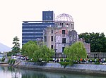
یادمان صلح هیروشیما Ruins of a building with a dome Hiroshima, استان هیروشیما,  ژاپن
۳۴°۲۳′۰″ شمالی ۱۳۲°۲۷′۰″ شرقی / ۳۴٫۳۸۳۳۳°شمالی ۱۳۲٫۴۵۰۰۰°شرقی / 34.38333; 132.45000 (Hiroshima Peace Memorial (Genbaku Dome))
فرهنگی:
(vi)
۰٫۴۰ (۰٫۹۹); buffer zone ۴۳ (۱۱۰) ۱۹۹۶ [۲۷]
مرکز تاریخی ماکائو Facade of a church. The rest of the building does not exist. ماکائو,  چین
۲۲°۱۱′۲۹″ شمالی ۱۱۳°۳۲′۱۱″ شرقی / ۲۲٫۱۹۱۳۹°شمالی ۱۱۳٫۵۳۶۳۹°شرقی / 22.19139; 113.53639 (Historic Centre of Macao)
فرهنگی:
(ii)(iii)(iv)(vi)
۱۶ (۴۰); buffer zone ۱۰۷ (۲۶۰) ۲۰۰۵ [۲۸]
قصر پوتالا
معبد جوخانگ
معبد نوربولینگکا
A large red and white building complex built on a rocky hill. لهاسا, منطقه خودمختار تبت,  چین
۲۹°۳۹′۲۸٫۵″ شمالی ۹۱°۷′۲″ شرقی / ۲۹٫۶۵۷۹۱۷°شمالی ۹۱٫۱۱۷۲۲°شرقی / 29.657917; 91.11722 (Historic Ensemble of the Potala Palace, Lhasa)
فرهنگی:
(i)(iv)(vi)
۶۱ (۱۵۰); buffer zone ۱۹۹ (۴۹۰) ۱۹۹۴[nb ۳] [۲۹]
[۳۰]
[۳۱]
آثار تاریخی و باستانی کیوتو A three storied pavilion. The lower story is in wood and white color, the two upper stories golden. استان کیوتو and استان شیگا Prefectures,  ژاپن
۳۴°۵۸′۵۰″ شمالی ۱۳۵°۴۶′۱۰″ شرقی / ۳۴٫۹۸۰۵۶°شمالی ۱۳۵٫۷۶۹۴۴°شرقی / 34.98056; 135.76944 (Historic Monuments of Ancient Kyoto (Kyoto, Uji and Otsu Cities))
فرهنگی:
(ii)(iv)
۱٬۰۵۶ (۲٬۶۱۰); buffer zone ۳٬۵۷۹ (۸٬۸۴۰) ۱۹۹۴ [۳۲]
Historic Monuments of Ancient Nara A large building with wooden beams and white walls. نارا (ژاپن), استان نارا,  ژاپن
۳۴°۴۰′۳۲″ شمالی ۱۳۵°۵۰′۲۲″ شرقی / ۳۴٫۶۷۵۵۶°شمالی ۱۳۵٫۸۳۹۴۴°شرقی / 34.67556; 135.83944 (Historic Monuments of Ancient Nara)
فرهنگی:
(ii)(iii)(iv)(vi)
۶۱۷ (۱٬۵۲۰); buffer zone ۲٬۵۰۲ (۶٬۱۸۰) ۱۹۹۸ [۳۳]
دنگ فنگ A red building with a tile roof. استان هنان,  چین
۳۴°۲۷′۳۱٫۵″ شمالی ۱۱۳°۴′۳٫۸″ شرقی / ۳۴٫۴۵۸۷۵۰°شمالی ۱۱۳٫۰۶۷۷۲۲°شرقی / 34.458750; 113.067722 (Historic Monuments of Dengfeng in “The Centre of Heaven and Earth”)
فرهنگی:
(iii)(vi)
۸۲۵ (۲٬۰۴۰); buffer zone ۳٬۴۳۸ (۸٬۵۰۰) ۲۰۱۰ [۳۴]
Historic Villages of Korea: Hahoe and Yangdong Overview of a village with traditional houses.  کره جنوبی
۳۶°۳۲′۲۱″ شمالی ۱۲۸°۳۱′۰″ شرقی / ۳۶٫۵۳۹۱۷°شمالی ۱۲۸٫۵۱۶۶۷°شرقی / 36.53917; 128.51667 (Historic Villages of Korea: Hahoe and Yangdong)
فرهنگی:
(iii)(iv)
۶۰۰ (۱٬۵۰۰); buffer zone ۸۸۵ (۲٬۱۹۰) ۲۰۱۰ [۳۵]
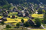
روستاهای تاریخی شیراکاواگو و گوکایاما A village with wooden houses with steep roofs. استان گیفو and استان تویاما Prefectures,  ژاپن
۳۶°۲۴′۰″ شمالی ۱۳۶°۵۳′۰″ شرقی / ۳۶٫۴۰۰۰۰°شمالی ۱۳۶٫۸۸۳۳۳°شرقی / 36.40000; 136.88333 (Historic Villages of Shirakawa-go and Gokayama)
فرهنگی:
(iv)(v)
۶۸ (۱۷۰); buffer zone ۵۸٬۸۷۳ (۱۴۵٬۴۸۰) ۱۹۹۵ [۳۶]
هانگ لونگ Turquoise colored limestone ponds. Songpan County, سیچوآن,  چین
۳۲°۴۵′۱۵″ شمالی ۱۰۳°۴۹′۲۰″ شرقی / ۳۲٫۷۵۴۱۷°شمالی ۱۰۳٫۸۲۲۲۲°شرقی / 32.75417; 103.82222 (Huanglong Scenic and Historic Interest Area)
طبیعی:
(vii)
۶۰٬۰۰۰ (۱۵۰٬۰۰۰) ۱۹۹۲ [۳۷]
دژ هوآسیونگ Wall, tower and roofs of one larger building of a fortress. گیونگی-دو,  کره جنوبی
۳۷°۱۶′۲۰″ شمالی ۱۲۷°۰′۳۰″ شرقی / ۳۷٫۲۷۲۲۲°شمالی ۱۲۷٫۰۰۸۳۳°شرقی / 37.27222; 127.00833 (Hwaseong Fortress)
فرهنگی:
(ii)(iii)
۱۹۹۷ [۳۸]
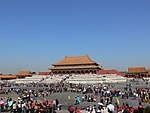
شهر ممنوعه و قصر موکدن A large building with red roof on the top of a white staircase. پکن and شن‌یانگ, لیائونینگ,  چین
۴۱°۴۷′۳۹″ شمالی ۱۲۳°۲۶′۴۹″ شرقی / ۴۱٫۷۹۴۱۷°شمالی ۱۲۳٫۴۴۶۹۴°شرقی / 41.79417; 123.44694 (Imperial Palaces of the Ming and Qing Dynasties in Beijing and Shenyang)
فرهنگی:
(i)(ii)(iii)(iv)
۱۳ (۳۲); buffer zone ۱۵۳ (۳۸۰) ۱۹۸۷[nb ۴] [۳۹]
آرامگاه سلطنتی دودمان چینگ و مینگ . نانجینگ, جیانگسو; چانگپینگ, پکن; لیائونینگ; هوبئی,  چین
فرهنگی:
(i)(ii)(iii)(iv)(vi)
۳٬۴۳۵ (۸٬۴۹۰); buffer zone ۲۳٬۴۲۹ (۵۷٬۸۹۰) ۲۰۰۰[nb ۵] [۴۰]
[۴۱]
[۴۲]
معبد ایتسوکوشیما Red and white wooden buildings over water and a large wooden gate in the water Itsukushima, استان هیروشیما,  ژاپن
۳۴°۱۷′۳۹٫۹″ شمالی ۱۳۲°۱۹′۲۸٫۷″ شرقی / ۳۴٫۲۹۴۴۱۷°شمالی ۱۳۲٫۳۲۴۶۳۹°شرقی / 34.294417; 132.324639 (Itsukushima Shinto Shrine)
فرهنگی:
(i)(ii)(iv)(vi)
۴۳۱ (۱٬۰۷۰); buffer zone ۲٬۶۳۴ (۶٬۵۱۰) ۱۹۹۶ [۴۳]
کوه نقره ایوامی Ruins of terraces built on a hillside. اودا، شیمانه, استان شیمانه,  ژاپن
۳۵°۶′۴۶″ شمالی ۱۳۲°۲۶′۶″ شرقی / ۳۵٫۱۱۲۷۸°شمالی ۱۳۲٫۴۳۵۰۰°شرقی / 35.11278; 132.43500 (Iwami Ginzan Silver Mine and its Cultural Landscape)
فرهنگی:
(ii)(iii)(v)
۵۲۹ (۱٬۳۱۰); buffer zone ۳٬۱۳۴ (۷٬۷۴۰) ۲۰۰۷[nb ۶] [۴۴]
[۴۵]
Jeju Volcanic Island and Lava Tubes View into an inactive volcanic crater with a small like. ججو-دو,  کره جنوبی
۳۳°۲۸′۸″ شمالی ۱۲۶°۴۳′۱۳″ شرقی / ۳۳٫۴۶۸۸۹°شمالی ۱۲۶٫۷۲۰۲۸°شرقی / 33.46889; 126.72028 (Jeju Volcanic Island and Lava Tubes)
طبیعی:
(vii)(viii)
۹٬۴۷۵ (۲۳٬۴۱۰); buffer zone ۹٬۳۷۱ (۲۳٬۱۶۰) ۲۰۰۷ [۴۶]
دره جیوژایگو
Mountain valley with a green, blue and turquoise colored river.
Jiuzhaigou County, سیچوآن,  چین
۳۳°۵′۰″ شمالی ۱۰۳°۵۵′۰″ شرقی / ۳۳٫۰۸۳۳۳°شمالی ۱۰۳٫۹۱۶۶۷°شرقی / 33.08333; 103.91667 (Jiuzhaigou Valley Scenic and Historic Interest Area)
طبیعی:
(vii)
۷۲٬۰۰۰ (۱۸۰٬۰۰۰) ۱۹۹۲ [۴۷]
جانگمیو Very wide and narrow building with a prominent roof and red columns. سئول,  کره جنوبی
۳۷°۳۳′۰″ شمالی ۱۲۶°۵۹′۰″ شرقی / ۳۷٫۵۵۰۰۰°شمالی ۱۲۶٫۹۸۳۳۳°شرقی / 37.55000; 126.98333 (Jongmyo Shrine)
فرهنگی:
(iv)
۱۹ (۴۷) ۱۹۹۵ [۴۸]
کای‌پینگ دیائولو
A multi-storied tower like house with white walls.
گوانگ‌دونگ,  چین
۲۹°۵۴′۱۶″ شمالی ۱۱۷°۵۹′۱۵″ شرقی / ۲۹٫۹۰۴۴۴°شمالی ۱۱۷٫۹۸۷۵۰°شرقی / 29.90444; 117.98750 (Kaiping Diaolou and Villages)
فرهنگی:
(ii)(iii)(iv)
۳۷۲ (۹۲۰); buffer zone ۲٬۷۳۸ (۶٬۷۷۰) ۲۰۰۷ [۴۹]
غارهای بودایی لونگ‌من Carved Buddhist deities in a rock face. لوئویانگ, استان هنان,  چین
۳۴°۲۸′۰″ شمالی ۱۱۲°۲۸′۰″ شرقی / ۳۴٫۴۶۶۶۷°شمالی ۱۱۲٫۴۶۶۶۷°شرقی / 34.46667; 112.46667 (Longmen Grottoes)
فرهنگی:
(i)(ii)(iii)
۳۳۱ (۸۲۰); buffer zone ۱٬۰۴۲ (۲٬۵۷۰) ۲۰۰۰ [۵۰]
پارک ملی لوشان A long stone bridge crossing a lake. جیاجیانگ, جیانگشی,  چین
۲۹°۲۶′۰″ شمالی ۱۱۵°۵۲′۰″ شرقی / ۲۹٫۴۳۳۳۳°شمالی ۱۱۵٫۸۶۶۶۷°شرقی / 29.43333; 115.86667 (Lushan National Park)
فرهنگی:
(ii)(iii)(iv)(vi)
۱۹۹۶ [۵۱]
لشکر سفالین A large number of lined up human sculptures in a pit. Lintong District, شاآنشی,  چین
۳۴°۲۳′۰″ شمالی ۱۰۹°۶′۰″ شرقی / ۳۴٫۳۸۳۳۳°شمالی ۱۰۹٫۱۰۰۰۰°شرقی / 34.38333; 109.10000 (Mausoleum of the First Qin Emperor)
فرهنگی:
(i)(iii)(iv)(vi)
۱۹۸۷ [۵۲]
غار موگای Mural in brown-reddish colors showing one on a hors and several people on foot. دون‌هوانگ, گانسو,  چین
۴۰°۸′۰″ شمالی ۹۴°۴۹′۰″ شرقی / ۴۰٫۱۳۳۳۳°شمالی ۹۴٫۸۱۶۶۷°شرقی / 40.13333; 94.81667 (Mogao Caves)
فرهنگی:
(i)(ii)(iii)(iv)(v)(vi)
۱۹۸۷ [۵۳]
کوهستان ریزورت Several Chinese style pavilions near a lotus pond. چنگده, هبئی,  چین
۴۰°۵۹′۱۳″ شمالی ۱۱۷°۵۶′۱۸″ شرقی / ۴۰٫۹۸۶۹۴°شمالی ۱۱۷٫۹۳۸۳۳°شرقی / 40.98694; 117.93833 (Mountain Resort and its Outlying Temples, Chengde)
فرهنگی:
(ii)(iv)
۱۹۹۴ [۵۴]
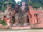
کوهستان امی Scenic Area, including بودای بزرگ لشان Scenic Area A giant seated buddha cut from a rock face. امیشان, سیچوآن,  چین
۲۹°۳۲′۴۲″ شمالی ۱۰۳°۴۶′۱۰″ شرقی / ۲۹٫۵۴۵۰۰°شمالی ۱۰۳٫۷۶۹۴۴°شرقی / 29.54500; 103.76944 (Mount Emei Scenic Area, including Leshan Giant Buddha Scenic Area)
ترکیبی:
(iv)(vi)(x)
۱۵٬۴۰۰ (۳۸٬۰۰۰) ۱۹۹۶ [۵۵]
کوهستان هونگ‌شان Rocky mountain landscape with pine trees. آن‌هوئی,  چین
۳۰°۱۰′ شمالی ۱۱۸°۱۱′ شرقی / ۳۰٫۱۶۷°شمالی ۱۱۸٫۱۸۳°شرقی / 30.167; 118.183 (Mount Huangshan)
ترکیبی:
(ii)(vii)(x)
۱۵٬۴۰۰ (۳۸٬۰۰۰) ۱۹۹۰ [۵۶]
کوه کینگ چنگ and the سامانه آبیاری دوجیانگ یان A dark Chinese-style temple. دوژیانگیان, سیچوآن,  چین
۲۹°۴۲′۴″ شمالی ۱۰۵°۴۲′۱۸″ شرقی / ۲۹٫۷۰۱۱۱°شمالی ۱۰۵٫۷۰۵۰۰°شرقی / 29.70111; 105.70500 (Mount Qingcheng and the Dujiangyan Irrigation System)
فرهنگی:
(ii)(iv)(vi)
۲۰۰۰ [۵۷]
کوه سنکینگ Rock pinnacles in the fog. جیانگشی,  چین
۲۸°۵۴′۵۷″ شمالی ۱۱۸°۳′۵۲″ شرقی / ۲۸٫۹۱۵۸۳°شمالی ۱۱۸٫۰۶۴۴۴°شرقی / 28.91583; 118.06444 (Mount Sanqingshan National Park)
طبیعی:
(vii)
۲۲٬۹۵۰ (۵۶٬۷۰۰); buffer zone ۱۶٬۸۵۰ (۴۱٬۶۰۰) ۲۰۰۸ [۵۸]
کوه تای Red two-storied building in a rocky mountain landscape. Tai'an and جینان, شاندونگ,  چین
۳۶°۱۶′ شمالی ۱۱۷°۶′ شرقی / ۳۶٫۲۶۷°شمالی ۱۱۷٫۱۰۰°شرقی / 36.267; 117.100 (Mount Taishan)
ترکیبی:
(i)(ii)(iii)(iv)(v)(vi)(vii)
۲۵٬۰۰۰ (۶۲٬۰۰۰) ۱۹۸۷ [۵۹]
کوه ووتای A village in the mountains with a complex of red buildings. شانشی,  چین
۳۹°۱′۵۰″ شمالی ۱۱۳°۳۳′۴۸″ شرقی / ۳۹٫۰۳۰۵۶°شمالی ۱۱۳٫۵۶۳۳۳°شرقی / 39.03056; 113.56333 (Mount Wutai)
فرهنگی:
(ii)(iii)(iv)(vi)
۱۸٬۴۱۵ (۴۵٬۵۰۰); buffer zone ۴۲٬۳۱۲ (۱۰۴٬۵۶۰) ۲۰۰۹ [۶۰]
کوه وویی A river lined by dense vegetation and steep rocks. وایشان, فوجیان,  چین
۲۷°۴۳′ شمالی ۱۱۷°۴۱′ شرقی / ۲۷٫۷۱۷°شمالی ۱۱۷٫۶۸۳°شرقی / 27.717; 117.683 (Mount Wuyi)
ترکیبی:
(iii)(vi)(vii)(x)
۹۹٬۹۷۵ (۲۴۷٬۰۴۰); buffer zone ۲۷٬۸۸۸ (۶۸٬۹۱۰) ۱۹۹۹ [۶۱]
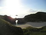
جزایر اوگاساوارا Sea, beach and rocks. Ogasawara Subprefecture,  ژاپن
۲۷°۴۳′۶″ شمالی ۱۴۲°۵′۵۹″ شرقی / ۲۷٫۷۱۸۳۳°شمالی ۱۴۲٫۰۹۹۷۲°شرقی / 27.71833; 142.09972 (Ogasawara Islands)
طبیعی:
(ix)
۷٬۹۳۹ (۱۹٬۶۲۰) ۲۰۱۱ [۶۲]
شهر قدیمی لیجیانگ A small stone bridge across a small channel. On the opposite site there is a two storied red building with a three storied gate tower. Lijiang, یون‌نان,  چین
۲۶°۵۲′۰″ شمالی ۱۰۰°۱۴′۰″ شرقی / ۲۶٫۸۶۶۶۷°شمالی ۱۰۰٫۲۳۳۳۳°شرقی / 26.86667; 100.23333 (Old Town of Lijiang)
فرهنگی:
(ii)(iv)(v)
۱۹۹۷ [۶۳]
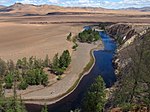
دشت اورخون River running through a desert landscape. There are some trees near the river. استان آرخان,  مغولستان
۴۷°۳۳′ شمالی ۱۰۲°۵۰′ شرقی / ۴۷٫۵۵۰°شمالی ۱۰۲٫۸۳۳°شرقی / 47.550; 102.833 (Orkhon Valley Cultural Landscape)
فرهنگی:
(ii)(iii)(iv)
۱۲۱٬۹۷۶ (۳۰۱٬۴۱۰); buffer zone ۶۱٬۰۴۴ (۱۵۰٬۸۴۰) ۲۰۰۴ [۶۴]
زوکودیان Narrow rocky gorge. A plaque with Chinese text is attached to the rock. فانگشان, پکن,  چین
۳۹°۴۴′۰″ شمالی ۱۱۵°۵۵′۰″ شرقی / ۳۹٫۷۳۳۳۳°شمالی ۱۱۵٫۹۱۶۶۷°شرقی / 39.73333; 115.91667 (Peking Man Site at Zhoukoudian)
فرهنگی:
(iii)(vi)
۱۹۸۷ [۶۵]
Petroglyphic Complexes of the Mongolian Altai  مغولستان
۴۹°۲۰′ شمالی ۸۸°۲۴′ شرقی / ۴۹٫۳۳۳°شمالی ۸۸٫۴۰۰°شرقی / 49.333; 88.400 (Petroglyphic Complexes of the Mongolian Altai)
فرهنگی:
(iii)
۱۱٬۳۰۰ (۲۸٬۰۰۰); buffer zone ۱۰٬۷۰۰ (۲۶٬۰۰۰) ۲۰۱۱ [۶۶]
Royal Tombs of the Joseon Dynasty A stone sculpture of a horse and a man, a stone column and a grass covered mound surrounded by a carved stone fence.  کره جنوبی
۳۷°۱۱′۵۰″ شمالی ۱۲۸°۲۷′۱۰″ شرقی / ۳۷٫۱۹۷۲۲°شمالی ۱۲۸٫۴۵۲۷۸°شرقی / 37.19722; 128.45278 (Royal Tombs of the Joseon Dynasty)
فرهنگی:
(iii)(iv)(vi)
۱٬۸۹۱ (۴٬۶۷۰); buffer zone ۴٬۶۶۰ (۱۱٬۵۰۰) ۲۰۰۹ [۶۷]
دامنه کوه کی
A small gate and stairs through a forest.
استان میه, استان نارا and استان واکایاما Prefectures,  ژاپن
۳۳°۵۰′۱۳″ شمالی ۱۳۵°۴۶′۳۵″ شرقی / ۳۳٫۸۳۶۹۴°شمالی ۱۳۵٫۷۷۶۳۹°شرقی / 33.83694; 135.77639 (Sacred Sites and Pilgrimage Routes in the Kii Mountain Range)
فرهنگی:
(ii)(iii)(iv)(vi)
۴۹۵ (۱٬۲۲۰); buffer zone ۱٬۱۳۷ (۲٬۸۱۰) ۲۰۰۴ [۶۸]
سئوک گورام وبولگوکسا
Figure of a seated buddha.
 کره جنوبی
۳۵°۴۷′۰″ شمالی ۱۲۹°۲۱′۰″ شرقی / ۳۵٫۷۸۳۳۳°شمالی ۱۲۹٫۳۵۰۰۰°شرقی / 35.78333; 129.35000 (Seokguram Grotto and Bulguksa Temple)
فرهنگی:
(i)(iv)
۱۹۹۵ [۶۹]
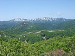
شیراکامی سانچی A forested mountain landscape. Ajigasawa and Fukaura, Nishitsugaru District, استان آئوموری; Fujisato, Yamamoto District, استان آکیتا,  ژاپن
۴۰°۲۸′۱۲″ شمالی ۱۴۰°۷′۴۸″ شرقی / ۴۰٫۴۷۰۰۰°شمالی ۱۴۰٫۱۳۰۰۰°شرقی / 40.47000; 140.13000 (Shirakami-Sanchi)
طبیعی:
(ix)
۱۶٬۹۳۹ (۴۱٬۸۶۰) ۱۹۹۳ [۷۰]
پارک ملی شیرتوکو Mountains reflected in a lake. هوکایدو,  ژاپن
۴۳°۵۶′۵۸″ شمالی ۱۴۴°۵۷′۵۷″ شرقی / ۴۳٫۹۴۹۴۴°شمالی ۱۴۴٫۹۶۵۸۳°شرقی / 43.94944; 144.96583 (Shiretoko National Park)
طبیعی:
(ix)(x)
۷۱٬۱۰۰ (۱۷۶٬۰۰۰) ۲۰۰۵ [۷۱]
آرامگاه‌ها و معابد نی کو Several traditional buildings including a gate. نیکو، توچیگی, استان توچیگی,  ژاپن
۳۶°۴۴′۵۱″ شمالی ۱۳۹°۳۶′۳۸″ شرقی / ۳۶٫۷۴۷۵۰°شمالی ۱۳۹٫۶۱۰۵۶°شرقی / 36.74750; 139.61056 (Shrines and Temples of Nikko)
فرهنگی:
(i)(iv)(vi)
۵۱ (۱۳۰); buffer zone ۳۷۳ (۹۲۰) ۱۹۹۹ [۷۲]
پناهگاه‌های پاندا سیچوان Three giant panda on grass. سیچوآن,  چین
۳۰°۵۰′۰″ شمالی ۱۰۳°۰′۰″ شرقی / ۳۰٫۸۳۳۳۳°شمالی ۱۰۳٫۰۰۰۰۰°شرقی / 30.83333; 103.00000 (Sichuan Giant Panda Sanctuaries)
طبیعی:
(x)
۹۲۴٬۵۰۰ (۲٬۲۸۴٬۰۰۰); buffer zone ۵۲۷٬۱۰۰ (۱٬۳۰۲٬۰۰۰) ۲۰۰۶ [۷۳]
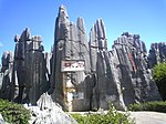
کارست جنوب چین Grey rock pillars. گوانگشی, گوئیژو and یون‌نان,  چین
۲۵°۱۳′۱۵″ شمالی ۱۰۷°۵۸′۳۰″ شرقی / ۲۵٫۲۲۰۸۳°شمالی ۱۰۷٫۹۷۵۰۰°شرقی / 25.22083; 107.97500 (South China Karst)
طبیعی:
(vii)(viii)
۴۷٬۵۸۸ (۱۱۷٬۵۹۰); buffer zone ۹۸٬۴۲۸ (۲۴۳٬۲۲۰) ۲۰۰۷ [۷۴]
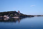
کاخ تابستانی پکن Various traditional buildings on a hillside. پکن,  چین
۳۹°۵۴′۳۸″ شمالی ۱۱۶°۸′۲۸″ شرقی / ۳۹٫۹۱۰۵۶°شمالی ۱۱۶٫۱۴۱۱۱°شرقی / 39.91056; 116.14111 (Summer Palace, an Imperial Garden in Beijing)
فرهنگی:
(i)(ii)(iii)
۱۹۹۸ [۷۵]
آرامگاه و پرستشگاه کنفوسیوس
Small Chinese pavillion on a platform.
Qufu, شاندونگ,  چین
۳۵°۳۶′۴۲″ شمالی ۱۱۶°۵۸′۳۰″ شرقی / ۳۵٫۶۱۱۶۷°شمالی ۱۱۶٫۹۷۵۰۰°شرقی / 35.61167; 116.97500 (Temple and Cemetery of Confucius and the Kong Family Mansion in Qufu)
فرهنگی:
(i)(iv)(vi)
۱۹۹۴ [۷۶]
معبد آسمان A multi-level circular building at the top of white staircases. Tiantan Park, پکن,  چین
۳۹°۵۰′۴۴″ شمالی ۱۱۶°۲۶′۴۱″ شرقی / ۳۹٫۸۴۵۵۶°شمالی ۱۱۶٫۴۴۴۷۲°شرقی / 39.84556; 116.44472 (Temple of Heaven: an Imperial Sacrificial Altar in Beijing)
فرهنگی:
(i)(ii)(iii)
۱۹۹۸ [۷۷]
دیوار چین A high defensive wall with watch towers running through a mountain landscape. لیائونینگ, جی‌لین, هبئی, پکن, تیانجین, شانشی, مغولستان داخلی, شاآنشی, نینگ‌شیا, گانسو, سین‌کیانگ, شاندونگ, استان هنان, هوبئی, هونان, سیچوآن, چینگهای,  چین
۴۰°۲۵′ شمالی ۱۱۶°۵′ شرقی / ۴۰٫۴۱۷°شمالی ۱۱۶٫۰۸۳°شرقی / 40.417; 116.083 (The Great Wall)
فرهنگی:
(i)(ii)(iii)(iv)(vi)
۱۹۸۷ [۷۸]
مناطق حفاظت شده یوننان River running through a gorge in a desert mountain landscape. Lijiang, Dêqên Tibetan Autonomous Prefecture and Nujiang Lisu Autonomous Prefecture, یون‌نان,  چین
۲۷°۵۳′۴۲″ شمالی ۹۸°۲۴′۲۳″ شرقی / ۲۷٫۸۹۵۰۰°شمالی ۹۸٫۴۰۶۳۹°شرقی / 27.89500; 98.40639 (Three Parallel Rivers of Yunnan Protected Areas)
طبیعی:
(vii)(viii)(ix)(x)
۲۰۰۳[nb ۷] [۷۹]
[۸۰]
حوضه اوبسونور Uvs, Zavkhan and Khövsgöl Provinces  مغولستان*; Mongun-Tayginsky, Ovyursky, Tes-Khemsky and Erzinsky Districts, تووا,  روسیه*
۵۰°۱۶′۳۰″ شمالی ۹۲°۴۳′۱″ شرقی / ۵۰٫۲۷۵۰۰°شمالی ۹۲٫۷۱۶۹۴°شرقی / 50.27500; 92.71694 (Uvs Nuur Basin))
طبیعی:
(ix)(x)
۸۹۸٬۰۶۴ (۲٬۲۱۹٬۱۶۰); buffer zone ۱۷۰٬۷۹۰ (۴۲۲٬۰۰۰) ۲۰۰۳ [۸۱]
دریاچه غرب A lake with a bridge and a pagoda on the lakeside. هانگژو, چجیانگ,  چین
۳۰°۱۴′۱۵″ شمالی ۱۲۰°۸′۲۷″ شرقی / ۳۰٫۲۳۷۵۰°شمالی ۱۲۰٫۱۴۰۸۳°شرقی / 30.23750; 120.14083 (West Lake Cultural Landscape of Hangzhou)
فرهنگی:
(ii)(iii)(vi)
۳٬۳۲۳ (۸٬۲۱۰); buffer zone ۷٬۲۷۰ (۱۸٬۰۰۰) ۲۰۱۱ [۸۲]
ولینگ یانگ Mountain landscape with rock pillars. Wulingyuan District, ژانگجیاجی, هونان,  چین
۲۹°۲۰′۰″ شمالی ۱۱۰°۳۰′۰″ شرقی / ۲۹٫۳۳۳۳۳°شمالی ۱۱۰٫۵۰۰۰۰°شرقی / 29.33333; 110.50000 (Wulingyuan Scenic and Historic Interest Area)
طبیعی:
(vii)
۲۶٬۴۰۰ (۶۵٬۰۰۰) ۱۹۹۲ [۸۳]
یاکوشیما An old tree with thick whitish stem in a densely vegetated forest. Yakushima, Kumage District, استان کاگوشیما,  ژاپن
۳۰°۲۰′۰″ شمالی ۱۳۰°۳۲′۰″ شرقی / ۳۰٫۳۳۳۳۳°شمالی ۱۳۰٫۵۳۳۳۳°شرقی / 30.33333; 130.53333 (Yakushima)
طبیعی:
(vii)(ix)
۱۰٬۷۴۷ (۲۶٬۵۶۰) ۱۹۹۳ [۸۴]
یین شو Archaeological excavation of a pit with boxes and vases. استان هنان,  چین
۳۶°۷′۳۶″ شمالی ۱۱۴°۱۸′۵۰″ شرقی / ۳۶٫۱۲۶۶۷°شمالی ۱۱۴٫۳۱۳۸۹°شرقی / 36.12667; 114.31389 (Yin Xu)
فرهنگی:
(ii)(iii)(iv)(vi)
۴۱۴ (۱٬۰۲۰); buffer zone ۷۲۰ (۱٬۸۰۰) ۲۰۰۶ [۸۵]
غارهای بودایی یون‌گانگ Buddhist deities of various sizes carved from rock and painted in many colors. داتونگ, شانشی,  چین
۴۰°۶′۳۵″ شمالی ۱۱۳°۷′۲۰″ شرقی / ۴۰٫۱۰۹۷۲°شمالی ۱۱۳٫۱۲۲۲۲°شرقی / 40.10972; 113.12222 (Yungang Grottoes)
فرهنگی:
(i)(ii)(iii)(iv)
۳۴۹ (۸۶۰); buffer zone ۸۴۷ (۲٬۰۹۰) ۲۰۰۱ [۸۶]

یادداشت‌ها[ویرایش]

  1. The Jerusalem site is not associated with a state by UNESCO and sorts as "Jerusalem".
  2. Extended in 2000 to include the Great Wave Pavilion, the Lion Grove Garden, the Garden of Cultivation, the Couple's Retreat Garden, and the Retreat & Reflection Garden.
  3. Extended in 2000 to include the Jokhang Temple and in 2001 to include the Norbulingka area. Accordingly the name of the site changed from Potala Palace at time of first inscription over Potala Palace and the Jokhang Temple Monastery in 2000 to the present name in 2001.
  4. Extended in 2004 to include the Mukden Palace and name change from Imperial Palace of the Ming and Qing Dynasties to the present name.
  5. Extended in 2003 to include the Ming tombs, the Ming Xiaoling Mausoleum and the tombs of Chang Yuchun, Qiu Cheng, Wu Liang, Wu Zhen, Xu Da and Li Wenzhong; and in 2004 to include the Liaoning Tombs (Yongling, Fuling and Zhaoling).
  6. Minor modification of boundaries in 2010.
  7. Minor modification in 2010.

منابع[ویرایش]

  1. "Number of World Heritage Properties by region". یونسکو. Retrieved 10 September 2011.
  2. "Composition of macro geographical (continental) regions, geographical sub-regions, and selected economic and other groupings". Geographical region and composition of each region. United Nations Statistics Division. 2010. Retrieved 20 October 2011.
  3. ۳٫۰ ۳٫۱ "World Heritage List". UNESCO. Retrieved 28 May 2010. خطای یادکرد: برچسب <ref> نامعتبر؛ نام «list» چندین بار با محتوای متفاوت تعریف شده است. (صفحهٔ راهنما را مطالعه کنید.).
  4. "Number of World Heritage properties inscribed each Year". UNESCO. Retrieved 8 September 2011.
  5. "The Criteria for Selection". UNESCO. Retrieved 10 September 2011.
  6. "World Heritage in Danger". UNESCO. Retrieved 28 May 2010.
  7. «unesco/China». دریافت‌شده در ۰۷-ژانویه-۲۰۱۲. تاریخ وارد شده در |تاریخ بازدید= را بررسی کنید (کمک)
  8. «unesco/Japan». دریافت‌شده در ۰۷-ژانویه-۲۰۱۲. تاریخ وارد شده در |تاریخ بازدید= را بررسی کنید (کمک)
  9. "List of World Heritage in Danger". UNESCO. Retrieved 10 December 2010.
  10. «Ancient Building Complex in the Wudang Mountains». UNESCO. دریافت‌شده در ۱۷ اوت ۲۰۱۱.
  11. «Ancient City of Ping Yao». UNESCO. دریافت‌شده در ۱۷ اوت ۲۰۱۱.
  12. «Ancient Villages in Southern Anhui – Xidi and Hongcun». UNESCO. دریافت‌شده در ۱۷ اوت ۲۰۱۱.
  13. «Buddhist Monuments in the Horyu-ji Area». UNESCO. دریافت‌شده در ۱۷ اوت ۲۰۱۱.
  14. «Capital Cities and Tombs of the Ancient Koguryo Kingdom». UNESCO. دریافت‌شده در ۱۷ اوت ۲۰۱۱.
  15. «Changdeokgung Palace Complex». UNESCO. دریافت‌شده در ۱۷ اوت ۲۰۱۱.
  16. «China Danxia». UNESCO. دریافت‌شده در ۱۷ دسامبر ۲۰۱۱.
  17. «Classical Gardens of Suzhou». UNESCO. دریافت‌شده در ۱۷ اوت ۲۰۱۱.
  18. «Complex of Koguryo Tombs». UNESCO. دریافت‌شده در ۱۷ اوت ۲۰۱۱.
  19. «Dazu Rock Carvings». UNESCO. دریافت‌شده در ۱۷ اوت ۲۰۱۱.
  20. «Fujian Tulou». UNESCO. دریافت‌شده در ۱۷ اوت ۲۰۱۱.
  21. «Gochang, Hwasun and Ganghwa Dolmen Sites». UNESCO. دریافت‌شده در ۱۷ اوت ۲۰۱۱.
  22. «Gusuku Sites and Related Properties of the Kingdom of Ryukyu». UNESCO. دریافت‌شده در ۱۷ اوت ۲۰۱۱.
  23. «Gyeongju Historic Areas». UNESCO. دریافت‌شده در ۱۷ اوت ۲۰۱۱.
  24. «Haeinsa Temple Janggyeong Panjeon, the Depositories for the Tripitaka Koreana Woodblocks». UNESCO. دریافت‌شده در ۱۷ اوت ۲۰۱۱.
  25. «Himeji-jo». UNESCO. دریافت‌شده در ۱۷ اوت ۲۰۱۱.
  26. «Hiraizumi – Temples, Gardens and Archaeological Sites Representing the Buddhist Pure Land». UNESCO. دریافت‌شده در ۱۷ اوت ۲۰۱۱.
  27. «Hiroshima Peace Memorial (Genbaku Dome)». UNESCO. دریافت‌شده در ۱۷ اوت ۲۰۱۱.
  28. «Historic Centre of Macao». UNESCO. دریافت‌شده در ۱۷ اوت ۲۰۱۱.
  29. «Historic Ensemble of the Potala Palace, Lhasa». UNESCO. دریافت‌شده در ۱۷ اوت ۲۰۱۱.
  30. «Decision - 24COM X.C.2 - The Potala Palace and the Jokhang Temple Monastery, Lhasa (China)». UNESCO. دریافت‌شده در ۱۷ اوت ۲۰۱۱.
  31. [Decision - 25COM X.B - Historic Ensemble of the Potala Palace, Lhasa [Extension to include the Norbulingka area] (China) «Decision - 25COM X.B - Historic Ensemble of the Potala Palace, Lhasa [Extension to include the Norbulingka area] (China)»] مقدار |url= را بررسی کنید (کمک). UNESCO. دریافت‌شده در ۱۷ اوت ۲۰۱۱.
  32. «Historic Monuments of Ancient Kyoto (Kyoto, Uji and Otsu Cities)». UNESCO. دریافت‌شده در ۱۷ اوت ۲۰۱۱.
  33. «Historic Monuments of Ancient Nara». UNESCO. دریافت‌شده در ۱۷ اوت ۲۰۱۱.
  34. «Historic Monuments of Dengfeng in "The Centre of Heaven and Earth"». UNESCO. دریافت‌شده در ۱۷ اوت ۲۰۱۱.
  35. «Historic Villages of Korea: Hahoe and Yangdong». UNESCO. دریافت‌شده در ۱۷ اوت ۲۰۱۱.
  36. «Historic Villages of Shirakawa-go and Gokayama». UNESCO. دریافت‌شده در ۱۷ اوت ۲۰۱۱.
  37. «Huanglong Scenic and Historic Interest Area». UNESCO. دریافت‌شده در ۱۷ اوت ۲۰۱۱.
  38. «Hwaseong Fortress». UNESCO. دریافت‌شده در ۱۷ اوت ۲۰۱۱.
  39. «Imperial Palaces of the Ming and Qing Dynasties in Beijing and Shenyang». UNESCO. دریافت‌شده در ۱۷ اوت ۲۰۱۱.
  40. «Imperial Tombs of the Ming and Qing Dynasties». UNESCO. دریافت‌شده در ۱۷ اوت ۲۰۱۱.
  41. «DECISIONS ADOPTED BY THE 27TH SESSION OF THE WORLD HERITAGE COMMITTEE IN 2003». UNESCO. دریافت‌شده در ۱۷ اوت ۲۰۱۱.
  42. «Decision - 28COM 14B.31 - Extension of Properties Inscribed on the World Heritage List (Imperial Tombs of the Ming and Qing Dynasties)». UNESCO. دریافت‌شده در ۱۷ اوت ۲۰۱۱.
  43. «Itsukushima Shinto Shrine». UNESCO. دریافت‌شده در ۱۷ اوت ۲۰۱۱.
  44. «Iwami Ginzan Silver Mine and its Cultural Landscape». UNESCO. دریافت‌شده در ۱۷ اوت ۲۰۱۱.
  45. «Decision - 34COM 8B.53 - Cultural Properties - Examination of minor boundary modifications - Iwami Ginzan Silver Mine and its Cultural Landscape (Japan)». UNESCO. دریافت‌شده در ۱۷ اوت ۲۰۱۱.
  46. «Jeju Volcanic Island and Lava Tubes». UNESCO. دریافت‌شده در ۱۷ اوت ۲۰۱۱.
  47. «Jiuzhaigou Valley Scenic and Historic Interest Area». UNESCO. دریافت‌شده در ۱۷ اوت ۲۰۱۱.
  48. «Jongmyo Shrine». UNESCO. دریافت‌شده در ۱۷ اوت ۲۰۱۱.
  49. «Kaiping Diaolou and Villages». UNESCO. دریافت‌شده در ۱۷ اوت ۲۰۱۱.
  50. «Longmen Grottoes». UNESCO. دریافت‌شده در ۱۷ اوت ۲۰۱۱.
  51. «Lushan National Park». UNESCO. دریافت‌شده در ۱۷ اوت ۲۰۱۱.
  52. «Mausoleum of the First Qin Emperor». UNESCO. دریافت‌شده در ۱۷ اوت ۲۰۱۱.
  53. «Mogao Caves». UNESCO. دریافت‌شده در ۱۷ اوت ۲۰۱۱.
  54. «Mountain Resort and its Outlying Temples, Chengde». UNESCO. دریافت‌شده در ۱۷ اوت ۲۰۱۱.
  55. «Mount Emei Scenic Area, including Leshan Giant Buddha Scenic Area». UNESCO. دریافت‌شده در ۱۷ اوت ۲۰۱۱.
  56. «Mount Huangshan». UNESCO. دریافت‌شده در ۱۷ اوت ۲۰۱۱.
  57. «Mount Qingcheng and the Dujiangyan Irrigation System». UNESCO. دریافت‌شده در ۱۷ اوت ۲۰۱۱.
  58. «Mount Sanqingshan National Park». UNESCO. دریافت‌شده در ۱۷ اوت ۲۰۱۱.
  59. «Mount Taishan». UNESCO. دریافت‌شده در ۱۷ اوت ۲۰۱۱.
  60. «Mount Wutai». UNESCO. دریافت‌شده در ۱۷ اوت ۲۰۱۱.
  61. «Mount Wuyi». UNESCO. دریافت‌شده در ۱۷ اوت ۲۰۱۱.
  62. «Ogasawara Islands». UNESCO. دریافت‌شده در ۷ دسامبر ۲۰۱۱.
  63. «Old Town of Lijiang». UNESCO. دریافت‌شده در ۱۷ اوت ۲۰۱۱.
  64. «Orkhon Valley Cultural Landscape». UNESCO. دریافت‌شده در ۱۷ اوت ۲۰۱۱.
  65. «Peking Man Site at Zhoukoudian». UNESCO. دریافت‌شده در ۱۷ اوت ۲۰۱۱.
  66. «Petroglyphic Complexes of the Mongolian Altai». UNESCO. دریافت‌شده در ۷ دسامبر ۲۰۱۱.
  67. «Royal Tombs of the Joseon Dynasty». UNESCO. دریافت‌شده در ۱۷ اوت ۲۰۱۱.
  68. «Sacred Sites and Pilgrimage Routes in the Kii Mountain Range». UNESCO. دریافت‌شده در ۱۷ اوت ۲۰۱۱.
  69. «Seokguram Grotto and Bulguksa Temple». UNESCO. دریافت‌شده در ۱۷ اوت ۲۰۱۱.
  70. «Shirakami-Sanchi». UNESCO. دریافت‌شده در ۱۷ اوت ۲۰۱۱.
  71. «Shiretoko National Park». UNESCO. دریافت‌شده در ۷ دسامبر ۲۰۱۱.
  72. «Shrines and Temples of Nikko». UNESCO. دریافت‌شده در ۱۷ اوت ۲۰۱۱.
  73. «Sichuan Giant Panda Sanctuaries». UNESCO. دریافت‌شده در ۱۷ اوت ۲۰۱۱.
  74. «South China Karst». UNESCO. دریافت‌شده در ۱۷ دسامبر ۲۰۱۱.
  75. «Summer Palace, an Imperial Garden in Beijing». UNESCO. دریافت‌شده در ۱۷ اوت ۲۰۱۱.
  76. «Temple and Cemetery of Confucius and the Kong Family Mansion in Qufu». UNESCO. دریافت‌شده در ۱۷ اوت ۲۰۱۱.
  77. «Temple of Heaven: an Imperial Sacrificial Altar in Beijing». UNESCO. دریافت‌شده در ۱۷ اوت ۲۰۱۱.
  78. «The Great Wall». UNESCO. دریافت‌شده در ۱۷ اوت ۲۰۱۱.
  79. «Three Parallel Rivers of Yunnan Protected Areas». UNESCO. دریافت‌شده در ۱۷ اوت ۲۰۱۱.
  80. «Decision - 34COM 8B.44 - Natural Properties - Examination of minor boundary modifications - Three Parallel Rivers of Yunnan Protected Areas (China)». UNESCO. دریافت‌شده در ۱۷ اوت ۲۰۱۱.
  81. «Uvs Nuur Basin». UNESCO. دریافت‌شده در ۲۰ اکتبر ۲۰۱۱.
  82. «West Lake Cultural Landscape of Hangzhou». UNESCO. دریافت‌شده در ۱۷ دسامبر ۲۰۱۱.
  83. «Wulingyuan Scenic and Historic Interest Area». UNESCO. دریافت‌شده در ۱۷ اوت ۲۰۱۱.
  84. «Yakushima». UNESCO. دریافت‌شده در ۱۷ اوت ۲۰۱۱.
  85. «Yin Xu». UNESCO. دریافت‌شده در ۱۷ اوت ۲۰۱۱.
  86. «Yungang Grottoes». UNESCO. دریافت‌شده در ۱۷ اوت ۲۰۱۱.