فهرست میراث جهانی در شمال و آسیای مرکزی
فهرست میراث جهانی در شمال و آسیای میانه شامل ۱۹ میراث جهانی در شش کشور قزاقستان، قرقیزستان، تاجیکستان، ترکمنستان، ازبکستان و قسمت آسیایی روسیه میشود.[۱][۲] قلعه ایچان نخستین مکان ثبت شده در فهرست میراث جهانی در این منطقهاست.[۳] و روسیه با ۷ میراث که در یکی از آنها با مغولستان مشترک است بیشترین میراث ثبت شده را دارا میباشد.[۴]
از ۱۹ میراث ثبت شده در این منطقه ۱۱ عدد فرهنگی و ۸ تای آن طبیعی است.[۴] تا کنون هیچیک از میراث ثبت شده در این منطقه در فهرست میراث در خطر قرار نگرفتهاند.[۵]
شرح[ویرایش]
- نام; توسط کمیته میراث جهانی فهرست شدهاند[۶]
- مکان; شهر ٬استان یا نام کشور، با مختصات[nb ۱]
- معیارها; ذکر شده برای میراث
- مساحت; برپایه هکتار
- سال; سالی که در فهرست میراث جهانی ثبت شدهاست.
- خطر; سال قرار گرفتن فهرست میراث جهانی در معرض خطر
- دلیل;تهدید مورد نظر
فهرست میراث[ویرایش]
* در کنار مرزهای ملی قرار دارند.
| منطقه | تصویر | موقعیت | میراث جهانی یونسکو | مساحت هکتار (جریب) |
سال | توضیحات | منابع |
|---|---|---|---|---|---|---|---|
| سیخوته-آلین | 
|
سرزمین پریمورسکی، ۴۵°۲۰′ شمالی ۱۳۶°۱۰′ شرقی / ۴۵٫۳۳۳°شمالی ۱۳۶٫۱۶۷°شرقی |
طبیعی: (x) |
۱٬۵۵۳٬۹۲۸ (۳٬۸۳۹٬۸۴۰); buffer zone ۶۵٬۲۵۰ (۱۶۱٬۲۰۰) | ۲۰۰۱ | The Sikhote-Alin mountain range contains one the richest and most unusual temperate forests of the world. In this mixed zone between taiga and subtropics, southern species such as the tiger and Himalayan bear cohabit with northern species such as the brown bear and lynx. The site stretches from the peaks of Sikhote-Alin to the Sea of Japan and is important for the survival of many endangered species such as the Amur tiger. | [۷] |
| Golden Mountains of Altai | 
|
جمهوری آلتایی، ۵۰°۲۸′ شمالی ۸۶°۰′ شرقی / ۵۰٫۴۶۷°شمالی ۸۶٫۰۰۰°شرقی |
طبیعی: (x) |
۱٬۶۱۱٬۴۵۷ (۳٬۹۸۲٬۰۰۰) | ۱۹۹۸ | The Altai mountains in southern Siberia form the major mountain range in the western Siberia biogeographic region and provide the source of its greatest rivers – the Ob and the Irtysh. Three separate areas are inscribed: Altaisky Zapovednik and a buffer zone around Lake Teletskoye; Katunsky Zapovednik and a buffer zone around Mount Belukha; and the Ukok Quiet Zone on the Ukok plateau. The region represents the most complete sequence of altitudinal vegetation zones in central Siberia, from steppe, forest-steppe, mixed forest, subalpine vegetation to alpine vegetation. The site is also an important habitat for endangered animal species such as the snow leopard. | [۸] |
| بخارا | 
|
استان بخارا، ۳۹°۴۶′۲۹″ شمالی ۶۴°۲۵′۴۳″ شرقی / ۳۹٫۷۷۴۷۲°شمالی ۶۴٫۴۲۸۶۱°شرقی |
فرهنگی: (ii), (iv), (vi) |
—
|
۱۹۹۳ | [۹] | |
| شهرسبز | 
|
استان قشقهدریا، ۳۹°۳′۰″ شمالی ۶۶°۵۰′۰″ شرقی / ۳۹٫۰۵۰۰۰°شمالی ۶۶٫۸۳۳۳۳°شرقی |
فرهنگی: (iii), (iv) |
۲۴۰ (۵۹۰); buffer zone ۸۲ (۲۰۰) | ۲۰۰۰ | [۱۰] | |
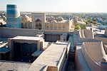
| قلعه ایچان | 
|
خیوه، استان خوارزم، ۴۱°۲۲′۴۲″ شمالی ۶۰°۲۱′۵۰″ شرقی / ۴۱٫۳۷۸۳۳°شمالی ۶۰٫۳۶۳۸۹°شرقی |
فرهنگی: (iii), (iv), (v) |
۲۶ (۶۴) | ۱۹۹۰ | [۱۱] | |
| کهنهگرگانج | 
|
استان داشاغوز، ۴۲°۱۰′۵۹″ شمالی ۵۹°۵′۶″ شرقی / ۴۲٫۱۸۳۰۶°شمالی ۵۹٫۰۸۵۰۰°شرقی |
فرهنگی: (ii), (iii) |
—
|
۲۰۰۵ | [۱۲] | |
| دریاچه بایکال | 
|
استان ایرکوتسک and بوریاتیا، ۵۳°۱۰′۲۵″ شمالی ۱۰۷°۳۹′۴۵″ شرقی / ۵۳٫۱۷۳۶۱°شمالی ۱۰۷٫۶۶۲۵۰°شرقی |
طبیعی: (vii), (viii), (ix), (x) |
۸٬۸۰۰٬۰۰۰ (۲۲٬۰۰۰٬۰۰۰) | ۱۹۹۶ | Situated in south-east Siberia, the 3.15-million-ha Lake Baikal is the oldest (25 million years) and deepest (1,700 m) lake in the world. It contains 20% of the world's total unfrozen freshwater reserve. Known as the 'Galapagos of Russia', its age and isolation have produced one of the world's richest and most unusual freshwater faunas, which is of exceptional value to evolutionary science. | [۱۳] |
| مزار خواجه احمد یسوی | 
|
Turkestan, استان قزاقستان جنوبی، ۴۳°۱۷′۳۵″ شمالی ۶۸°۱۶′۲۸″ شرقی / ۴۳٫۲۹۳۰۶°شمالی ۶۸٫۲۷۴۴۴°شرقی |
فرهنگی: (i), (iii), (iv) |
۰٫۵۵ (۱٫۴); buffer zone ۸۸ (۲۲۰) | ۲۰۰۳ | [۱۴] | |
| جزیره ورانگل | 
|
چوکوتکا، ۷۱°۱۱′۲۰″ شمالی ۱۷۹°۴۲′۵۵″ شرقی / ۷۱٫۱۸۸۸۹°شمالی ۱۷۹٫۷۱۵۲۸°شرقی |
طبیعی: (ix), (x) |
۹۱۶٬۳۰۰ (۲٬۲۶۴٬۰۰۰); buffer zone ۳٬۷۴۵٬۳۰۰ (۹٬۲۵۵٬۰۰۰) | ۲۰۰۴ | Located well above the Arctic Circle, the site includes the mountainous Wrangel Island (7,608 km2), Herald Island (11 km2) and surrounding waters. Wrangel was not glaciated during the Quaternary Ice Age, resulting in exceptionally high levels of biodiversity for this region. The island boasts the world’s largest population of Pacific walrus and the highest density of ancestral polar bear dens. It is a major feeding ground for the grey whale migrating from Mexico and the northernmost nesting ground for 100 migratory bird species, many endangered. Currently, 417 species and subspecies of vascular plants have been identified on the island, double that of any other Arctic tundra territory of comparable size and more than any other Arctic island. Some species are derivative of widespread continental forms, others are the result of recent hybridization, and 23 are endemic. | [۱۵] |
| نسا | 
|
Bagyr settlement, شهرستان دروازه، ترکمنستان، استان آخال، ۳۷°۵۹′۵۹″ شمالی ۵۸°۱۱′۵۵″ شرقی / ۳۷٫۹۹۹۷۲°شمالی ۵۸٫۱۹۸۶۱°شرقی |
فرهنگی: (ii), (iii) |
۷۸ (۱۹۰); buffer zone ۴۰۰ (۹۹۰) | ۲۰۰۷ | [۱۶] | |
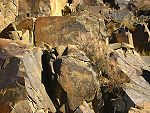
| تامقالی (منطقه سنگنگاره) | 
|
استان الماتی، ۴۳°۴۸′۱۲″ شمالی ۷۵°۳۲′۶″ شرقی / ۴۳٫۸۰۳۳۳°شمالی ۷۵٫۵۳۵۰۰°شرقی |
فرهنگی: (iii) |
۹۰۰ (۲٬۲۰۰); buffer zone ۲٬۹۰۰ (۷٬۲۰۰) | ۲۰۰۴ | [۱۷] | |
| سرزم | —
|
اوش، ۳۹°۳۰′۲۸″ شمالی ۶۷°۲۷′۳۷″ شرقی / ۳۹٫۵۰۷۷۸°شمالی ۶۷٫۴۶۰۲۸°شرقی |
فرهنگی: (ii), (iii) |
۱۶ (۴۰); buffer zone ۱۴۲ (۳۵۰) | ۲۰۱۰ | [۱۸] | |
| Putorana Plateau | 
|
سرزمین کراسنویارسک، ۶۹°۲′۴۹″ شمالی ۹۴°۹′۲۹″ شرقی / ۶۹٫۰۴۶۹۴°شمالی ۹۴٫۱۵۸۰۶°شرقی |
طبیعی: (vii), (ix) |
۱٬۸۸۷٬۲۵۱ (۴٬۶۶۳٬۵۰۰); buffer zone ۱٬۷۷۳٬۳۰۰ (۴٬۳۸۲٬۰۰۰) | ۲۰۱۰ | This site coincides with the area of the Putoransky State Nature Reserve, and is located in the central part of the Putorana Plateau in northern Central Siberia. It is situated about 100 km north of the Arctic Circle. The part of the plateau inscribed on the World Heritage List harbours a complete set of subarctic and arctic ecosystems in an isolated mountain range, including pristine taiga, forest tundra, tundra and arctic desert systems, as well as untouched cold-water lake and river systems. A major reindeer migration route crosses the property, which represents an exceptional, large-scale and increasingly rare natural phenomenon. | [۱۹] |
| سمرقند | 
|
استان سمرقند، ۳۹°۴۰′۷″ شمالی ۶۷°۰′۰″ شرقی / ۳۹٫۶۶۸۶۱°شمالی ۶۷٫۰۰۰۰۰°شرقی |
فرهنگی: (i), (ii), (iv) |
۹۶۵ (۲٬۳۸۰) | ۲۰۰۱ | [۲۰] | |
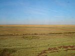
| ساریارکا (منطقه جغرافیایی) | 
|
استان الماتی، ۵۰°۲۶′ شمالی ۶۹°۱۱′ شرقی / ۵۰٫۴۳۳°شمالی ۶۹٫۱۸۳°شرقی |
طبیعی: (ix), (x) |
۴۵۰٬۳۴۴ (۱٬۱۱۲٬۸۲۰); buffer zone ۲۱۱٬۱۴۸ (۵۲۱٬۷۶۰) | ۲۰۰۸ | [۲۱] | |
| مرو | 
|
استان مرو، ۳۷°۴۲′۳″ شمالی ۶۲°۱۰′۳۹″ شرقی / ۳۷٫۷۰۰۸۳°شمالی ۶۲٫۱۷۷۵۰°شرقی |
فرهنگی: (ii), (iii) |
۳۵۳ (۸۷۰); buffer zone ۸۸۳ (۲٬۱۸۰) | ۱۹۹۹ | [۲۲] | |
| سلیمان (کوه) | 
|
اوش، ۴۰°۳۱′۵۲″ شمالی ۷۲°۴۶′۵۸″ شرقی / ۴۰٫۵۳۱۱۱°شمالی ۷۲٫۷۸۲۷۸°شرقی |
فرهنگی: (iii), (vi) |
۱۱۲ (۲۸۰); buffer zone ۴٬۷۸۸ (۱۱٬۸۳۰) | ۲۰۰۹ | [۲۳] | |
| حوضه اوبسونور | 
|
Uvs, Zavkhan and Khövsgöl Provinces ۵۰°۱۶′۳۰″ شمالی ۹۲°۴۳′۱″ شرقی / ۵۰٫۲۷۵۰۰°شمالی ۹۲٫۷۱۶۹۴°شرقی |
طبیعی: (ix), (x) |
۸۹۸٬۰۶۴ (۲٬۲۱۹٬۱۶۰); buffer zone ۱۷۰٬۷۹۰ (۴۲۲٬۰۰۰) | ۲۰۰۳ | The Uvs Nuur Basin is the northernmost of the enclosed basins of Central Asia. It takes its name from Uvs Nuur Lake, a large, shallow and very saline lake, important for migrating birds, waterfowl and seabirds. The site is made up of twelve protected areas representing the major biomes of eastern Eurasia. The steppe ecosystem supports a rich diversity of birds and the desert is home to a number of rare gerbil, jerboas and the marbled polecat. The mountains are an important refuge for the globally endangered snow leopard, mountain sheep (argali) and the Asiatic ibex. | [۲۴] |
| آتشفشانهای کامچاتکا | 
|
سرزمین کامچاتکا، ۵۶°۲۰′ شمالی ۱۵۸°۳۰′ شرقی / ۵۶٫۳۳۳°شمالی ۱۵۸٫۵۰۰°شرقی |
طبیعی: (vii), (viii), (ix), (x) |
۳٬۸۳۰٬۲۰۰ (۹٬۴۶۵٬۰۰۰) | ۱۹۹۶[nb ۲] | This is one of the most outstanding volcanic regions in the world, with a high density of active volcanoes, a variety of types, and a wide range of related features. The six sites included in the serial designation group together the majority of volcanic features of the Kamchatka peninsula. The interplay of active volcanoes and glaciers forms a dynamic landscape of great beauty. The sites contain great species diversity, including the world's largest known variety of salmonoid fish and exceptional concentrations of sea otter, brown bear and Stellar's sea eagle. | [۲۵][۲۶] |
یادداشتها[ویرایش]
- ↑ The Jerusalem site is not associated with a state by UNESCO and sorts as "Jerusalem".
- ↑ Extended in 2001 to include Kluchevskoy Nature Park.
منابع[ویرایش]
- یادداشت
- ↑ "Composition of macro geographical (continental) regions, geographical sub-regions, and selected economic and other groupings". Geographical region and composition of each region. United Nations Statistics Division. 2010. Retrieved 20 October 2011.
- ↑ "Number of World Heritage Properties by region". یونسکو. Retrieved 10 September 2011.
- ↑ "Number of World Heritage properties inscribed each Year". UNESCO. Retrieved 8 September 2011.
- ↑ ۴٫۰ ۴٫۱ "World Heritage List". UNESCO. Retrieved 28 May 2010. خطای یادکرد: برچسب
<ref>نامعتبر؛ نام «list» چندین بار با محتوای متفاوت تعریف شده است. (صفحهٔ راهنما را مطالعه کنید.). - ↑ "World Heritage in Danger". UNESCO. Retrieved 28 May 2010.
- ↑ "List of World Heritage in Danger". UNESCO. Retrieved 10 December 2010.
- ↑ «Central Sikhote-Alin». UNESCO. دریافتشده در ۲۰ اکتبر ۲۰۱۱.
- ↑ «Golden Mountains of Altai». UNESCO. دریافتشده در ۲۰ اکتبر ۲۰۱۱.
- ↑ «Historic Centre of Bukhara». UNESCO. دریافتشده در ۲۰ اکتبر ۲۰۱۱.
- ↑ «Historic Centre of Shakhrisyabz». UNESCO. دریافتشده در ۲۰ اکتبر ۲۰۱۱.
- ↑ «Itchan Kala». UNESCO. دریافتشده در ۲۰ اکتبر ۲۰۱۱.
- ↑ «Kunya-Urgench». UNESCO. دریافتشده در ۲۰ اکتبر ۲۰۱۱.
- ↑ «Lake Baikal». UNESCO. دریافتشده در ۲۰ اکتبر ۲۰۱۱.
- ↑ «Mausoleum of Khoja Ahmed Yasawi». UNESCO. دریافتشده در ۲۰ اکتبر ۲۰۱۱.
- ↑ «Natural System of Wrangel Island Reserve». UNESCO. دریافتشده در ۲۰ اکتبر ۲۰۱۱.
- ↑ «Parthian Fortresses of Nisa». UNESCO. دریافتشده در ۲۰ اکتبر ۲۰۱۱.
- ↑ «Petroglyphs within the Archaeological Landscape of Tamgaly». UNESCO. دریافتشده در ۲۰ اکتبر ۲۰۱۱.
- ↑ «Proto-urban site of Sarazm». UNESCO. دریافتشده در ۲۰ اکتبر ۲۰۱۱.
- ↑ «Putorana Plateau». UNESCO. دریافتشده در ۲۰ اکتبر ۲۰۱۱.
- ↑ «Samarkand – Crossroads of Cultures». UNESCO. دریافتشده در ۲۰ اکتبر ۲۰۱۱.
- ↑ «Saryarka — Steppe and Lakes of Northern Kazakhstan». UNESCO. دریافتشده در ۲۰ اکتبر ۲۰۱۱.
- ↑ «State Historical and Cultural Park "Ancient Merv"». UNESCO. دریافتشده در ۲۰ اکتبر ۲۰۱۱.
- ↑ «Sulaiman-Too Sacred Mountain». UNESCO. دریافتشده در ۲۰ اکتبر ۲۰۱۱.
- ↑ «Uvs Nuur Basin». UNESCO. دریافتشده در ۲۰ اکتبر ۲۰۱۱.
- ↑ «Volcanoes of Kamchatka». UNESCO. دریافتشده در ۲۰ اکتبر ۲۰۱۱.
- ↑ «Decision - 25COM X.B - Volcanoes of Kamchatka [Extension to include Kluchevskoy Nature Park] (Russian Federation)». UNESCO. دریافتشده در ۲۰ اکتبر ۲۰۱۱.

