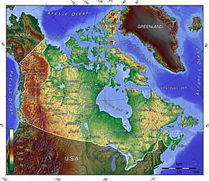
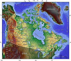
الگو:Location map CanadaTerrain/توضیحات
| این زیرصفحهٔ مستندات الگو:Location map CanadaTerrain است. این شامل اطلاعات استفاده، الگوها، پیوندهای بین زبانی و سایر اطلاعات است که در اصل الگو صفحه قرار نمیگیرد. |
Usage[ویرایش]
This map definition, {{Location map CanadaTerrain}}, is intended for overlaying markers/labels on similar terrain maps of کانادا, as polar projections, using coordinates of 38.4-85.5 for عرض جغرافیایی and 56.4-124.0 W for طول جغرافیایی.
Some of the related mapping procedures are:
- الگو:Location map - puts symbols/labels on an image.
- الگو:Location map many - puts up to 7 symbols/labels on an image.

| Map parameters | ||
| x | 51.3688770752693 - 2.08993734501698*({{{2}}} - 89.1948328371273)*sin(0.0146738856952723*({{{3}}} - ({{{3}}} > 0)*360 + 88.6496582505060)) | equation for the x coordinate |
| y | -6.11618556585059 - 2.08993734501698*({{{2}}} - 89.1948328371273)*cos(0.0146738856952723*({{{3}}} - ({{{3}}} > 0)*360 + 88.6496582505060)) | equation for the y coordinate |
All mapping templates use similar parameters (see Examples):
- CanadaTerrain - the first parameter is always the map name
- AlternativeMap - name of image (omit "Image:")
- caption=text - caption text along bottom of image
- width=250 - for image width (omit "px")
- label - movable label (can be padded " XX YY ")
- label_size - percent from 0-200 (default: 95)
- background - color of label (such as: darkorange or #4499DD)
- position=right - (or left, top, bottom) position of label at marker
- lat = 26.25 - for latitude 38.4-85.5 (higher towards top)
- long= -75.3 - for longitude 56.4-124.0 W (higher towards right)
- mark - name of image for marker symbol (omit "Image:")
- marksize - size of image for marker symbol (default: 8px, 1px=none)
- float=right (or left, center) - position of map formatted on page
Some common label background colors are: #CCCC55 for dim yellow,
- #44EE44 for lime green, #BBBBBB for gray,
- #44CCDD for light aqua, #DDDDDD for light gray (almost white),
- PaleGreen for pale green, PaleTurquoise, DarkOrange, etc.
- By default, the label is transparent overwriting the image.
For small lettering use label_size=80, for tiny words use 55. Note that the words in the label will wrap unless using "nbsp": DO NOT WRAP.
When specifying image "width=270" be sure to OMIT "px" (which causes the image to span the width of the screen) because "px" cannot (yet) be detected by the (new) MediaWiki language which processes those mapping templates.
- WARNING: Having too much text in Template:Location_map_CanadaTerrain can kill mapping templates that use it, even inside "<noinclude>".
See each specific mapping template for other parameters to pass.
Examples[ویرایش]
{{Location map
| CanadaTerrain
| caption = Ottawa in Canada
| width=270
| label=Ottawa
| label-size=90
| background = #DDDD44
| position=right
| lat = 45.42
| long= -75.67
| mark=X_sheer_red_17.gif
| marksize=17
| float=right
}}
{{Location map many
|CanadaTerrain
  |top   =86.1
  |bottom=38.4
|lon_shift=-.3
|label=
  Vancouver
  |bg=#44CCDD
  |pos =top
  |lat = 49.25
  |long=-123.1
  |mark=Green_pog.svg
  |label_size=75
  |marksize= 5
| label2=Alert
  |lat2 =82.50
  |long2=-62.34
  |bg2 =Orange
  |pos2=bottom
  |mark2=Green_pog.svg
  |label2_size=75
  |mark2size=5
| label3=
  Whitehorse
  |lat3 =60.72
  |long3=-135.05
  |pos3= top
  |mark3=Green_pog.svg
  |label3_size=78
  |bg3=PaleGreen
  |mark3size=5
| label4=
  Winnipeg
  |bg4=SkyBlue
  |pos4=left
  |lat4 =49.90
  |long4=-97.14
  |mark4=Blue_pog.svg
  |label4_size=70
  |mark4size=5
| label5=Halifax | lat5 = 44.85 | long5 = -63.20
  | bg5 = #77EE77 | pos5 = top
  | mark5=Blue_pog.svg | mark5size=5
| label6=Churchill,_MB
  | lat6 = 58.76 | long6 = -94.17
  | bg6 = #CCCC55
  | pos6 = right
  | mark6=Blue_pog.svg | mark6size=5 |label6_size=75
| label7=Quebec City
  | lat7=46.82 | long7= -71.38
  | mark7=Blue_pog.svg | mark7size=5
| caption = Vancouver, Whitehorse, Alert, Churchill, Winnipeg, Quebec & Halifax
| width=430 <!--map width-->
| float=right <!--left/center-->
}}
{{Location map
| CanadaTerrain
| width=320 <!--omit "px"-->
|label=Quebec City
 | label_size=75
 | background=DarkOrange
 | position=right
 | lat=46.48 | long= -71.38
 | mark=Green_pog.svg
 | marksize=10
|label2=Yellowknife
 | label2_size=75
 | bg2 = #DDDD44
 | pos2=top
 | lat2= 62.45
 | long2= -114.40
 | mark2=Blue_pog.svg
 | mark2size=5
| float=right
| caption = Quebec east, Yellowknife in northwest
}}
Other options[ویرایش]
It is possible to place markers/labels outside a map, by specifying latitude outside 38.4-85.5 or longitude coordinates beyond 56.0-124.0 W:
- Over longitude= -56.0 might push a label off-map to the right;
- Under longitude= -124.0 can push a label off-map to the left;
- Over latitude= 85.5 will push a label off-map to the top.
For templates that restrict coordinates, expand the minutes field: lat_deg=89.0 but lat_min=120 yielding a combined 91 degrees (60 minutes = 1 degree).
See also[ویرایش]
- الگو:Superimpose - to label an image without a border box
- پودمان:Location map/data/USA - for mapping the "lower 48" states


