الگو:Infobox U.S. county/Sample
| Infobox U.S. county/Sample | |
|---|---|
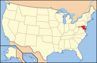
 مکان در ایالت مریلند | |
 مکان Maryland در ایالات متحده آمریکا | |
| تأسیس | ۱ فوریه, ۱۶۶۹ میلادی |
| مشهور به | county name origin |
| مرکز شهرستان | Cambridge |
| بزرگترین شهر | Cambridge |
| مساحت | |
| • کل | ۹۸۳ sq mi (۲٬۵۴۶ km2) |
| • خشکی | ۵۵۸ sq mi (۱٬۴۴۴ km2) |
| • آب | ۴۲۵ sq mi (۱٬۱۰۲ km2), 43.28% |
| جمعیت | |
| • (۲۰۰۰) | ۳۰٬۶۷۴ |
| • تراکم | ۵۵/sq mi (۲۱/km²) |
| منطقه زمانی | Eastern: UTC-5/-4 |
| وبگاه | www |
| Footnotes: This is a sample footnote | |
The following code yields the box appearing on the right side of this page. Note that for image fair use reasons (not allowed in non-main namespace), the seal does not appear here but it is in the شهرستان دارچستر، مریلند article.
{{Infobox U.S. county
| county          = Dorchester County
| state           = Maryland
| seal            =
| founded date    = ۱ فوریه
| founded year    = ۱۶۶۹ میلادی
| seat wl         = Cambridge
| largest city wl = Cambridge
| city type       =
| area_total_sq_mi= 983
| area_total_km2  = 2546
| area_land_sq_mi = 558
| area_land_km2   = 1444
| area_water_sq_mi= 425
| area_water_km2  = 1102
| area percentage = 43.28%
| lat deg         =
| lat min         =
| long deg        =
| long min        =
| census yr       = 2000
| pop             = 30674
| density_sq_mi   = 55
| density_km2     = 21
| time zone       = Eastern
| footnotes       = This is a sample footnote
| web             = www.docogonet.com
| named for       = county name origin
| logo            =
| flag            =
| ex image        =
| ex image size   =
| ex image cap    =
|}}
Alternatively, for census estimate years, you may substitute census yr with
| census estimate yr = 2004
