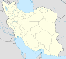
الگو:جعبه اطلاعات معدن
| این الگو از لوآ استفاده میکند: |
استفاده[ویرایش]
| [[پرونده:{{{نگاره}}}|frameless]] {{{زیرنویس}}} | |
| مکان | |
|---|---|
| موقعیت | {{{مکان}}} |
| {{{گونه زیربخش}}} | {{{ایالت/استان}}} |
| کشور | {{{کشور}}} |
| تولید | |
| تولیدات | {{{تولیدات}}} |
| تولید | {{{مقدار}}} |
| سال مالی | {{{سال مالی}}} |
| گونه | {{{گونه}}} |
| بیشترین ژرفا | {{{بیشترین ژرفا}}} |
| تاریخچه | |
| سال اکتشاف | {{{سال اکتشاف}}} |
| آغاز به کار | {{{آغاز به کار}}} |
| سالهای کار | {{{سالهای کار}}} |
| پایان کار | {{{پایان کار}}} |
| مالک | |
| شرکت | {{{مالک}}} |
| وبگاه | {{{وبگاه رسمی}}} |
| سال مالکیت | {{{سال مالکیت}}} |
| {{{جاسازی شده}}} | |
فارسی[ویرایش]
{{جعبه اطلاعات معدن
|نام =
|نگاره =
|پهنا = <!-- میتوانید از اعداد فارسی نیز استفاده کنید. -->
|زیرنویس =
|گونه زیربخش =
|موقعیت =
|مکان =
|ایالت/استان =
|کشور =
<!-- پارامترهای ویژه نقشه -->
| pushpin_map =
| pushpin_mapsize = <!-- میتوانید از اعداد فارسی نیز استفاده کنید. -->
| pushpin_map_alt =
| pushpin_map_caption =
| pushpin_image =
| pushpin_label =
| pushpin_label_position =
|مختصات = <!-- {{coord|xxxx|N/S|xxxx|E/W|region:ZZ_type:TT|display=inline,title}} یا {{coord|dd|mm|ss|N/S|dd|mm|ss|E/W|region:ZZ_type:TT|display=inline,title}} -->
|تولیدات =
|مقدار =
|سال مالی =
|گونه =
|بیشترین ژرفا =
|سال اکتشاف =
|آغاز به کار =
|سالهای کار =
|پایان کار =
|مالک =
|وبگاه رسمی = <!-- {{نشانی وب|example.com}} یا {{وبگاه رسمی|example.com}} -->
|سال مالکیت =
|جاسازی شده = <!-- برای فراخوانی الگوهای دیگر | میتوانید از " |پودمان = " نیز استفاده کنید. -->
}}
انگلیسی[ویرایش]
میتوانید از روی نسخه انگلیسی کپی کنید یا به صورت دستی زیر، وارد کنید:
{{Infobox mine
| name               =
| image              =
| width              =
| caption            =
| alt                =
| pushpin_map        =
| pushpin_mapsize    =
| pushpin_map_alt    =
| pushpin_map_caption=
| pushpin_image      =
| pushpin_label      =
| pushpin_label_position =
| coordinates        = <!-- {{Coord|latitude|N/S|longitude|E/W|display=inline,title}} -->
| place              =
| subdivision_type   =
| state/province     =
| country            =
| products           =
| amount             = <!--include units-->
| financial year     =
| type               =
| greatest depth     =
| discovery year     =
| opening year       = <!-- {{Start date|YYYY}} -->
| active years       = <!-- use only if inactive for a period of time-->
| closing year       = <!-- {{End date|YYYY}} -->
| owner              =
| official website   = <!-- {{URL|example.com}} -->
| acquisition year   =
| module             = <!-- or 'embedded' or 'nrhp' -->
}}
نمونه[ویرایش]
| مکان | |
|---|---|
| موقعیت | چادرملو |
| استان | یزد |
| کشور | ایران |
| مختصات | ۳۲°۱۹′۰۳″ شمالی ۵۵°۳۱′۴۰″ شرقی / ۳۲٫۳۱۷۵۰°شمالی ۵۵٫۵۲۷۷۸°شرقی |
| تولید | |
| تولیدات | سنگ آهن |
| مالک | |
| شرکت | شرکت معدنی و صنعتی چادرملو |
| وبگاه | |
{{Infobox mine
| name = چادرملو
| image =
| width =
| caption =
| location =
| pushpin_map = Iran
| pushpin_label = چادرملو
| pushpin_map_caption = موقعیت در ایران
| coordinates = {{Coord|32|19|03|N|55|31|40|E|region:IR|format=dms|display=inline}}
| place = چادرملو
| subdivision_type = استان
| state/province = [[استان یزد|یزد]]
| country = [[ایران]]
| owner = [[شرکت معدنی و صنعتی چادرملو]]
| official website = https://web.archive.org/web/20120120071148/http://www.chadormalu.com
| acquisition year =
| stock_code =
| products = [[سنگ آهن]]
| financial year =
| amount =
| opening year =
| closing year =
}}
ریزقالب[ویرایش]
The HTML mark up produced by this template includes an hCard microformat, which makes the place-name and location parsable by computers, either acting automatically to catalogue articles across Wikipedia, or via a browser tool operated by a person, to (for example) add the subject to an address book. Within the hCard is a Geo microformat, which additionally makes the coordinates (latitude & longitude) parsable, so that they can be, say, looked up on a map, or downloaded to a GPS unit. For more information about the use of microformats on Wikipedia, please see the microformat project.
زیرالگوها[ویرایش]
اگر مکان دارای تاریخ "ساخت"ُ، "پایهگذاری"، "گشایش" یا موارد مشابه است از {{تاریخ آغاز}} استفاده کنید. مگر اینکه تاریخ گاهشماری دوران مشترک پیش از ۱۵۸۳ باشد.
اگر پیوند دارد از {{نشانی وب}} استفاده کنید.
خواهشمند است کاربردهای این زیرالگوها را حذف نکنید.
کلاسها[ویرایش]
hCard از کلاسهای HTML زیر استفاده میکند:
- adr
- agent
- category
- county-name
- extended-address
- fn
- label
- locality
- nickname
- note
- org
- region
- street-address
- uid
- url
- vcard
مختصات با فراخوانی {{coord}} و استفاده از کلاسهای اچتیمال زیر تولید میشود:
- geo
- latitude
- longitude
خواهشمند است این کلاسها را تغییرنام ندهید یا حذف نکنید. عناصر تودرتویی که از آنها استفاده میکنند را نیز به حالت جمعشده درنیاورید.
دقت[ویرایش]
هنگام ارائه مختصات، خواهشمند است از سطح مناسبی از دقت استفاده کنید. پارامتر |name= از الگوی {{coord}} را بکار نبرید.

