
کیپ می غربی، نیوجرسی
West Cape May, New Jersey | |
|---|---|
 Sign indicating West Cape May | |
 West Cape May Borough highlighted in Cape May County. Inset map: Cape May County highlighted in the State of New Jersey. | |
 Census Bureau map of West Cape May, New Jersey | |
| مختصات: ۳۸°۵۶′۳۲″شمالی ۷۴°۵۶′۲۱″غربی / ۳۸٫۹۴۲۲۲۶°شمالی ۷۴٫۹۳۹۰۳۳°غربی | |
| کشور | United States |
| ایالات آمریکا | نیوجرسی |
| County | Cape May |
| Incorporated | April 17, 1884 |
| مدیریت | |
| • نوع | Walsh Act (New Jersey) |
| • شهردار | Pamela Kaithern (term ends May 21, 2013)[۱] |
| • Clerk | Dianne Rutherford[۲] |
| مساحت | |
| • کل | ۱٫۱۷۵ مایل مربع (۳٫۰۴۴ کیلومتر مربع) |
| • خشکی | ۱٫۱۶۵ مایل مربع (۳٫۰۱۸ کیلومتر مربع) |
| • آب | ۰٫۰۱۰ مایل مربع (۰٫۰۲۶ کیلومتر مربع) 0.86% |
| رتبه مساحت | 487th of 566 in state 14th of 16 in county[۴] |
| بلندی | ۱۰ پا (۳ متر) |
| جمعیت | |
| • کل | ۱٬۰۲۴ |
| • رتبه | 533rd of 566 in state 13th of 16 in county[۹] |
| • تراکم | ۸۷۸٫۸/مایل مربع (۳۳۹٫۳/کیلومتر مربع) |
| • رتبه تراکم | 399th of 566 in state 9th of 16 in county[۹] |
| منطقه زمانی | یوتیسی -۵ (EST) |
| • تابستانی (DST) | یوتیسی -4 (Eastern (EDT)) |
| زیپکد | 08204[۱۰] |
| پیششماره(های) تلفن | 609 |
| FIPS code | 3400978530[۱۱][۴][۱۲] |
| GNIS feature ID | 0885435[۱۳][۴] |
| وبگاه | |
کیپ می غربی (به انگلیسی: West Cape May) شهری در ایالت نیوجرسی کشور ایالات متحده آمریکا است که جمعیت آن در سرشماری سال ۲۰۱۰ میلادی، ۱٬۰۲۴ نفر بودهاست.[۱۴]
جستارهای وابسته[ویرایش]
منابع[ویرایش]
- ↑ 2012 New Jersey Mayors Directory, New Jersey Department of Community Affairs, dated August 9, 2012. Accessed October 17, 2012.
- ↑ Directory of Offices بایگانیشده در ۲۱ ژانویه ۲۰۱۳ توسط Wayback Machine, Borough of West Cape May. Accessed October 17, 2012.
- ↑ 2005 New Jersey Legislative District Data Book, دانشگاه راتگرز Edward J. Bloustein School of Planning and Public Policy, April 2005, p. 8.
- ↑ ۴٫۰ ۴٫۱ ۴٫۲ ۴٫۳ Gazetteer of New Jersey Places بایگانیشده در ۵ دسامبر ۲۰۱۲ توسط Archive.today, اداره آمار آمریکا. Accessed October 17, 2012.
- ↑ سامانه اطلاعات نامهای جغرافیایی ایالات متحده آمریکا: Borough of West Cape May, Geographic Names Information System. Accessed January 4, 2008.
- ↑ DP-1 - Profile of General Population and Housing Characteristics: 2010 for West Cape May borough, Cape May County, New Jersey, اداره آمار آمریکا. Accessed October 17, 2012.
- ↑ Municipalities Grouped by 2011-2020 Legislative Districts بایگانیشده در ۴ ژوئن ۲۰۱۹ توسط Wayback Machine, New Jersey Department of State, p. 1. Accessed January 6, 2013.
- ↑ Profile of General Demographic Characteristics: 2010 for West Cape May borough بایگانیشده در ۶ مه ۲۰۱۲ توسط Wayback Machine, New Jersey Department of Labor and Workforce Development. Accessed October 17, 2012.
- ↑ ۹٫۰ ۹٫۱ GCT-PH1 Population, Housing Units, Area, and Density: 2010 - State -- County Subdivision from the 2010 Census Summary File 1 for New Jersey, اداره آمار آمریکا. Accessed October 17, 2012.
- ↑ Look Up a ZIP Code for West Cape May, NJ, خدمات پستی ایالات متحده آمریکا. Accessed December 7, 2011.
- ↑ "American FactFinder". اداره آمار آمریکا. Retrieved 2008-01-31.
- ↑ A Cure for the Common Codes: New Jersey بایگانیشده در ۲۷ مه ۲۰۱۲ توسط Archive.today, Missouri Census Data Center. Accessed October 17, 2012.
- ↑ "US Board on Geographic Names". سازمان نقشهبرداریهای زمینشناسی آمریکا. 2007-10-25. Retrieved 2008-01-31.
- ↑ "New Jersey" (به انگلیسی). world-gazetteer. Archived from the original on 23 April 2013. Retrieved 10 Jan 2013.
| عمومی | |
|---|---|
| کتابخانههای ملی | |
این یک مقالهٔ خرد نیوجرسی است. میتوانید با گسترش آن به ویکیپدیا کمک کنید. |
شهرداریها و جوامع شهرستان کیپ می، نیوجرسی، ایالات متحده | ||
|---|---|---|
| شهرها | 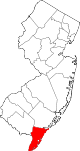 | |
| Boroughs | ||
| تاونشیپها | ||
| سیدیپیها | ||
| سایر محدودههای ثبتنشده | ||