
کربوندیل، کلرادو
Town of Carbondale, Colorado | |
|---|---|
Town | |
 Mount Sopris, south of town, as viewed from Colorado Rocky Mountain School | |
| لقب(ها): 'Bonedale; The Ultimate Rocky Mountain Hideout | |
| شعار(ها): " A Great Place To Be" | |
 Location in Garfield County and the کلرادو | |
| مختصات: ۳۹°۲۳′۵۸″ شمالی ۱۰۷°۱۲′۵۳″ غربی / ۳۹٫۳۹۹۴۴°شمالی ۱۰۷٫۲۱۴۷۲°غربی | |
| کشور | |
| ایالت | |
| County | Garfield County[۱] |
| Incorporated (town) | April 26, 1888[۲] |
| مدیریت | |
| • نوع | فهرست شهرها و روستاهای کلرادو[۱] |
| مساحت | |
| • کل | ۲ مایل مربع (۵٫۲ کیلومتر مربع) |
| • خشکی | ۲ مایل مربع (۵٫۲ کیلومتر مربع) |
| • آب | ۰ مایل مربع (۰ کیلومتر مربع) |
| بلندی | ۶۱۸۱ پا (۱۸۸۱ متر) |
| جمعیت (2010) | |
| • کل | ۶٬۴۲۷ |
| منطقه زمانی | یوتیسی -۷ (MST) |
| • تابستانی (DST) | یوتیسی -6 (MDT) |
| زیپکد | 81623[۳] |
| پیششماره(های) تلفن | 970 |
| FIPS code | 08-12045 |
| GNIS feature ID | 0174841 |
| وبگاه | |
کربوندیل (به انگلیسی: Carbondale) شهری در ایالت کلرادو کشور ایالات متحده آمریکا است که جمعیت آن در سرشماری سال ۲۰۱۰ میلادی، ۶٬۴۲۷ نفر بودهاست.[۴]
جستارهای وابسته[ویرایش]
منابع[ویرایش]
- ↑ ۱٫۰ ۱٫۱ "Active Colorado Municipalities". کلرادو, Department of Local Affairs. Archived from the original on 23 November 2010. Retrieved 2007-09-01.
- ↑ "Colorado Municipal Incorporations". Colorado, Department of Personnel & Administration, Colorado State Archives. 2004-12-01. Retrieved 2007-09-02.
- ↑ "ZIP Code Lookup" (JavaScript/HTML). United States Postal Service. Retrieved September 4, 2007.
- ↑ "Colorado" (به انگلیسی). world-gazetteer. Archived from the original on 23 April 2013. Retrieved 26 Dec 2012.
این یک مقالهٔ خرد کلرادو است. میتوانید با گسترش آن به ویکیپدیا کمک کنید. |
شهرداریها و جوامع شهرستان گارفیلد، کلرادو، ایالات متحده | ||
|---|---|---|
| شهرها | 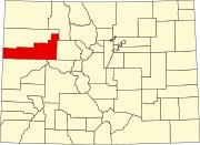 | |
| شهرک | ||
| سیدیپیها | ||
| محدوده ثبتنشده | ||