پارکه سان مارتین
Parque San Martín | |
|---|---|
 Colegio Nuestra Señora de la Gruta, private Catholic school. | |
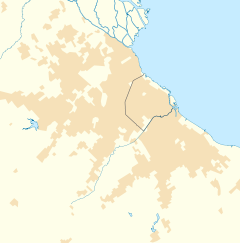
Location in Greater Buenos Aires | |
| مختصات: ۳۴°۳۹′ جنوبی ۵۸°۴۳′ غربی / ۳۴٫۶۵۰°جنوبی ۵۸٫۷۱۷°غربی | |
| کشور | |
| استان | |
| Partido | Merlo |
| بلندی | ۱۶ متر (۵۲ پا) |
| جمعیت | |
| • کل | ۸۹٬۰۷۳ |
| کد پستی | B 1722 |
| پیششماره(های) تلفن | + 220 |
پارکه سان مارتین (به اسپانیایی: Parque San Martín) شهری در کشور آرژانتین، استان بوئنوس آیرس است که در سال ۲۰۰۹ میلادی، حدود ۸۹٬۰۷۳ نفر جمعیت داشته است.
جستارهای وابسته[ویرایش]
منابع[ویرایش]
- "Instituto Nacional de Estadisticas y Censos" (به انگلیسی). Archived from the original on 6 April 2007. Retrieved = 19 May 2012.
{{cite web}}: Check date values in:|تاریخ بازبینی=(help)نگهداری CS1: نقطهگذاری اضافه (link) - "INDEC eph" (PDF) (به انگلیسی). Instituto Nacional de Estadística y Censos. Archived from the original (PDF) on 21 August 2011. Retrieved = 19 May 2012.
{{cite web}}: Check date values in:|تاریخ بازبینی=(help)نگهداری CS1: نقطهگذاری اضافه (link) - "INDEC est" (PDF) (به انگلیسی). Instituto Nacional de Estadística y Censos. Archived from the original (PDF) on 9 April 2014. Retrieved = 19 May 2012.
{{cite web}}: Check date values in:|تاریخ بازبینی=(help)نگهداری CS1: نقطهگذاری اضافه (link)

