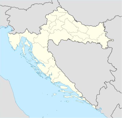
الگو:Location map Croatia
ظاهر
| نام | کرواسی | |||
|---|---|---|---|---|
| مختصات مرزها | ||||
| 46.8 | ||||
| 13.1 | →↕← | 19.9 | ||
| 42.1 | ||||
| وسط نقشه | ۴۴°۲۷′شمالی ۱۶°۳۰′شرقی / ۴۴٫۴۵°شمالی ۱۶٫۵°شرقی | |||
| تصویر | Croatia_location_map.svg
| |||

| ||||
| انحراف | 1.0 | |||
| انحراف عرضی | 0.0 | |||
The locator map definition, Template:Location_map_Croatia, is intended for overlaying markers and labels on similar maps of کرواسی.
Some of the related mapping procedures are:
- Template:Location_map - puts 1 symbol/label on the map image;
- Template:Location_map_many - puts multiple symbols/labels on the map image.
This template uses the mapping procedure "Template:Location_map" which must be invoked with parameter "Croatia" to process the options before it uses the template. Specify each of the individual parameters by using vertical bars: {{Location map | Croatia | ...}}.

| Map parameters | ||
| top | 46.8 | latitude at top of map |
| bottom | 42.1 | latitude at bottom of map |
| left | 13.1 | longitude at map left edge |
| right | 19.9 | longitude at map right edge |
| skew | 1.0 | skew to narrow longitudes |
| lat_skew | 0.0 | skew to arc latitudes at edges |
See {{Location map}} for description of the parameters.
WARNING: Having too much text in Template:Location_map_Croatia can kill mapping templates that use it, even inside "<noinclude>".
