
پرونده:West Virginia Congressional Districts, 113th Congress.tif

حجم پیشنمایش PNG این TIF file:۷۱۳ × ۵۹۹ پیکسل کیفیتهای دیگر: ۲۸۶ × ۲۴۰ پیکسل | ۵۷۱ × ۴۸۰ پیکسل | ۹۱۴ × ۷۶۸ پیکسل | ۱٬۲۱۹ × ۱٬۰۲۴ پیکسل | ۱٬۳۴۷ × ۱٬۱۳۲ پیکسل.
پروندهٔ اصلی (۱٬۳۴۷ × ۱٬۱۳۲ پیکسل، اندازهٔ پرونده: ۴۰۴ کیلوبایت، نوع MIME پرونده: image/tiff)
این پرونده در ویکیانبار موجود است. محتویات صفحهٔ توصیف آن در زیر نمایش داده میشود. |
خلاصه
| توضیح |
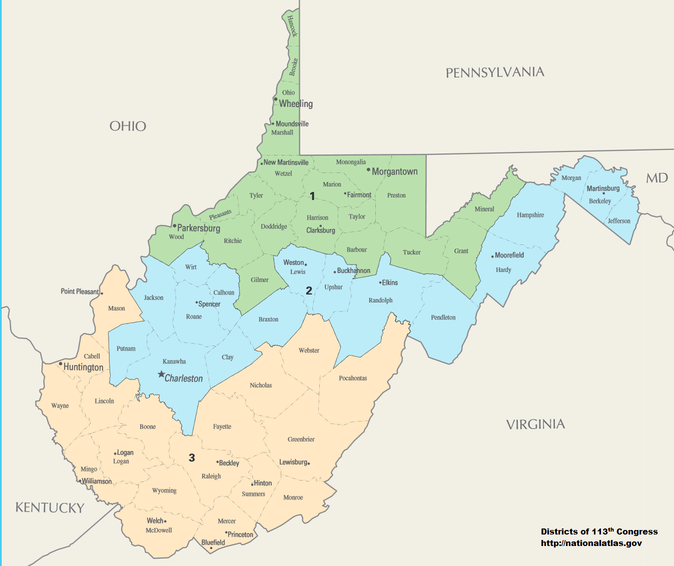
English: Map of Congressional Districts in the state of West Virginia, reflecting district boundaries current to the 113th United States Congress. |
| تاریخ | |
| منبع | National Atlas of the United States (http://nationalatlas.gov/printable/congress.html) |
| پدیدآور | Department of the Interior |
| اجازهنامه (استفادهٔ مجدد از این پرونده) |
This image is free information provided by the department of the interior. It was downloaded from http://nationalatlas.gov/printable/congress.html. All of that information has been provided in the captions, I'm not sure what other information is required. --7partparadigm talk 02:35, 8 February 2014 (UTC) |
اجازهنامه
| This image or media file contains material based on a work of a United States Department of the Interior employee, created as part of that person's official duties. As a work of the U.S. federal government, such work is in the public domain in the United States. See the Department of the Interior copyright policy for more information. |  |
تاریخچهٔ پرونده
روی تاریخ/زمانها کلیک کنید تا نسخهٔ مربوط به آن هنگام را ببینید.
| تاریخ/زمان | بندانگشتی | ابعاد | کاربر | توضیح | |
|---|---|---|---|---|---|
| کنونی | ۲ فوریهٔ ۲۰۱۴، ساعت ۰۶:۰۱ |  | ۱٬۳۴۷ در ۱٬۱۳۲ (۴۰۴ کیلوبایت) | 7partparadigm | User created page with UploadWizard |
کاربرد پرونده
صفحهٔ زیر از این تصویر استفاده میکند:
کاربرد سراسری پرونده
ویکیهای دیگر زیر از این پرونده استفاده میکنند:
- کاربرد در ru.wikipedia.org
- کاربرد در uk.wikipedia.org
- کاربرد در zh.wikipedia.org