
پمبنا، داکوتای شمالی
Pembina, North Dakota | |
|---|---|
 Building and water tower in Pembina | |
| شعار(ها): "Oldest Settlement in the Dakota Territories" | |
 Location of Pembina, North Dakota | |
| مختصات: ۴۸°۵۷′۵۹″ شمالی ۹۷°۱۴′۴۳″ غربی / ۴۸٫۹۶۶۳۹°شمالی ۹۷٫۲۴۵۲۸°غربی | |
| کشور | ایالات متحده آمریکا |
| State | داکوتای شمالی |
| شهرستان | Pembina |
| مساحت | |
| • کل | ۰٫۷۷ مایل مربع (۱٫۹۹ کیلومتر مربع) |
| • خشکی | ۰٫۷۷ مایل مربع (۱٫۹۹ کیلومتر مربع) |
| • آب | ۰ مایل مربع (۰ کیلومتر مربع) |
| بلندی | ۷۷۸ پا (۲۳۷ متر) |
| جمعیت | |
| • کل | ۵۹۲ |
| • برآورد (2011[۳]) | ۵۸۵ |
| • تراکم | ۷۶۸٫۸/مایل مربع (۲۹۶٫۸/کیلومتر مربع) |
| منطقه زمانی | یوتیسی -۶ (Central (CST)) |
| • تابستانی (DST) | یوتیسی -5 (CDT) |
| زیپکد | 58271 |
| پیششماره(های) تلفن | 701 |
| FIPS code | 38-61580[۴] |
| GNIS feature ID | 1030666[۵] |
پمبنا(به انگلیسی: Pembina) شهری در ایالت داکوتای شمالی کشور ایالات متحده آمریکا است که جمعیت آن در سرشماری سال ۲۰۱۰ میلادی، ۵۹۲ نفر بودهاست.[۶]
جستارهای وابسته[ویرایش]
منابع[ویرایش]
- ↑ "US Gazetteer files 2010". United States Census Bureau. Archived from the original on 14 July 2012. Retrieved 2012-06-14.
- ↑ "American FactFinder". United States Census Bureau. Retrieved 2012-06-14.
- ↑ "Population Estimates". United States Census Bureau. Archived from the original on 18 September 2012. Retrieved 2013-01-04.
{{cite web}}: External link in|publisher= - ↑ "American FactFinder". اداره آمار آمریکا. Retrieved 2008-01-31.
- ↑ "US Board on Geographic Names". سازمان نقشهبرداریهای زمینشناسی آمریکا. 2007-10-25. Retrieved 2008-01-31.
- ↑ "North Dakota" (به انگلیسی). factfinder2.census.gov. Retrieved 29 Jan 2013.
این یک مقالهٔ خرد پیرامون داکوتای شمالی است. میتوانید با گسترش آن به ویکیپدیا کمک کنید. |
شهرداریها و جوامع شهرستان پمبینا، داکوتای شمالی، ایالات متحده | ||
|---|---|---|
| شهرها | 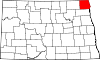 | |
| تاونشیپها | ||
| محدوده ثبتنشده | ||