
پرونده:East Langton, Leicestershire - geograph.org.uk - 587829.jpg
تفکیکپذیری بالاتری در دسترس نیست.
East_Langton,_Leicestershire_-_geograph.org.uk_-_587829.jpg (۶۴۰ × ۵۱۳ پیکسل، اندازهٔ پرونده: ۱۳۰ کیلوبایت، نوع MIME پرونده: image/jpeg)
این پرونده در ویکیانبار موجود است. محتویات صفحهٔ توصیف آن در زیر نمایش داده میشود. |
خلاصه
| توضیح |
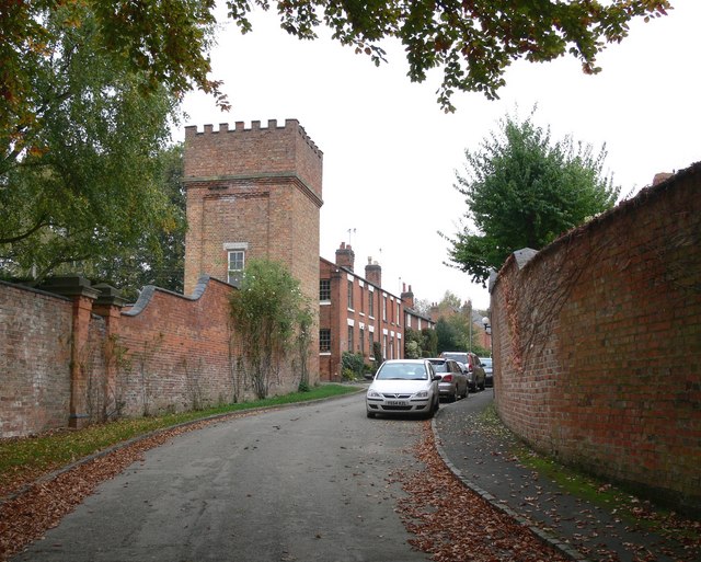
English: East Langton, Leicestershire The large castellated water tower belongs to East Langton Grange. Text from :
J M Lee and R A McKinley, 'Church Langton', in A History of the County of Leicestershire: Volume 5, Gartree Hundred (London, 1964), pp. 193-213. British History Online http://www.british-history.ac.uk/vch/leics/vol5/pp193-213 [accessed 15 February 2020].
|
| تاریخ | |
| منبع | From geograph.org.uk |
| پدیدآور | Mat Fascione |
| انتساب (required by the license) | Mat Fascione / East Langton, Leicestershire / |
| مختصات دوربین | | محل قرارگیری این نگاره و سایر نگارهها در: نقشهٔ شهری باز |
|---|
_heading:22.00&language=fa)
| مختصات شیء | | محل قرارگیری این نگاره و سایر نگارهها در: نقشهٔ شهری باز |
|---|
_heading:22.00&language=fa)
اجازهنامه

|
این نگاره از مجموعهٔ پروژهٔ Geograph گرفته شدهاست. این صفحهٔ عکسها را در وبگاه Geograph برای جزئیات تماس با عکاس ببینید. حق تکثیر این تصویر به Mat Fascione تعلق دارد و برای استفادهٔ مجدد تحت Creative Commons Attribution-ShareAlike 2.0 مجوزدهی شدهاست.
|
این پرونده با اجازهنامهٔ کریتیو کامانز Attribution-Share Alike 2.0 عمومی منتشر شدهاست.
انتساب: Mat Fascione
- شما اجازه دارید:
- برای به اشتراک گذاشتن – برای کپی، توزیع و انتقال اثر
- تلفیق کردن – برای انطباق اثر
- تحت شرایط زیر:
- انتساب – شما باید اعتبار مربوطه را به دست آورید، پیوندی به مجوز ارائه دهید و نشان دهید که آیا تغییرات ایجاد شدهاند یا خیر. شما ممکن است این کار را به هر روش منطقی انجام دهید، اما نه به هر شیوهای که پیشنهاد میکند که مجوزدهنده از شما یا استفادهتان حمایت کند.
- انتشار مشابه – اگر این اثر را تلفیق یا تبدیل میکنید، یا بر پایه آن اثری دیگر خلق میکنید، میبایست مشارکتهای خود را تحت مجوز یکسان یا مشابه با ا اصل آن توزیع کنید.
- Remove redundant categories and try to put this image in the most specific category/categories
- Remove this template
- The location categories are based on information from this geonames tool and this OpenStreetMap tool combined with a database. You can also have a look at this tool from mysociety.
- The topic category from Geograph was Village (find similar images at Geograph)
تاریخچهٔ پرونده
روی تاریخ/زمانها کلیک کنید تا نسخهٔ مربوط به آن هنگام را ببینید.
| تاریخ/زمان | بندانگشتی | ابعاد | کاربر | توضیح | |
|---|---|---|---|---|---|
| کنونی | ۶ فوریهٔ ۲۰۱۱، ساعت ۱۳:۳۸ | | ۶۴۰ در ۵۱۳ (۱۳۰ کیلوبایت) | GeographBot | == {{int:filedesc}} == {{Information |description={{en|1=East Langton, Leicestershire The large castellated water tower belongs to East Langton Grange.}} |date=2007-10-14 |source=From [http://www.geograph.org.uk/photo/587829 geograph.org.uk] |author=[http |
کاربرد پرونده
صفحهٔ زیر از این تصویر استفاده میکند:
کاربرد سراسری پرونده
ویکیهای دیگر زیر از این پرونده استفاده میکنند:
- کاربرد در en.wikipedia.org
- کاربرد در fr.wikipedia.org