
پرونده:Zoarville Bridge.jpg
اندازهٔ این پیشنمایش: ۴۳۹ × ۶۰۰ پیکسل. کیفیتهای دیگر: ۱۷۶ × ۲۴۰ پیکسل | ۳۵۱ × ۴۸۰ پیکسل | ۵۶۲ × ۷۶۸ پیکسل | ۷۵۰ × ۱٬۰۲۴ پیکسل | ۱٬۴۹۹ × ۲٬۰۴۸ پیکسل | ۳٬۱۵۴ × ۴٬۳۰۸ پیکسل.
پروندهٔ اصلی (۳٬۱۵۴ × ۴٬۳۰۸ پیکسل، اندازهٔ پرونده: ۱٫۶۵ مگابایت، نوع MIME پرونده: image/jpeg)
این پرونده در ویکیانبار موجود است. محتویات صفحهٔ توصیف آن در زیر نمایش داده میشود. |
| مختصات دوربین | | محل قرارگیری این نگاره و سایر نگارهها در: نقشهٔ شهری باز |
|---|
|
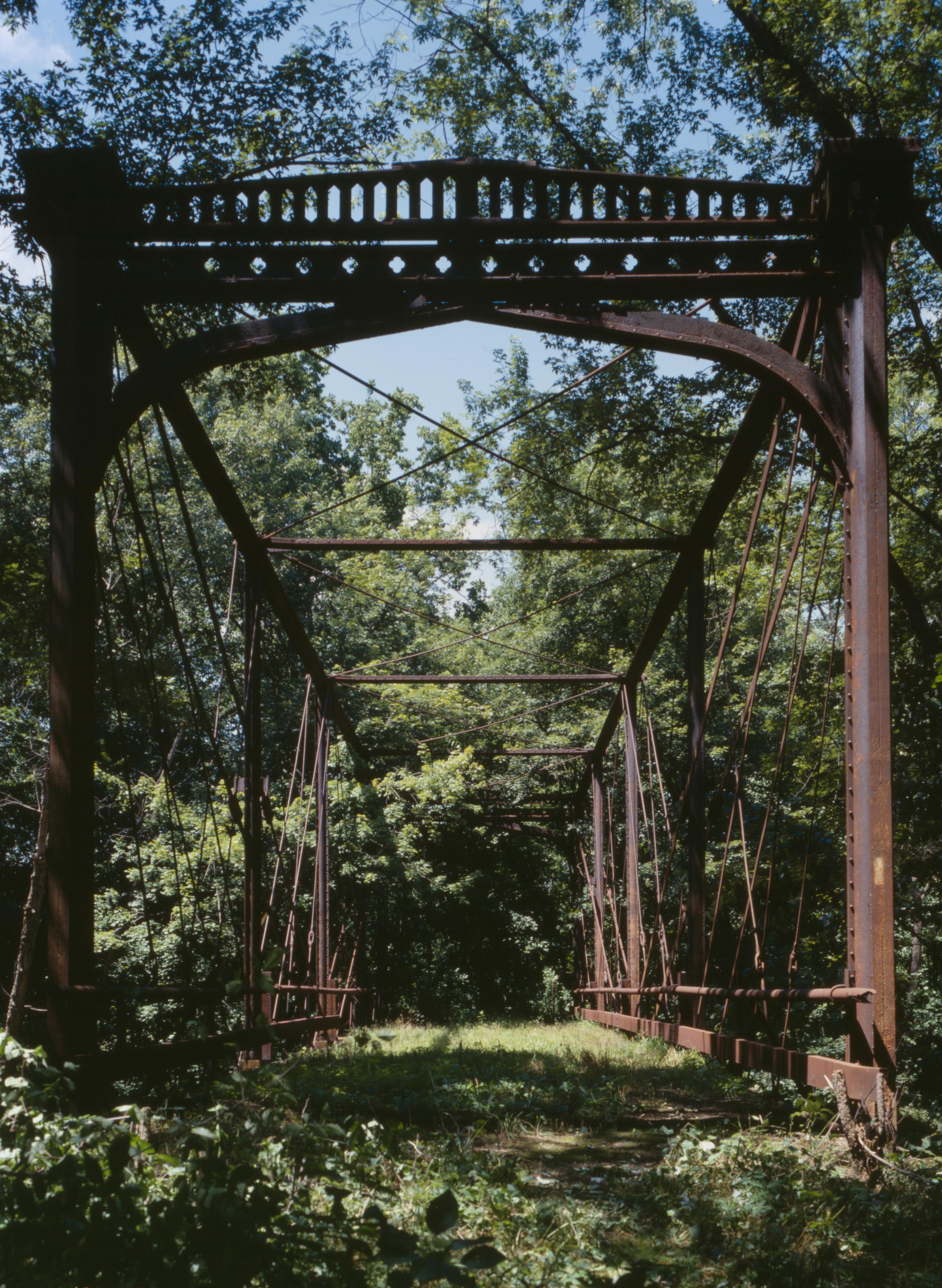
This is an image of a place or building that is listed on the National Register of Historic Places in the United States of America. Its reference number is 97000199. |
| توضیح |
English: Southern end of the Zoarville Bridge, which spans Conotton Creek southeast of Zoarville in Fairfield Township, Tuscarawas County, Ohio, United States. Built in 1868 and listed on the National Register of Historic Places, it is the only Fink through truss bridge in the United States. |
||||
| تاریخ | |||||
| منبع |
Library of Congress, Prints and Photograph Division HAER: OHIO,79-ZOARV.V,1-18
|
||||
| پدیدآور | Joseph Elliott | ||||
| اجازهنامه (استفادهٔ مجدد از این پرونده) |
|

تاریخچهٔ پرونده
روی تاریخ/زمانها کلیک کنید تا نسخهٔ مربوط به آن هنگام را ببینید.
| تاریخ/زمان | بندانگشتی | ابعاد | کاربر | توضیح | |
|---|---|---|---|---|---|
| کنونی | ۲۷ آوریل ۲۰۰۹، ساعت ۱۶:۴۶ | | ۳٬۱۵۴ در ۴٬۳۰۸ (۱٫۶۵ مگابایت) | Martin H. | high res; cropped |
| ۲۶ آوریل ۲۰۰۹، ساعت ۰۲:۵۶ |  | ۸۱۷ در ۱٬۰۲۴ (۳۲۹ کیلوبایت) | Nyttend | {{Location|40|34|38|N|81|23|30|W}} {{Information |Description={{en|Southern end of the {{w|Zoarville Bridge}}, which spans Conotton Creek southeast of Zoarville in {{w|Fairfield Township, Tuscarawas County, Ohio|Fairfield Township}}, {{w|Tuscarawas County |
کاربرد پرونده
صفحهٔ زیر از این تصویر استفاده میکند:
کاربرد سراسری پرونده
ویکیهای دیگر زیر از این پرونده استفاده میکنند:
- کاربرد در en.wikipedia.org
- کاربرد در es.wikipedia.org
- کاربرد در eu.wikipedia.org
- کاربرد در pt.wikipedia.org
- کاربرد در ur.wikipedia.org
- کاربرد در vi.wikipedia.org
- کاربرد در www.wikidata.org
- کاربرد در zh.wikipedia.org