
پرونده:Woleai old map.png

اندازهٔ این پیشنمایش: ۸۰۰ × ۵۶۲ پیکسل. کیفیتهای دیگر: ۳۲۰ × ۲۲۵ پیکسل | ۶۴۰ × ۴۵۰ پیکسل | ۱٬۰۲۴ × ۷۱۹ پیکسل | ۱٬۲۰۰ × ۸۴۳ پیکسل.
پروندهٔ اصلی (۱٬۲۰۰ × ۸۴۳ پیکسل، اندازهٔ پرونده: ۲۲ کیلوبایت، نوع MIME پرونده: image/png)
این پرونده در ویکیانبار موجود است. محتویات صفحهٔ توصیف آن در زیر نمایش داده میشود. |
خلاصه
| توضیح |
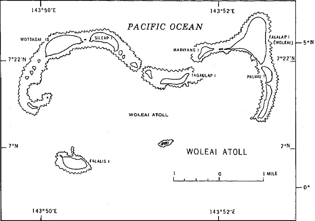
English: 1970 census of the (former) Trust Territory of the Pacific Islands (now Federated States of Micronesia, Palua, and Marshall Islands)
with several maps, including a map of Woleai Atoll, eastern Yap State |
| تاریخ | |
| منبع | http://www2.census.gov/prod2/decennial/documents/00496492v1p54-58ch5.pdf, page 8 |
| پدیدآور | U.S. Bureau of the Census |
اجازهنامه
This image or file is a work of a United States Census Bureau employee, taken or made as part of that person's official duties. As a work of the U.S. federal government, the image is in the public domain.
|
 |
تاریخچهٔ پرونده
روی تاریخ/زمانها کلیک کنید تا نسخهٔ مربوط به آن هنگام را ببینید.
| تاریخ/زمان | بندانگشتی | ابعاد | کاربر | توضیح | |
|---|---|---|---|---|---|
| کنونی | ۱۰ ژانویهٔ ۲۰۱۰، ساعت ۱۶:۵۰ | | ۱٬۲۰۰ در ۸۴۳ (۲۲ کیلوبایت) | Ratzer | {{Information |Description={{en|1=1970 census of the (former) Trust Territory of the Pacific Islands (now Federated States of Micronesia, Palua, and Marshall Islands) with several maps, including a map of Woleai Atoll, eastern Yap State}} |Source=http://w |
کاربرد پرونده
صفحهٔ زیر از این تصویر استفاده میکند:
کاربرد سراسری پرونده
ویکیهای دیگر زیر از این پرونده استفاده میکنند: