
پرونده:Un-bahrain.png

پروندهٔ اصلی (۲٬۱۰۴ × ۲٬۸۲۱ پیکسل، اندازهٔ پرونده: ۸۶۳ کیلوبایت، نوع MIME پرونده: image/png)
این پرونده در ویکیانبار موجود است. محتویات صفحهٔ توصیف آن در زیر نمایش داده میشود. |
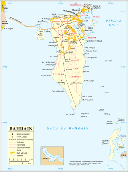
| This image is a map derived from a United Nations map.
Unless stated otherwise, UN maps are to be considered in the public domain. This applies worldwide. UN maps are, in principle, open source material and you can use them in your work or for making your own map. UN requests however that you delete the UN name, logo and reference number upon any modification to the map. Content of your map will be your responsibility. You can state in your publication, if you wish, something like: based on UN map … (map name, map number, revision number and date). See: Geospatial Information Section. And: Geospatial, location data for a better world. |
 |
تاریخچهٔ پرونده
روی تاریخ/زمانها کلیک کنید تا نسخهٔ مربوط به آن هنگام را ببینید.
| تاریخ/زمان | بندانگشتی | ابعاد | کاربر | توضیح | |
|---|---|---|---|---|---|
| کنونی | ۲۳ اکتبر ۲۰۰۷، ساعت ۰۲:۵۱ | | ۲٬۱۰۴ در ۲٬۸۲۱ (۸۶۳ کیلوبایت) | Jeroen | {{UN map}} Category:Maps of Bahrain |
کاربرد پرونده
صفحههای زیر از این تصویر استفاده میکنند:
کاربرد سراسری پرونده
ویکیهای دیگر زیر از این پرونده استفاده میکنند:
- کاربرد در ar.wikipedia.org
- کاربرد در az.wikipedia.org
- کاربرد در bn.wikipedia.org
- کاربرد در el.wikipedia.org
- کاربرد در en.wikipedia.org
- Transport in Bahrain
- Sitra
- Amwaj Islands
- Muharraq Island
- Durrat Al Bahrain
- Halat Nuaim
- Outline of Bahrain
- Bahrain Island
- Umm an Nasan
- Nabih Saleh
- Jidda Island
- Umm as Sabaan
- Bahrain light rail network
- Bahrain Bay
- Northern City
- Passport Island
- Al Dar Island
- Diyar Al Muharraq
- Nurana Islands
- Prince Khalifa Bin Salman Island
- Qassar al Qulayʽah
- Reef Island, Bahrain
- South Sitra Island
- Al Garum Islands
- Qassar Khusayfah
- کاربرد در eo.wikipedia.org
- کاربرد در es.wikipedia.org
- کاربرد در gl.wikipedia.org
- کاربرد در gom.wikipedia.org
- کاربرد در ha.wikipedia.org
نمایش استفادههای سراسری از این پرونده.