
پرونده:Santa lucia praslin political.png

اندازهٔ این پیشنمایش: ۴۲۴ × ۵۹۹ پیکسل. کیفیتهای دیگر: ۱۷۰ × ۲۴۰ پیکسل | ۳۳۹ × ۴۸۰ پیکسل | ۷۳۳ × ۱٬۰۳۶ پیکسل.
پروندهٔ اصلی (۷۳۳ × ۱٬۰۳۶ پیکسل، اندازهٔ پرونده: ۲۳ کیلوبایت، نوع MIME پرونده: image/png)
این پرونده در ویکیانبار موجود است. محتویات صفحهٔ توصیف آن در زیر نمایش داده میشود. |
خلاصه
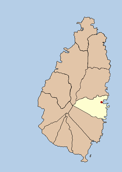
| توضیح | this is a political map showing the quarter of Praslin on the island nation of Santa Lucia. I created it myself by using the GIMP to trace a public domain map that i found at the Perry-Castañeda Library Map Collection. |
| تاریخ | ۲۱ سپتامبر ۲۰۰۵ (تاریخ اصلی بارگذاری) |
| منبع | No machine-readable source provided. Own work assumed (based on copyright claims). |
| پدیدآور | No machine-readable author provided. Doviende~commonswiki assumed (based on copyright claims). |
اجازهنامه
| من، دارنده حق تکثیر این اثر، این اثر را به مالکیت عمومی منتشر میکنم. این قابل اجرا در تمام نقاط جهان است. در برخی از کشورها ممکن است به صورت قانونی این امکانپذیر نباشد؛ اگر چنین است: من اجازهٔ استفاده از این اثر را برای هر مقصودی، بدون هیچگونه شرایطی میدهم، تا وقتی که این شرایط توسط قانون مستلزم نشده باشد. |

|
File:Saint Lucia district of Praslin.svg یک نسخهٔ برداری از این پرونده است.
آن پرونده را هنگامی که بهتر بود میبایست به جای این نسخهٔ تصویر استفاده کرد. File:Santa lucia praslin political.png → File:Saint Lucia district of Praslin.svg
برای کسب اطلاعات بیشتر در ارتباط با تصاویر برداری لطفاً اینجا را مطالعهکنید. همچنین اطلاعات بیشتری در ارتباط با حمایت مدیاویکی از تصاویر اسویجی وجود دارد. |
 |
تاریخچهٔ پرونده
روی تاریخ/زمانها کلیک کنید تا نسخهٔ مربوط به آن هنگام را ببینید.
| تاریخ/زمان | بندانگشتی | ابعاد | کاربر | توضیح | |
|---|---|---|---|---|---|
| کنونی | ۲۱ سپتامبر ۲۰۰۵، ساعت ۰۳:۴۲ | | ۷۳۳ در ۱٬۰۳۶ (۲۳ کیلوبایت) | Doviende~commonswiki | this is a political map showing the quarter of Praslin on the island nation of Santa Lucia. I created it myself by using the GIMP to trace [http://www.lib.utexas.edu/maps/americas/saint_lucia.gif a public domain map that i found] at the Perry-Castañ |
| ۲۱ سپتامبر ۲۰۰۵، ساعت ۰۳:۳۶ |  | ۷۳۳ در ۱٬۰۳۶ (۲۱ کیلوبایت) | Doviende~commonswiki | this is a political map showing the quarter of Praslin on the island nation of Santa Lucia. I created it myself by using the GIMP to trace [http://www.lib.utexas.edu/maps/americas/saint_lucia.gif|a public domain map that i found] at the Perry-Castañ |
کاربرد پرونده
صفحهٔ زیر از این تصویر استفاده میکند:
کاربرد سراسری پرونده
ویکیهای دیگر زیر از این پرونده استفاده میکنند:
- کاربرد در eo.wikipedia.org
- کاربرد در ko.wikipedia.org
- کاربرد در ur.wikipedia.org
- کاربرد در vi.wikipedia.org