پرونده:Prince William's Parish Church (Ruins), Sheldon vicinity (Beaufort County, South Carolina).jpg

Page contents not supported in other languages.
از ویکی‌پدیا، دانشنامهٔ آزاد

Prince_William's_Parish_Church_(Ruins),_Sheldon_vicinity_(Beaufort_County,_South_Carolina).jpg(۵۸۸ × ۴۱۱ پیکسل، اندازهٔ پرونده: ۱۳۱ کیلوبایت، نوع MIME پرونده: image/jpeg)

This is an image of a place or building that is listed on the National Register of Historic Places in the United States of America. Its reference number is 70000562.

توضیح
English: Prince William's Parish Church (Ruins), Sheldon vicinity (Beaufort County, South Carolina) - (cropped)
This file comes from the Historic American Buildings Survey (HABS), Historic American Engineering Record (HAER) or Historic American Landscapes Survey (HALS). These are programs of the National Park Service established for the purpose of documenting historic places. Records consist of measured drawings, archival photographs, and written reports.

این برچست وضعیت حق تکثیر اثر ضمیمه شده را مشخص نمی‌کند. یک برچسپ معمولی همچنان مورد نیاز است. Commons:Licensing را برای کسب اطلاعات مشاهده فرمایید.

Public domain This image or media file contains material based on a work of a National Park Service employee, created as part of that person's official duties. As a work of the U.S. federal government, such work is in the public domain in the United States. See the NPS website and NPS copyright policy for more information.
مختصات شیء۳۲° ۳۷′ ۰۶٫۷″ N, ۸۰° ۴۶′ ۴۹٫۷″ W Kartographer map based on OpenStreetMap.محل قرارگیری این نگاره و سایر نگاره‌ها در: نقشهٔ شهری بازinfo
تاریخ
منبع http://memory.loc.gov/cgi-bin/displayPhoto.pl?path=/pnp/habshaer/sc/sc0200/sc0277/photos&topImages=151946pr.jpg&topLinks=151946pv.jpg,151946pu.tif&title=HABS%20SC,7-SHELD,1-1&displayProfile=0
پدیدآور نامعلومUnknown author
اجازه‌نامه
(استفادهٔ مجدد از این پرونده)
This file comes from the Historic American Buildings Survey (HABS), Historic American Engineering Record (HAER) or Historic American Landscapes Survey (HALS). These are programs of the National Park Service established for the purpose of documenting historic places. Records consist of measured drawings, archival photographs, and written reports.


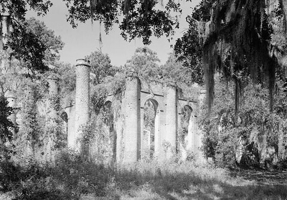
When reusing please credit: Library of Congress, Prints & Photographs Division, SC,7-SHELD,1-1
این برچست وضعیت حق تکثیر اثر ضمیمه شده را مشخص نمی‌کند. یک برچسپ معمولی همچنان مورد نیاز است. Commons:Licensing را برای کسب اطلاعات مشاهده فرمایید.

Public domain This image or media file contains material based on a work of a National Park Service employee, created as part of that person's official duties. As a work of the U.S. federal government, such work is in the public domain in the United States. See the NPS website and NPS copyright policy for more information.

عنوان

شرحی یک‌خطی از محتوای این فایل اضافه کنید

آیتم‌هایی که در این پرونده نمایش داده شده‌اند

توصیف‌ها

32°37'6.701"N, 80°46'49.699"W

تاریخچهٔ پرونده

روی تاریخ/زمان‌ها کلیک کنید تا نسخهٔ مربوط به آن هنگام را ببینید.

تاریخ/زمانبندانگشتیابعادکاربرتوضیح
کنونی‏۴ ژوئیهٔ ۲۰۰۸، ساعت ۱۹:۲۷تصویر بندانگشتی از نسخهٔ مورخ ‏۴ ژوئیهٔ ۲۰۰۸، ساعت ۱۹:۲۷۵۸۸ در ۴۱۱ (۱۳۱ کیلوبایت)KudzuVine{{Information |Description={{en|1=Prince William's Parish Church (Ruins), Sheldon vicinity (Beaufort County, South Carolina) - (cropped) {{PD-USGov-Interior-HABS}}}} |Source=http://memory.loc.gov/cgi-bin/displayPhoto.pl?path=/pnp/habshaer/sc/sc0200/sc0277

صفحهٔ زیر از این تصویر استفاده می‌کند:

کاربرد سراسری پرونده

ویکی‌های دیگر زیر از این پرونده استفاده می‌کنند:

فراداده