
پرونده:Ocean City Maryland aerial view north.jpg
اندازهٔ این پیشنمایش: ۸۰۰ × ۵۳۴ پیکسل. کیفیتهای دیگر: ۳۲۰ × ۲۱۴ پیکسل | ۶۴۰ × ۴۲۷ پیکسل | ۱٬۰۲۴ × ۶۸۳ پیکسل | ۱٬۵۰۰ × ۱٬۰۰۱ پیکسل.
پروندهٔ اصلی (۱٬۵۰۰ × ۱٬۰۰۱ پیکسل، اندازهٔ پرونده: ۷۵۳ کیلوبایت، نوع MIME پرونده: image/jpeg)
این پرونده در ویکیانبار موجود است. محتویات صفحهٔ توصیف آن در زیر نمایش داده میشود. |
| توضیح |
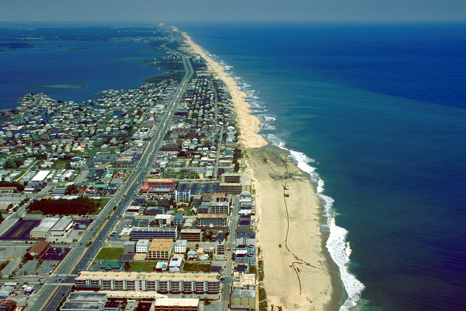
English: Aerial view of Ocean City, Maryland, USA. View is to the north-northeast. |
|||
| تاریخ | ||||
| منبع |
U.S. Army Corps of Engineers Digital Visual Library Image page Image description page Digital Visual Library home page |
|||
| پدیدآور | Tex Jobe, U.S. Army Corps of Engineers | |||
| اجازهنامه (استفادهٔ مجدد از این پرونده) |
|
|||
| مکان | Ocean City, Maryland, USA |
| مختصات دوربین | | محل قرارگیری این نگاره و سایر نگارهها در: نقشهٔ شهری باز |
|---|
تاریخچهٔ پرونده
روی تاریخ/زمانها کلیک کنید تا نسخهٔ مربوط به آن هنگام را ببینید.
| تاریخ/زمان | بندانگشتی | ابعاد | کاربر | توضیح | |
|---|---|---|---|---|---|
| کنونی | ۸ آوریل ۲۰۰۷، ساعت ۰۱:۱۰ | | ۱٬۵۰۰ در ۱٬۰۰۱ (۷۵۳ کیلوبایت) | DanMS | {{Information | Description = {{en|Aerial view of Ocean City, Maryland, USA. View is to the north-northeast.}} | Source = U.S. Army Corps of Engineers Digital Visual Library<br />[http://images.usace.army.mil/images/Hires/0454-12.Jpg Image page |
کاربرد پرونده
صفحهٔ زیر از این تصویر استفاده میکند:
کاربرد سراسری پرونده
ویکیهای دیگر زیر از این پرونده استفاده میکنند:
- کاربرد در ar.wikipedia.org
- کاربرد در bg.wikipedia.org
- کاربرد در bo.wikipedia.org
- کاربرد در ca.wikipedia.org
- کاربرد در de.wikipedia.org
- کاربرد در en.wikipedia.org
- کاربرد در es.wikipedia.org
- کاربرد در fr.wikipedia.org
- کاربرد در hak.wikipedia.org
- کاربرد در hi.wikipedia.org
- کاربرد در hu.wikipedia.org
- کاربرد در ilo.wikipedia.org
- کاربرد در is.wikipedia.org
- کاربرد در it.wikipedia.org
- کاربرد در ja.wikipedia.org
- کاربرد در kn.wikipedia.org
- کاربرد در pam.wikipedia.org
- کاربرد در pl.wikipedia.org
- کاربرد در pt.wikipedia.org
- کاربرد در tr.wikipedia.org
- کاربرد در ur.wikipedia.org
- کاربرد در zh.wikipedia.org