
پرونده:North Warwickshire UK locator map.svg

حجم پیشنمایش PNG این SVG file:۴۹۳ × ۵۹۹ پیکسل کیفیتهای دیگر: ۱۹۷ × ۲۴۰ پیکسل | ۳۹۵ × ۴۸۰ پیکسل | ۶۳۲ × ۷۶۸ پیکسل | ۸۴۳ × ۱٬۰۲۴ پیکسل | ۱٬۶۸۶ × ۲٬۰۴۸ پیکسل | ۱٬۰۴۲ × ۱٬۲۶۶ پیکسل.
پروندهٔ اصلی (پروندهٔ اسویجی، با ابعاد ۱٬۰۴۲ × ۱٬۲۶۶ پیکسل، اندازهٔ پرونده: ۹۱۱ کیلوبایت)
این پرونده در ویکیانبار موجود است. محتویات صفحهٔ توصیف آن در زیر نمایش داده میشود. |
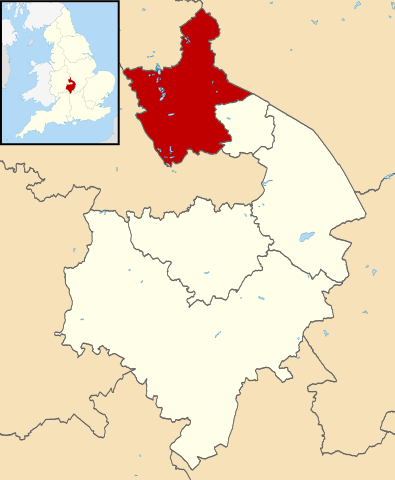
| توضیح | Map of Warwickshire, with North Warwickshire highlighted. |
| تاریخ | (UTC) |
| منبع | |
| پدیدآور |
|
.svg)
من، صاحب حقوق قانونی این اثر، به این وسیله این اثر را تحث اجازهنامهٔ ذیل منتشر میکنم:
این پرونده با اجازهنامهٔ کریتیو کامانز Attribution-Share Alike 3.0 سازگار نشده منتشر شده است.
- شما اجازه دارید:
- برای به اشتراک گذاشتن – برای کپی، توزیع و انتقال اثر
- تلفیق کردن – برای انطباق اثر
- تحت شرایط زیر:
- انتساب – شما باید اعتبار مربوطه را به دست آورید، پیوندی به مجوز ارائه دهید و نشان دهید که آیا تغییرات ایجاد شدهاند یا خیر. شما ممکن است این کار را به هر روش منطقی انجام دهید، اما نه به هر شیوهای که پیشنهاد میکند که مجوزدهنده از شما یا استفادهتان حمایت کند.
- انتشار مشابه – اگر این اثر را تلفیق یا تبدیل میکنید، یا بر پایه آن اثری دیگر خلق میکنید، میبایست مشارکتهای خود را تحت مجوز یکسان یا مشابه با ا اصل آن توزیع کنید.
سیاهه بارگذاری اصلی
This image is a derivative work of the following images:
- File:Warwickshire UK district map (blank).svg licensed with Cc-by-sa-3.0
- 2010-08-22T08:21:14Z Nilfanion 1042x1266 (931105 Bytes) +inset, water colour tweak
- 2010-07-16T23:57:57Z Nilfanion 1042x1266 (557360 Bytes) {{Information |Description=Map of [[w:Warwickshire|Warwickshire]], UK with districts shown. Equirectangular map projection on WGS 84 datum, with N/S stretched 160% Geographic limits: *West: 2.10W *East: 1.10W *North: 52.70N
تاریخچهٔ پرونده
روی تاریخ/زمانها کلیک کنید تا نسخهٔ مربوط به آن هنگام را ببینید.
| تاریخ/زمان | بندانگشتی | ابعاد | کاربر | توضیح | |
|---|---|---|---|---|---|
| کنونی | ۱۳ اوت ۲۰۱۱، ساعت ۰۹:۱۹ | | ۱٬۰۴۲ در ۱٬۲۶۶ (۹۱۱ کیلوبایت) | Renly~commonswiki | {{Information |Description=Map of Warwickshire, with North Warwickshire highlighted. |Source=*Warwickshire UK district map (blank).svg |Date=2011-08-13 09:19 (UTC) |Author=*[[:File:Warwickshire UK distric |
.svg)
کاربرد پرونده
صفحهٔ زیر از این تصویر استفاده میکند:
کاربرد سراسری پرونده
ویکیهای دیگر زیر از این پرونده استفاده میکنند:
- کاربرد در cy.wikipedia.org
- کاربرد در en.wikipedia.org
- کاربرد در es.wikipedia.org
- کاربرد در fr.wikipedia.org
- Polesworth
- Atherstone
- Coleshill (Warwickshire)
- North Warwickshire
- Astley (Warwickshire)
- Seckington
- Liste des paroisses civiles du Warwickshire
- Ansley (Royaume-Uni)
- Arley (Warwickshire)
- Austrey
- Baddesley Ensor
- Baxterley
- Curdworth
- Dordon
- Fillongley
- Great Packington
- Hartshill
- Lea Marston
- Little Packington
- Mancetter
- Maxstoke
- Merevale
- Nether Whitacre
- Newton Regis
- Over Whitacre
- Shustoke
- Shuttington
- Water Orton
- Bentley (Warwickshire)
- Caldecote (Warwickshire)
- Corley (Royaume-Uni)
- Kingsbury (Warwickshire)
- Middleton (Warwickshire)
- Wishaw (Angleterre)
- Grendon (Warwickshire)
- Modèle:Palette North Warwickshire
- کاربرد در it.wikipedia.org
- کاربرد در ja.wikipedia.org
- کاربرد در ko.wikipedia.org
- کاربرد در pl.wikipedia.org
- کاربرد در ro.wikipedia.org
- کاربرد در ru.wikipedia.org
- کاربرد در sv.wikipedia.org
- کاربرد در ur.wikipedia.org
- کاربرد در www.wikidata.org
نمایش استفادههای سراسری از این پرونده.