
پرونده:NZ-West Coast plain map.png
تفکیکپذیری بالاتری در دسترس نیست.
NZ-West_Coast_plain_map.png (۳۷۸ × ۴۲۳ پیکسل، اندازهٔ پرونده: ۲۱ کیلوبایت، نوع MIME پرونده: image/png)
این پرونده در ویکیانبار موجود است. محتویات صفحهٔ توصیف آن در زیر نمایش داده میشود. |
خلاصه
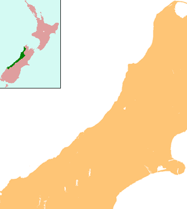
| توضیح | Locator map for West Coast Region, New Zealand |
| تاریخ | |
| منبع | combination of Image:NZ-SI plain map.png and Image:Position of West Coast.png |
| پدیدآور | Grutness |
| اجازهنامه (استفادهٔ مجدد از این پرونده) |
public domain |
اجازهنامه
| من، دارنده حق تکثیر این اثر، این اثر را به مالکیت عمومی منتشر میکنم. این قابل اجرا در تمام نقاط جهان است. در برخی از کشورها ممکن است به صورت قانونی این امکانپذیر نباشد؛ اگر چنین است: من اجازهٔ استفاده از این اثر را برای هر مقصودی، بدون هیچگونه شرایطی میدهم، تا وقتی که این شرایط توسط قانون مستلزم نشده باشد. |
تاریخچهٔ پرونده
روی تاریخ/زمانها کلیک کنید تا نسخهٔ مربوط به آن هنگام را ببینید.
| تاریخ/زمان | بندانگشتی | ابعاد | کاربر | توضیح | |
|---|---|---|---|---|---|
| کنونی | ۱۷ ژوئیهٔ ۲۰۰۸، ساعت ۱۳:۲۵ | | ۳۷۸ در ۴۲۳ (۲۱ کیلوبایت) | Grutness | {{Information |Description=== Summary == {{Information |Description=Locator map for West Coast Region, New Zealand |Source=combination of Image:NZ-SI plain map.png and Image:Position of West Coast.png |Date=17 July 2008 |Author=Grutness |Permiss |
کاربرد پرونده
صفحههای زیر از این تصویر استفاده میکنند:
کاربرد سراسری پرونده
ویکیهای دیگر زیر از این پرونده استفاده میکنند:
- کاربرد در ar.wikipedia.org
- کاربرد در ceb.wikipedia.org
- کاربرد در en.wikipedia.org
- Kokiri
- Punakaiki
- Franz Josef Glacier
- Crushington, New Zealand
- Lake Christabel
- Brunner, New Zealand
- Hokitika Airport
- Lendenfeld Peak
- Ngahere
- Cronadun
- Te Kuha
- Lake Ianthe
- Pukekura
- Lake Poerua
- Inchbonnie
- Ruatapu, New Zealand
- Lake Mahinapua
- Whataroa River
- Whataroa
- Stillwater, West Coast
- Westport Airport (New Zealand)
- Millerton, New Zealand
- Stockton, New Zealand
- Seddonville
- Summerlea, New Zealand
- Sergeants Hill
- List of schools in the West Coast, New Zealand
- Lake Daniell
- Module:Location map/data/New Zealand West Coast/doc
- Maruia
- Haupiri
- Kokatahi
- Lyell, New Zealand
- Waiuta
- Mount Rolleston
- User:Sladew/Charles Edward Douglas
- Charlie Douglas
- Mount Cook Aerodrome
- Mokihinui
- Module:Location map/data/New Zealand West Coast
- Agassiz Glacier (New Zealand)
- Wallsend, New Zealand
- Dunollie, New Zealand
- Ballroom Overhang
- Pancake Rocks and Blowholes
- Ōtūmahana Estuary
- Gates of Haast
- کاربرد در fr.wikipedia.org
نمایش استفادههای سراسری از این پرونده.