
پرونده:Map of Eastern Siberia.png

پروندهٔ اصلی (۱٬۵۴۱ × ۹۸۲ پیکسل، اندازهٔ پرونده: ۲٫۷۴ مگابایت، نوع MIME پرونده: image/png)
این پرونده در ویکیانبار موجود است. محتویات صفحهٔ توصیف آن در زیر نمایش داده میشود. |
خلاصه
| توضیح |
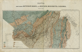
English: Map of the Southern Half of Eastern Siberia and Parts of Mongolia, Manchuria, and Sakhalin: For a General Sketch of the Orography of Eastern Siberia.
Русский: Кропоткин П. А. Карта южной половины Восточной Сибири, части Монголии: к Общему Очерку Орографии Восточной Сибири. Зап. по Общ. Геогр. т. 5. СПб.: [1875], Лит. Н. Брезв. 1 л.: цв. 48х76 см. |
| تاریخ | |
| منبع | http://www.wdl.org/en/item/125/ |
| پدیدآور | Peter Kropotkin |
اجازهنامه
|
این اثر در کشورهایی و مناطقی که مدت زمان حق تکثیر، عمر پدیدآورنده بعلاوه 70 سال یا کمتر بعد از مرگ او است، در مالکیت عمومی قرار دارد.
| |
| این پرونده تحت قانون حق تکثیر محدودیت آزاد منتشر شده که شامل تمامی حقوق مربوطه و حقوق نزدیک به آن میشود. | |
تاریخچهٔ پرونده
روی تاریخ/زمانها کلیک کنید تا نسخهٔ مربوط به آن هنگام را ببینید.
| تاریخ/زمان | بندانگشتی | ابعاد | کاربر | توضیح | |
|---|---|---|---|---|---|
| کنونی | ۲۰ نوامبر ۲۰۱۱، ساعت ۱۵:۴۹ | | ۱٬۵۴۱ در ۹۸۲ (۲٫۷۴ مگابایت) | Koroesu | {{Information |Description ={{en|1=Map of the Southern Half of Eastern Siberia and Parts of Mongolia, Manchuria, and Sakhalin: For a General Sketch of the Orography of Eastern Siberia.}} |Source =http://www.wdl.org/en/item/125/ |Author |
کاربرد پرونده
صفحهٔ زیر از این تصویر استفاده میکند:
کاربرد سراسری پرونده
ویکیهای دیگر زیر از این پرونده استفاده میکنند:
- کاربرد در ar.wikipedia.org
- کاربرد در az.wikipedia.org
- کاربرد در ba.wikipedia.org
- کاربرد در bg.wikipedia.org
- کاربرد در ca.wikipedia.org
- کاربرد در ce.wikipedia.org
- کاربرد در da.wikipedia.org
- کاربرد در de.wikipedia.org
- کاربرد در en.wikipedia.org
- کاربرد در eo.wikipedia.org
- کاربرد در et.wikipedia.org
- کاربرد در fi.wikipedia.org
- کاربرد در fr.wikipedia.org
- کاربرد در gl.wikipedia.org
- کاربرد در hy.wikipedia.org
- کاربرد در id.wikipedia.org
- کاربرد در ky.wikipedia.org
- کاربرد در no.wikipedia.org
- کاربرد در pl.wikipedia.org
- کاربرد در ru.wikipedia.org
- کاربرد در sk.wikipedia.org
- کاربرد در sv.wikipedia.org
- کاربرد در tr.wikipedia.org
- کاربرد در uk.wikipedia.org