
پرونده:Ireland.svg

حجم پیشنمایش PNG این SVG file:۴۷۱ × ۵۹۹ پیکسل کیفیتهای دیگر: ۱۸۸ × ۲۴۰ پیکسل | ۳۷۷ × ۴۸۰ پیکسل | ۶۰۳ × ۷۶۸ پیکسل | ۸۰۴ × ۱٬۰۲۴ پیکسل | ۱٬۶۰۹ × ۲٬۰۴۸ پیکسل | ۲٬۲۰۰ × ۲٬۸۰۰ پیکسل.
پروندهٔ اصلی (پروندهٔ اسویجی، با ابعاد ۲٬۲۰۰ × ۲٬۸۰۰ پیکسل، اندازهٔ پرونده: ۲۰۴ کیلوبایت)
این پرونده در ویکیانبار موجود است. محتویات صفحهٔ توصیف آن در زیر نمایش داده میشود. |
خلاصه
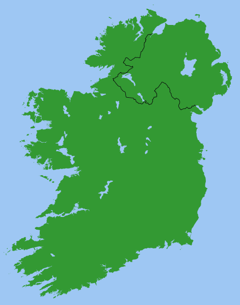
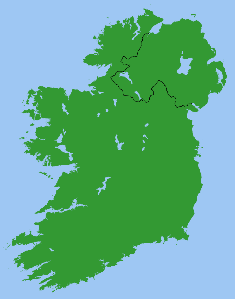
Map of Ireland, with North-South boundary delimited.
SVG should be fairly easy to alter or expand. For example the following can all be achieved with one-line CSS changes:
- You can toggle the Northern Ireland border on/off or change its thickness
- You can change any of the colours
- You can draw a border around all the land to make it more distinct from the sea
- You can hide Northern Ireland or the Republic of Ireland.
You can also do any of the following just by changing or adding/removing a few lines of SVG code:
- Zoom in on Northern Ireland, the Munster shoreline, or any other area
- Remove all the small islands (e.g. for faster rendering)
- Add drop shadows (feGaussianBlur), textured ground (feTurbulance) or topography (feDisplacementMap + feSpecularLighting)
- Add cities and towns.
- Add rivers. Anyone care to do this?
Originally derived from Image:Lough-Neagh.svg.
اجازهنامه
| من، دارنده حق تکثیر این اثر، این اثر را به مالکیت عمومی منتشر میکنم. این قابل اجرا در تمام نقاط جهان است. در برخی از کشورها ممکن است به صورت قانونی این امکانپذیر نباشد؛ اگر چنین است: من اجازهٔ استفاده از این اثر را برای هر مقصودی، بدون هیچگونه شرایطی میدهم، تا وقتی که این شرایط توسط قانون مستلزم نشده باشد. |
s]]
تاریخچهٔ پرونده
روی تاریخ/زمانها کلیک کنید تا نسخهٔ مربوط به آن هنگام را ببینید.
| تاریخ/زمان | بندانگشتی | ابعاد | کاربر | توضیح | |
|---|---|---|---|---|---|
| کنونی | ۱۳ مارس ۲۰۰۷، ساعت ۲۱:۴۹ | | ۲٬۲۰۰ در ۲٬۸۰۰ (۲۰۴ کیلوبایت) | Nickshanks | increased default size, modified lough Erne |
| ۱۳ مارس ۲۰۰۷، ساعت ۲۱:۱۹ |  | ۵۵۰ در ۷۰۰ (۲۰۴ کیلوبایت) | Nickshanks | Map of Ireland, with North-South boundary delimited.<br/> SVG should be fairly easy to alter or expand. Northern Ireland is a separate group element<br/> Needs rivers adding. Anyone care to do this? Originally derived from Image:Lough-Neagh.svg. |
کاربرد پرونده
صفحهٔ زیر از این تصویر استفاده میکند:
کاربرد سراسری پرونده
ویکیهای دیگر زیر از این پرونده استفاده میکنند:
- کاربرد در ca.wikipedia.org
- کاربرد در en.wikipedia.org
- Michael Collins (Irish leader)
- Irish Boundary Commission
- Talk:Ireland (disambiguation)
- Repartition of Ireland
- User talk:BrownHairedGirl/Archive/Archive 012
- User:Roadnote/Ireland
- Wikipedia talk:WikiProject Eurovision/Archive 3
- List of Irish Presbyteries
- National symbols of Ireland, the Republic of Ireland and Northern Ireland
- کاربرد در es.wikipedia.org
- کاربرد در fr.wikipedia.org
- کاربرد در ga.wikipedia.org
- کاربرد در it.wikipedia.org
- کاربرد در no.wikipedia.org
- کاربرد در pl.wikipedia.org
- کاربرد در pt.wikipedia.org
- کاربرد در ru.wikipedia.org
- کاربرد در simple.wikipedia.org
- کاربرد در sl.wikipedia.org
- کاربرد در sv.wikipedia.org