پرونده:Floridakeys-nasa.jpg
ظاهر

اندازهٔ این پیشنمایش: ۸۰۰ × ۵۷۱ پیکسل. کیفیتهای دیگر: ۳۲۰ × ۲۲۹ پیکسل | ۶۴۰ × ۴۵۷ پیکسل | ۱٬۰۲۴ × ۷۳۱ پیکسل | ۱٬۴۰۰ × ۱٬۰۰۰ پیکسل.
پروندهٔ اصلی (۱٬۴۰۰ × ۱٬۰۰۰ پیکسل، اندازهٔ پرونده: ۲۱۵ کیلوبایت، نوع MIME پرونده: image/jpeg)
تاریخچهٔ پرونده
روی تاریخ/زمانها کلیک کنید تا نسخهٔ مربوط به آن هنگام را ببینید.
| تاریخ/زمان | بندانگشتی | ابعاد | کاربر | توضیح | |
|---|---|---|---|---|---|
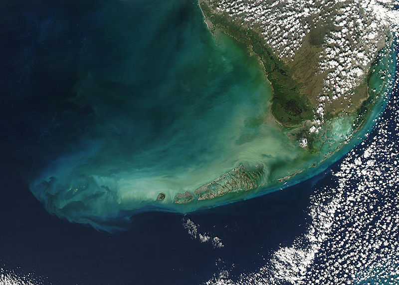
| کنونی | ۲۳ اوت ۲۰۰۵، ساعت ۲۱:۵۹ |  | ۱٬۴۰۰ در ۱٬۰۰۰ (۲۱۵ کیلوبایت) | Nanosmile | * Credit Jeff Schmaltz, MODIS Rapid Response Team, NASA/GSFC Turbid waters surround southern Florida and the Florida Keys in this true-color Moderate Resolution Imaging Spectroradiometer (MODIS) image taken by the Aqua satellite on Dece |
کاربرد پرونده
صفحهٔ زیر از این تصویر استفاده میکند:
کاربرد سراسری پرونده
ویکیهای دیگر زیر از این پرونده استفاده میکنند:
- کاربرد در ar.wikipedia.org
- کاربرد در arz.wikipedia.org
- کاربرد در az.wikipedia.org
- کاربرد در be.wikipedia.org
- کاربرد در ca.wikipedia.org
- کاربرد در ceb.wikipedia.org
- کاربرد در de.wikipedia.org
- کاربرد در en.wikipedia.org
- کاربرد در eo.wikipedia.org
- کاربرد در es.wikipedia.org
- کاربرد در fr.wikipedia.org
- کاربرد در fy.wikipedia.org
- کاربرد در he.wikipedia.org
- کاربرد در it.wikipedia.org
- کاربرد در ka.wikipedia.org
- کاربرد در no.wikipedia.org
- کاربرد در pl.wikipedia.org
- کاربرد در pl.wiktionary.org
- کاربرد در pt.wikipedia.org
- کاربرد در ru.wikipedia.org
- کاربرد در uk.wikipedia.org
- کاربرد در www.wikidata.org
- کاربرد در zh.wikipedia.org


