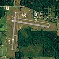
پرونده:Middleton Field.jpg

اندازهٔ این پیشنمایش: ۶۰۰ × ۶۰۰ پیکسل. کیفیتهای دیگر: ۲۴۰ × ۲۴۰ پیکسل | ۴۸۰ × ۴۸۰ پیکسل | ۷۶۸ × ۷۶۸ پیکسل | ۱٬۰۲۴ × ۱٬۰۲۴ پیکسل | ۱٬۸۸۹ × ۱٬۸۸۹ پیکسل.
پروندهٔ اصلی (۱٬۸۸۹ × ۱٬۸۸۹ پیکسل، اندازهٔ پرونده: ۱٫۰۹ مگابایت، نوع MIME پرونده: image/jpeg)
تاریخچهٔ پرونده
روی تاریخ/زمانها کلیک کنید تا نسخهٔ مربوط به آن هنگام را ببینید.
| تاریخ/زمان | بندانگشتی | ابعاد | کاربر | توضیح | |
|---|---|---|---|---|---|
| کنونی | ۲۱ ژوئن ۲۰۰۹، ساعت ۲۱:۱۱ |  | ۱٬۸۸۹ در ۱٬۸۸۹ (۱٫۰۹ مگابایت) | AuburnPilot | == Summary == {{Information |Description=Satellite image of Middleton Field in Evergreen, Alabama, United States on 30 June 2006 |Source=United States Geological Survey (National Agriculture Imagery Program (NAIP) Orthoimagery for Z |
کاربرد پرونده
صفحهٔ زیر از این تصویر استفاده میکند:
کاربرد سراسری پرونده
ویکیهای دیگر زیر از این پرونده استفاده میکنند:
- کاربرد در ceb.wikipedia.org
- کاربرد در en.wikipedia.org
- کاربرد در tg.wikipedia.org
- کاربرد در www.wikidata.org

