
پرونده:Mediterranean Sea political map-blank.svg

حجم پیشنمایش PNG این SVG file:۸۰۰ × ۵۸۵ پیکسل کیفیتهای دیگر: ۳۲۰ × ۲۳۴ پیکسل | ۶۴۰ × ۴۶۸ پیکسل | ۱٬۰۲۴ × ۷۴۹ پیکسل | ۱٬۲۸۰ × ۹۳۶ پیکسل | ۲٬۵۶۰ × ۱٬۸۷۲ پیکسل | ۲٬۰۴۶ × ۱٬۴۹۶ پیکسل.
پروندهٔ اصلی (پروندهٔ اسویجی، با ابعاد ۲٬۰۴۶ × ۱٬۴۹۶ پیکسل، اندازهٔ پرونده: ۱٫۰۶ مگابایت)
این پرونده در ویکیانبار موجود است. محتویات صفحهٔ توصیف آن در زیر نمایش داده میشود. |
خلاصه
| توضیح |
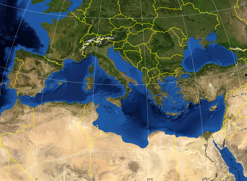
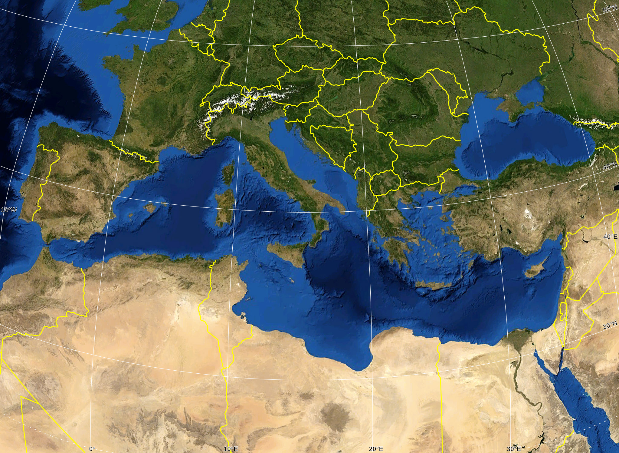
English: Blank map of the Mediterranean Sea, with the State borders.
Français : Carte vierge de la Mer Méditerranée avec les frontières nationales. |
| تاریخ | |
| منبع |
Own work ; Raster background map : screenshot from NASA World Wind (Public Domain) |
| پدیدآور | Eric Gaba (Sting - fr:Sting) |
| اجازهنامه (استفادهٔ مجدد از این پرونده) |
All rights released |
| دیگر نسخهها |
آثار انشقاقی از این پرونده: Delian League Campaign Map.png
|


اجازهنامه
| این تصویر در مالکیت عمومی قرار دارد به این دلیل که از نرمافزار زمین ناسا World Wind با استفاده یک لایهٔ مالکیت عمومی، از قبیل Blue Marble، MODIS، Landsat، SRTM، USGS یا GLOBE گرفته شده است.
|
 |
| This work was previously under Public Domain, or a Free License. It has been digitally enhanced and/or modified. This derivative work has been (or is hereby) released into the public domain by its author, Sting at the French Wikipedia project. This applies worldwide. In some countries this is not legally possible; if so:
|
تاریخچهٔ پرونده
روی تاریخ/زمانها کلیک کنید تا نسخهٔ مربوط به آن هنگام را ببینید.
| تاریخ/زمان | بندانگشتی | ابعاد | کاربر | توضیح | |
|---|---|---|---|---|---|
| کنونی | ۱۹ مهٔ ۲۰۰۸، ساعت ۱۶:۱۴ | | ۲٬۰۴۶ در ۱٬۴۹۶ (۱٫۰۶ مگابایت) | Sting | "Tropic of Cancer" label correction |
| ۲۱ ژوئن ۲۰۰۷، ساعت ۰۱:۰۷ |  | ۲٬۰۴۶ در ۱٬۴۹۶ (۱٫۰۶ مگابایت) | Sting | {{Information |Description=Blank map of the Mediterranean Sea, with the State borders. |Source=Own work ;<br/>Background map : screenshot from NASA World Wind (Public Domain) |Date=June 2007 |Author=Eric Gaba ([[User:Sting|Sting] |
کاربرد پرونده
این پرونده در هیچ صفحهای به کار نرفته است.
کاربرد سراسری پرونده
ویکیهای دیگر زیر از این پرونده استفاده میکنند:
- کاربرد در ar.wikipedia.org
- کاربرد در fr.wikipedia.org
- کاربرد در gv.wikipedia.org
- کاربرد در id.wikipedia.org
- کاربرد در pl.wiktionary.org