
پرونده:Location map Southern Los Angeles.png
اندازهٔ این پیشنمایش: ۶۳۱ × ۶۰۰ پیکسل. کیفیتهای دیگر: ۲۵۳ × ۲۴۰ پیکسل | ۵۰۵ × ۴۸۰ پیکسل | ۶۸۸ × ۶۵۴ پیکسل.
پروندهٔ اصلی (۶۸۸ × ۶۵۴ پیکسل، اندازهٔ پرونده: ۵۵۴ کیلوبایت، نوع MIME پرونده: image/png)
این پرونده در ویکیانبار موجود است. محتویات صفحهٔ توصیف آن در زیر نمایش داده میشود. |
| Description |
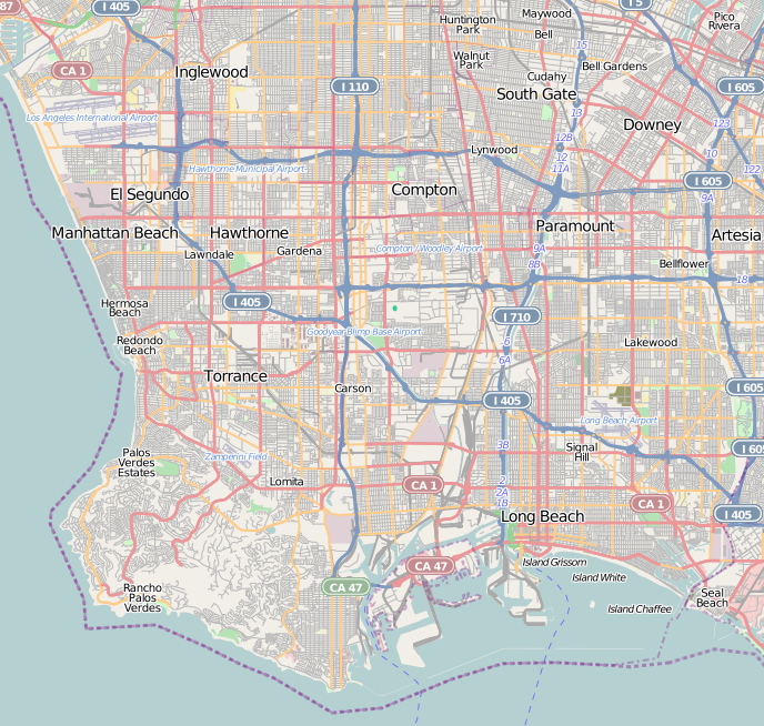
This map of Southern Los Angeles County and Greater Los Angeles, and South Bay region — Southern California. was created from OpenStreetMap project data, collected by the community. This map may be incomplete, and may contain errors. Don't rely solely on it for navigation. |
|||||||||
| تاریخ | (see file history) | |||||||||
| منبع | openstreetmap.org | |||||||||
| پدیدآورنده |
OpenStreetMap contributors |
|||||||||
| اجازهنامه (استفادهٔ مجدد از این پرونده) |
OpenStreetMap data and maps are licensed under the Creative Commons Attribution-ShareAlike 2.0 license (CC-BY-SA 2.0). این پرونده با اجازهنامهٔ کریتیو کامانز Attribution-Share Alike 2.0 عمومی منتشر شده است.
|
|||||||||
| دادههای زمینزمانی | ||||||||||
| جعبهٔ حدود |
|
|||||||||
| زمینمرجعسازی | اگر نامناسب بود لطفاً warp_status = skie را برای مخفیسازی تنظیم کنید. | |||||||||
تاریخچهٔ پرونده
روی تاریخ/زمانها کلیک کنید تا نسخهٔ مربوط به آن هنگام را ببینید.
| تاریخ/زمان | بندانگشتی | ابعاد | کاربر | توضیح | |
|---|---|---|---|---|---|
| کنونی | ۱۲ اکتبر ۲۰۱۰، ساعت ۰۶:۰۵ | | ۶۸۸ در ۶۵۴ (۵۵۴ کیلوبایت) | Zzyzx11 | {{OpenStreetMap |location= Southern Los Angeles |top= 33.992 |bottom= 33.691 |left= -118.458 |right= -118.077 }} Category:OpenStreetMap maps of the United States Category:Maps of Los Angeles |
کاربرد پرونده
صفحههای زیر از این تصویر استفاده میکنند:
کاربرد سراسری پرونده
ویکیهای دیگر زیر از این پرونده استفاده میکنند:
- کاربرد در ar.wikipedia.org
- کاربرد در azb.wikipedia.org
- کاربرد در ceb.wikipedia.org
- کاربرد در en.wikipedia.org
- San Pedro, Los Angeles
- Wilmington, Los Angeles
- Playa del Rey, Los Angeles
- Watts Towers
- Watts, Los Angeles
- Terminal Island
- Harbor City, Los Angeles
- Module:Location map/data/United States Los Angeles Southern/doc
- Manchester Square, Los Angeles
- West Park Terrace, Los Angeles
- Broadway-Manchester, Los Angeles
- Green Meadows, Los Angeles
- Vermont Vista, Los Angeles
- Module:Location map/data/United States Los Angeles Southern
- Magnolia Square, Los Angeles
- Hawkins House of Burgers
- کاربرد در fy.wikipedia.org
- کاربرد در ja.wikipedia.org
- کاربرد در kn.wikipedia.org
- کاربرد در simple.wikipedia.org
- کاربرد در si.wikipedia.org
- کاربرد در tr.wikipedia.org
- کاربرد در uz.wikipedia.org
- کاربرد در war.wikipedia.org