
پرونده:Brent crude oil map.png

اندازهٔ این پیشنمایش: ۷۷۶ × ۶۰۰ پیکسل. کیفیتهای دیگر: ۳۱۱ × ۲۴۰ پیکسل | ۶۲۱ × ۴۸۰ پیکسل | ۹۹۴ × ۷۶۸ پیکسل | ۱٬۲۸۰ × ۹۸۹ پیکسل | ۲٬۵۶۰ × ۱٬۹۷۸ پیکسل | ۳٬۳۰۰ × ۲٬۵۵۰ پیکسل.
پروندهٔ اصلی (۳٬۳۰۰ × ۲٬۵۵۰ پیکسل، اندازهٔ پرونده: ۲۴۳ کیلوبایت، نوع MIME پرونده: image/png)
این پرونده در ویکیانبار موجود است. محتویات صفحهٔ توصیف آن در زیر نمایش داده میشود. |
خلاصه
| توضیح |
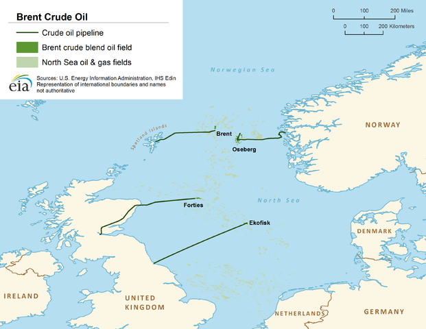
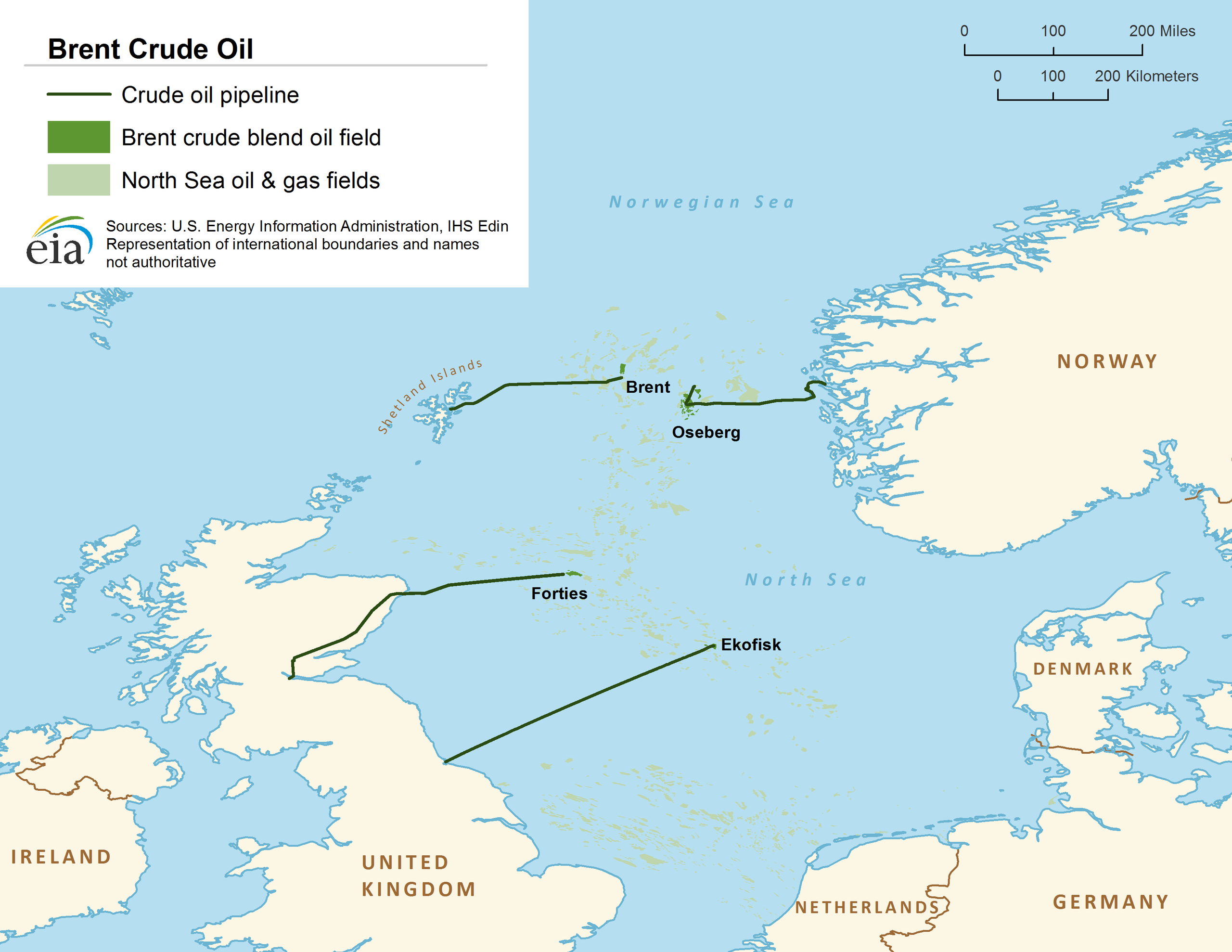
English: Location of Brent oil platform in the North Sea |
| تاریخ | |
| منبع | http://www.eia.gov/countries/cab.cfm?fips=UK |
| پدیدآور | US Energy Information Administration |
اجازهنامه
| This image is a work of a United States Department of Energy (or predecessor organization) employee, taken or made as part of that person's official duties. As a work of the U.S. federal government, the image is in the public domain.
Please note that national laboratories operate under varying licences and some are not free. Check the site policies of any national lab before crediting it with this tag.
|

|
تاریخچهٔ پرونده
روی تاریخ/زمانها کلیک کنید تا نسخهٔ مربوط به آن هنگام را ببینید.
| تاریخ/زمان | بندانگشتی | ابعاد | کاربر | توضیح | |
|---|---|---|---|---|---|
| کنونی | ۲۹ اوت ۲۰۱۳، ساعت ۰۳:۲۶ | | ۳٬۳۰۰ در ۲٬۵۵۰ (۲۴۳ کیلوبایت) | Plazak | User created page with UploadWizard |
کاربرد پرونده
صفحهٔ زیر از این تصویر استفاده میکند:
کاربرد سراسری پرونده
ویکیهای دیگر زیر از این پرونده استفاده میکنند:
- کاربرد در be-tarask.wikipedia.org
- کاربرد در ca.wikipedia.org
- کاربرد در de.wikipedia.org
- کاربرد در ko.wikipedia.org
- کاربرد در ms.wikipedia.org
- کاربرد در ru.wikipedia.org
- کاربرد در ru.wikinews.org
- کاربرد در simple.wikipedia.org
- کاربرد در tr.wikipedia.org
- کاربرد در uk.wikipedia.org
- کاربرد در vi.wikipedia.org