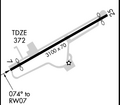
پرونده:Airport diagram Blairstown NJ 1N7.png

اندازهٔ این پیشنمایش: ۳۴۳ × ۵۹۹ پیکسل. کیفیتهای دیگر: ۱۳۷ × ۲۴۰ پیکسل | ۳۵۵ × ۶۲۰ پیکسل.
پروندهٔ اصلی (۳۵۵ × ۶۲۰ پیکسل، اندازهٔ پرونده: ۱۵ کیلوبایت، نوع MIME پرونده: image/png)
تاریخچهٔ پرونده
روی تاریخ/زمانها کلیک کنید تا نسخهٔ مربوط به آن هنگام را ببینید.
| تاریخ/زمان | بندانگشتی | ابعاد | کاربر | توضیح | |
|---|---|---|---|---|---|
| کنونی | ۲ ژوئیهٔ ۲۰۱۵، ساعت ۱۵:۲۷ |  | ۳۵۵ در ۶۲۰ (۱۵ کیلوبایت) | Cherkash | updated from RNAV (GPS) RWY 25 approach plate (effective 2015-06-25), with some modifications |
| ۱۶ فوریهٔ ۲۰۱۵، ساعت ۰۱:۰۴ |  | ۳۵۵ در ۶۲۰ (۱۵ کیلوبایت) | Cherkash | updated from RNAV (GPS) RWY 7 approach plate (effective 2015-02-05), with some modifications | |
| ۲۲ فوریهٔ ۲۰۰۸، ساعت ۱۶:۱۲ |  | ۲۸۰ در ۲۴۴ (۹ کیلوبایت) | Private Pilot | {{Information |Description=Airport Diagram of Blairstown Airport |Source= [http://naco.faa.gov/d-tpp/0802/06784V25.PDF] Link and image change every 30 days |Date= |Author=Federal Aviation Administration |Permission= |other_versions= }} |
کاربرد پرونده
صفحهٔ زیر از این تصویر استفاده میکند:
کاربرد سراسری پرونده
ویکیهای دیگر زیر از این پرونده استفاده میکنند:
- کاربرد در ceb.wikipedia.org
- کاربرد در en.wikipedia.org
- کاربرد در tg.wikipedia.org
- کاربرد در ur.wikipedia.org
- کاربرد در www.wikidata.org


