
پرونده:Whiteseamap.jpg
پروندهٔ اصلی (۱٬۴۷۸ × ۱٬۲۶۷ پیکسل، اندازهٔ پرونده: ۳۷۰ کیلوبایت، نوع MIME پرونده: image/jpeg)
این پرونده در ویکیانبار موجود است. محتویات صفحهٔ توصیف آن در زیر نمایش داده میشود. |
| توضیح |
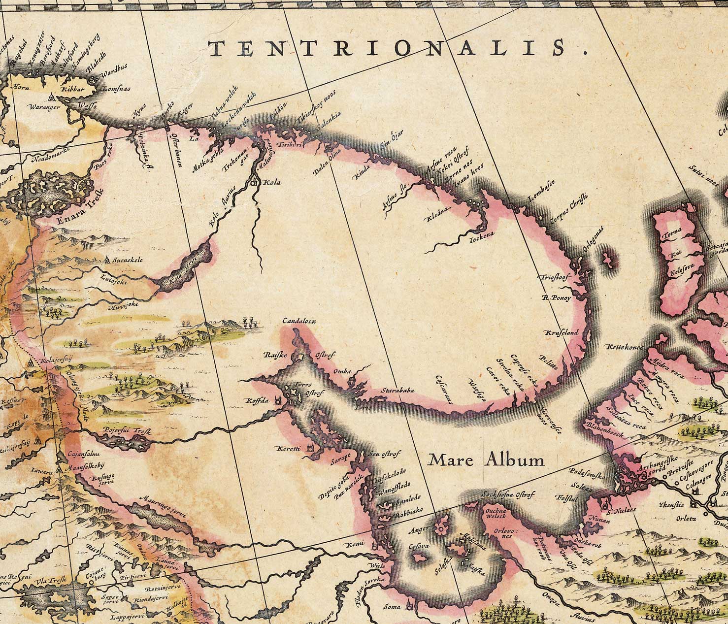
English: Map of the White Sea and adjacent regions. From the Dutch "Novus Atlas" (1635). Cartographer: Willem Janszoon Blaeu. |
|||||||||||
| منبع | http://biarmia.narod.ru/17.html Transferred from en.wikipedia to Commons by Hardscarf using CommonsHelper. | |||||||||||
| پدیدآور | ||||||||||||
| اجازهنامه (استفادهٔ مجدد از این پرونده) |
|
|||||||||||


سیاهه بارگذاری اصلی
- 2007-06-19 16:59 Ghirlandajo 1478×1267× (379069 bytes) Map of the [[White Sea]] and adjacent regions. From the Dutch "Novus Atlas" (1635). Cartographer: Willem Janszoon Blaeu. {{PD-art}} Source: http://biarmia.narod.ru/17.html
تاریخچهٔ پرونده
روی تاریخ/زمانها کلیک کنید تا نسخهٔ مربوط به آن هنگام را ببینید.
| تاریخ/زمان | بندانگشتی | ابعاد | کاربر | توضیح | |
|---|---|---|---|---|---|
| کنونی | ۲ دسامبر ۲۰۰۹، ساعت ۱۱:۰۰ | | ۱٬۴۷۸ در ۱٬۲۶۷ (۳۷۰ کیلوبایت) | File Upload Bot (Magnus Manske) | {{BotMoveToCommons|en.wikipedia|year={{subst:CURRENTYEAR}}|month={{subst:CURRENTMONTHNAME}}|day={{subst:CURRENTDAY}}}} {{Information |Description={{en|Map of the en:White Sea and adjacent regions. From the Dutch "Novus Atlas" (1635). Cartographer: |
کاربرد پرونده
صفحهٔ زیر از این تصویر استفاده میکند:
کاربرد سراسری پرونده
ویکیهای دیگر زیر از این پرونده استفاده میکنند:
- کاربرد در ar.wikipedia.org
- کاربرد در ca.wikipedia.org
- کاربرد در cs.wikipedia.org
- کاربرد در de.wikipedia.org
- کاربرد در en.wikipedia.org
- کاربرد در es.wikipedia.org
- کاربرد در fi.wikipedia.org
- کاربرد در frr.wikipedia.org
- کاربرد در hr.wikipedia.org
- کاربرد در la.wikipedia.org
- کاربرد در nl.wikipedia.org
- کاربرد در no.wikipedia.org
- کاربرد در ru.wikipedia.org
- کاربرد در sr.wikipedia.org
- کاربرد در ta.wikipedia.org
- کاربرد در te.wikipedia.org
- کاربرد در uk.wikipedia.org
- کاربرد در vi.wikipedia.org
- کاربرد در zh.wikipedia.org