
پرونده:Wallowa-Whitman National Forest map.gif

اندازهٔ این پیشنمایش: ۵۸۳ × ۶۰۰ پیکسل. کیفیتهای دیگر: ۲۳۳ × ۲۴۰ پیکسل | ۶۰۰ × ۶۱۷ پیکسل.
پروندهٔ اصلی (۶۰۰ × ۶۱۷ پیکسل، اندازهٔ پرونده: ۳۸ کیلوبایت، نوع MIME پرونده: image/gif)
این پرونده در ویکیانبار موجود است. محتویات صفحهٔ توصیف آن در زیر نمایش داده میشود. |
خلاصه
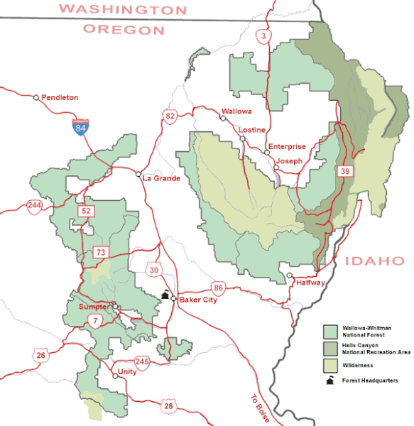
| توضیح | Map of the Wallowa-Whitman National Forest in northeastern Oregon. |
| منبع | U.S. Forest Service |
| پدیدآور | U.S. Forest Service |
| اجازهنامه (استفادهٔ مجدد از این پرونده) |
Public domain, created by federal government |
اجازهنامه
This image is a work of the Forest Service of the United States Department of Agriculture. As a work of the U.S. federal government, the image is in the public domain.
|
تاریخچهٔ پرونده
روی تاریخ/زمانها کلیک کنید تا نسخهٔ مربوط به آن هنگام را ببینید.
| تاریخ/زمان | بندانگشتی | ابعاد | کاربر | توضیح | |
|---|---|---|---|---|---|
| کنونی | ۱۴ مهٔ ۲۰۰۸، ساعت ۰۹:۳۶ | | ۶۰۰ در ۶۱۷ (۳۸ کیلوبایت) | Northwest-historian | {{Information |Description=Map of the Wallowa-Whitman National Forest in northeastern Oregon. |Source=[http://www.fs.fed.us/r6/w-w/recreation/recreation-map.shtml U.S. Forest Service] |Author=U.S. Forest Service |Permission=Public domain, created by feder |
کاربرد پرونده
صفحهٔ زیر از این تصویر استفاده میکند:
کاربرد سراسری پرونده
ویکیهای دیگر زیر از این پرونده استفاده میکنند:
- کاربرد در ca.wikipedia.org
- کاربرد در en.wikipedia.org
- کاربرد در es.wikipedia.org
- کاربرد در ja.wikipedia.org
- کاربرد در ro.wikipedia.org
- کاربرد در sh.wikipedia.org
- کاربرد در ur.wikipedia.org
- کاربرد در zh.wikipedia.org