
پرونده:Stillwater Minnesota waterfront aerial view.jpg

اندازهٔ این پیشنمایش: ۷۴۹ × ۶۰۰ پیکسل. کیفیتهای دیگر: ۳۰۰ × ۲۴۰ پیکسل | ۶۰۰ × ۴۸۰ پیکسل | ۹۵۹ × ۷۶۸ پیکسل | ۱٬۲۷۹ × ۱٬۰۲۴ پیکسل | ۱٬۵۰۰ × ۱٬۲۰۱ پیکسل.
پروندهٔ اصلی (۱٬۵۰۰ × ۱٬۲۰۱ پیکسل، اندازهٔ پرونده: ۱٫۰۵ مگابایت، نوع MIME پرونده: image/jpeg)
این پرونده در ویکیانبار موجود است. محتویات صفحهٔ توصیف آن در زیر نمایش داده میشود. |
| توضیح |
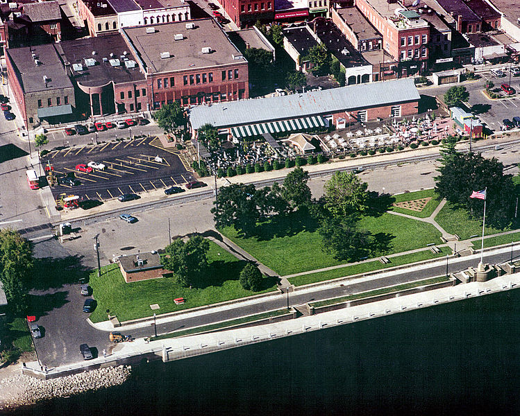
English: Aerial view of part of the waterfront section of Stillwater, Minnesota, USA, on the St. Croix River. View is to the west. The U.S. Army Corps of Engineers has constructed a floodwall along the waterfront. |
|||
| تاریخ | عکسبرداریشده در ۲۴ اوت ۱۹۹۹ | |||
| منبع |
U.S. Army Corps of Engineers Digital Visual Library Image page Image description page Digital Visual Library home page |
|||
| پدیدآور | U.S. Army Corps of Engineers, photographer not specified or unknown | |||
| اجازهنامه (استفادهٔ مجدد از این پرونده) |
|
|||
| مکان | Stillwater, Washington County, Minnesota, USA |
| مختصات دوربین | | محل قرارگیری این نگاره و سایر نگارهها در: نقشهٔ شهری باز |
|---|
تاریخچهٔ پرونده
روی تاریخ/زمانها کلیک کنید تا نسخهٔ مربوط به آن هنگام را ببینید.
| تاریخ/زمان | بندانگشتی | ابعاد | کاربر | توضیح | |
|---|---|---|---|---|---|
| کنونی | ۷ آوریل ۲۰۰۷، ساعت ۰۰:۰۸ | | ۱٬۵۰۰ در ۱٬۲۰۱ (۱٫۰۵ مگابایت) | DanMS | {{Information | Description = {{en|Aerial view of part of the waterfront section of Stillwater, Minnesota, USA, on the St. Croix River. View is to the west. The U.S. Army Corps of Engineers has constructed a floodwall along the waterfront.}} | |
کاربرد پرونده
صفحهٔ زیر از این تصویر استفاده میکند:
کاربرد سراسری پرونده
ویکیهای دیگر زیر از این پرونده استفاده میکنند:
- کاربرد در ar.wikipedia.org
- کاربرد در arz.wikipedia.org
- کاربرد در azb.wikipedia.org
- کاربرد در ca.wikipedia.org
- کاربرد در ceb.wikipedia.org
- کاربرد در ce.wikipedia.org
- کاربرد در dag.wikipedia.org
- کاربرد در en.wikipedia.org
- کاربرد در en.wikivoyage.org
- کاربرد در es.wikipedia.org
- کاربرد در eu.wikipedia.org
- کاربرد در fi.wikipedia.org
- کاربرد در fr.wikipedia.org
- کاربرد در he.wikivoyage.org
- کاربرد در ht.wikipedia.org
- کاربرد در hu.wikipedia.org
- کاربرد در ko.wikipedia.org
- کاربرد در ky.wikipedia.org
- کاربرد در lld.wikipedia.org
- کاربرد در no.wikipedia.org
- کاربرد در pl.wikipedia.org
- کاربرد در ru.wikipedia.org
- کاربرد در sh.wikipedia.org
- کاربرد در sr.wikipedia.org
- کاربرد در sv.wikipedia.org
- کاربرد در tr.wikipedia.org
- کاربرد در tt.wikipedia.org
- کاربرد در uk.wikipedia.org
- کاربرد در uz.wikipedia.org
- کاربرد در vi.wikipedia.org
- کاربرد در vo.wikipedia.org
- کاربرد در www.wikidata.org
- کاربرد در zh-min-nan.wikipedia.org
- کاربرد در zh.wikipedia.org