
پرونده:Corte Madera California aerial view.jpg

اندازهٔ این پیشنمایش: ۸۰۰ × ۵۳۴ پیکسل. کیفیتهای دیگر: ۳۲۰ × ۲۱۴ پیکسل | ۶۴۰ × ۴۲۷ پیکسل | ۱٬۰۲۴ × ۶۸۳ پیکسل | ۱٬۵۰۰ × ۱٬۰۰۱ پیکسل.
پروندهٔ اصلی (۱٬۵۰۰ × ۱٬۰۰۱ پیکسل، اندازهٔ پرونده: ۸۰۷ کیلوبایت، نوع MIME پرونده: image/jpeg)
این پرونده در ویکیانبار موجود است. محتویات صفحهٔ توصیف آن در زیر نمایش داده میشود. |
| توضیح |
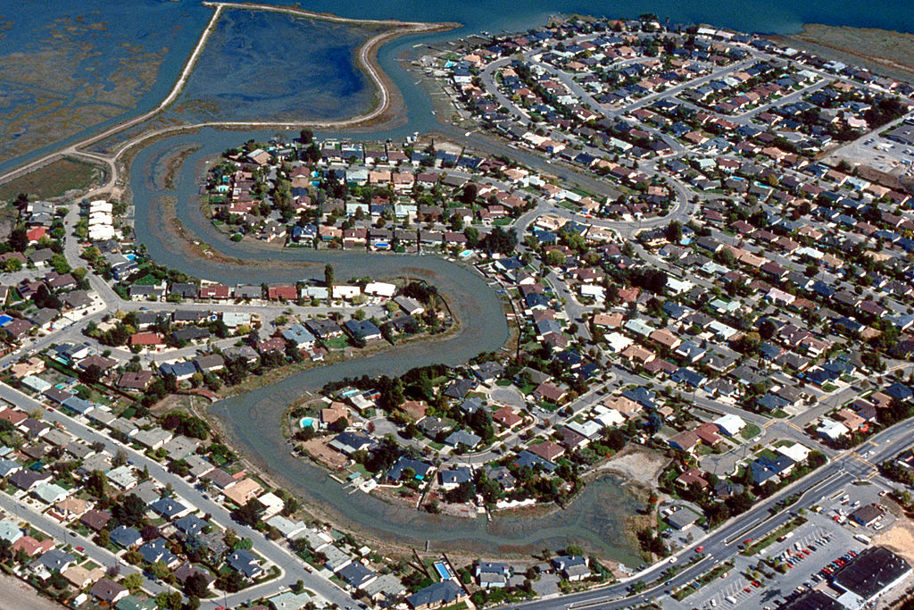
English: Aerial view of the Meadowsweet area of Corte Madera, California, USA. The city lies on the western side of upper San Francisco Bay. San Clemente Creek winds through the neighborhood. Paradise Drive is visible at the bottom of the picture. View is to the northeast.
Coordinates: 37°55′20.21″N 122°30′14.16″W / 37.9222806°N 122.5039333°W |
|||
| مکان | Corte Madera, California, USA | |||
| تاریخ | not specified or unknown | |||
| منبع |
U.S. Army Corps of Engineers Digital Visual Library Image page Image description page Digital Visual Library home page |
|||
| پدیدآور | Robert Campbell, U.S. Army Corps of Engineers | |||
| اجازهنامه (استفادهٔ مجدد از این پرونده) |
|
تاریخچهٔ پرونده
روی تاریخ/زمانها کلیک کنید تا نسخهٔ مربوط به آن هنگام را ببینید.
| تاریخ/زمان | بندانگشتی | ابعاد | کاربر | توضیح | |
|---|---|---|---|---|---|
| کنونی | ۳ مهٔ ۲۰۰۷، ساعت ۰۱:۵۷ | | ۱٬۵۰۰ در ۱٬۰۰۱ (۸۰۷ کیلوبایت) | DanMS | {{Information | Description = {{en|Aerial view of the Meadowsweet area of Corte Madera, California, USA. The city lies on the western side of upper San Francisco Bay. San Clemente Creek winds through the neighborhood. Paradise Drive is visible at the b |
کاربرد پرونده
صفحهٔ زیر از این تصویر استفاده میکند:
کاربرد سراسری پرونده
ویکیهای دیگر زیر از این پرونده استفاده میکنند:
- کاربرد در ar.wikipedia.org
- کاربرد در bg.wikipedia.org
- کاربرد در cs.wikipedia.org
- کاربرد در en.wikipedia.org
- کاربرد در es.wikipedia.org
- کاربرد در it.wikipedia.org
- کاربرد در pl.wikipedia.org
- کاربرد در pt.wikipedia.org
- کاربرد در sh.wikipedia.org
- کاربرد در sr.wikipedia.org
- کاربرد در uz.wikipedia.org