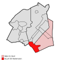
فیلرفین
فیلرفین | |
|---|---|
 Three-way bridge Noabers Badde in 2005 | |
Location of Veelerveen in the province of خرونینگن | |
| مختصات: ۵۳°۳′۲۰″ شمالی ۷°۷′۴۰″ شرقی / ۵۳٫۰۵۵۵۶°شمالی ۷٫۱۲۷۷۸°شرقی | |
| کشور | هلند |
| استان | خرونینگن (استان) |
| شهرستان | بلینگوده |
| مساحت (2012)[۱] | |
| • کل | ۴۳۰ هکتار (۱۰۶۰ جریب فرنگی) |
| • خشکی | ۴۲۳ هکتار (۱۰۴۵ جریب فرنگی) |
| • آب | ۷ هکتار (۱۷ جریب فرنگی) |
| جمعیت (۲۰۱۲)[۱] | |
| • کل | ۵۹۰ |
| • تراکم | ۱۴۰/کیلومتر مربع (۳۶۰/مایل مربع) |
| Postcode | 9566[۲] |
| Area code | ۰۵۹۷ |
فیلرفین (به هلندی: Veelerveen) یک منطقهٔ مسکونی در هلند است که در بلینگوده واقع شدهاست.[۳] فیلرفین ۵۹۰ نفر جمعیت دارد.
نگارخانه[ویرایش]
جستارهای وابسته[ویرایش]
منابع[ویرایش]
- ↑ ۱٫۰ ۱٫۱ (هلندی) Kerncijfers wijken en buurten 2009-2012, Statistics Netherlands، 2014. Retrieved on 27 April 2014.
- ↑ (هلندی) Resultaten voor "Veelerveen,", Postcode.nl. Retrieved on 27 April 2014.
- ↑ مشارکت کنندگان ویکیپدیای انگلیسی. «Veelerveen».
پیوند به بیرون[ویرایش]
| در ویکیانبار پروندههایی دربارهٔ فیلرفین موجود است. |


