
پرونده:Wales Carmarthenshire locator map.svg

حجم پیشنمایش PNG این SVG file:۵۰۲ × ۶۰۰ پیکسل کیفیتهای دیگر: ۲۰۱ × ۲۴۰ پیکسل | ۴۰۲ × ۴۸۰ پیکسل | ۶۴۳ × ۷۶۸ پیکسل | ۸۵۷ × ۱٬۰۲۴ پیکسل | ۱٬۷۱۴ × ۲٬۰۴۸ پیکسل | ۱٬۰۴۷ × ۱٬۲۵۱ پیکسل.
پروندهٔ اصلی (پروندهٔ اسویجی، با ابعاد ۱٬۰۴۷ × ۱٬۲۵۱ پیکسل، اندازهٔ پرونده: ۱۵۱ کیلوبایت)
این پرونده در ویکیانبار موجود است. محتویات صفحهٔ توصیف آن در زیر نمایش داده میشود. |
خلاصه
| توضیح |
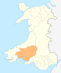
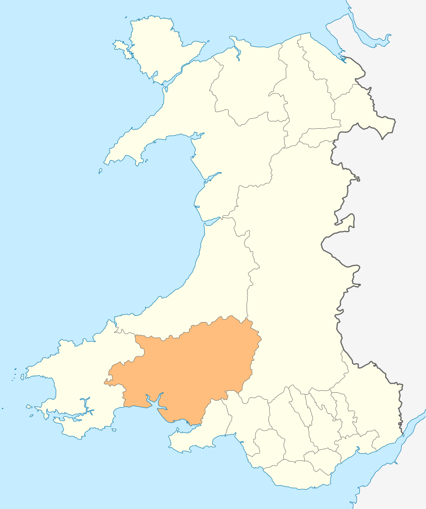
Deutsch: Lagekarte von Carmarthenshire in Wales
English: Locator map of Carmarthenshire in Wales |
| تاریخ | |
| منبع | اثر شخصی |
| پدیدآور | NordNordWest |
| اجازهنامه (استفادهٔ مجدد از این پرونده) |
من، صاحب حقوق قانونی این اثر، به این وسیله این اثر را تحث اجازهنامهٔ ذیل منتشر میکنم: این پرونده با اجازهنامهٔ کریتیو کامانز Attribution-Share Alike 3.0 سازگار نشده منتشر شده است.
|

|
این نقشه در Kartenwerkstatt "(آزمایشگاه نقشه)" آلمانی ساخته یا بهبود یافته است. همچنین می توانید نقشه هایی را برای بهبود پیشنهاد دهید.
|
تاریخچهٔ پرونده
روی تاریخ/زمانها کلیک کنید تا نسخهٔ مربوط به آن هنگام را ببینید.
| تاریخ/زمان | بندانگشتی | ابعاد | کاربر | توضیح | |
|---|---|---|---|---|---|
| کنونی | ۴ مهٔ ۲۰۱۰، ساعت ۱۸:۴۹ | | ۱٬۰۴۷ در ۱٬۲۵۱ (۱۵۱ کیلوبایت) | NordNordWest | {{int:filedesc}} {{Information |Description= {{de|Lagekarte von Carmarthenshire in Wales}} {{en|Locator map of Carmarthenshire in Wales}} |Source={{Own}} |Date=2010-05-04 |Author={{U|NordNordWest}} |Permission={{self|cc-by-sa-3.0}} |other_versions= }} {{ |
کاربرد پرونده
صفحهٔ زیر از این تصویر استفاده میکند:
کاربرد سراسری پرونده
ویکیهای دیگر زیر از این پرونده استفاده میکنند:
- کاربرد در cs.wikipedia.org
- کاربرد در de.wikipedia.org
- کاربرد در en.wikipedia.org
- WWT Llanelli Wetlands Centre
- Carmarthenshire
- Sandy, Carmarthenshire
- Llanelli
- Carmarthen
- Llandeilo
- Newcastle Emlyn
- Whitland
- Burry Port
- Kidwelly
- Llandovery
- Laugharne
- St Clears
- Pendine
- Garreg Lwyd (Black Mountain)
- Llandybie
- Llanwrda
- Afon Cothi
- Cwmann
- Bancyfelin
- Talley
- Aber-arad
- Aber-giar
- Abergorlech
- Abernant, Carmarthenshire
- Cross Hands
- Pantyffynnon
- List of places in Carmarthenshire
- Brandy Hill, Wales
- Caio, Carmarthenshire
- Template:Carmarthenshire-geo-stub
- Bryn, Llanelli
- Pemberton, Carmarthenshire
- Dafen, Carmarthenshire
- Pendine Museum of Speed
- Usk Reservoir
- River Cywyn
- Five Roads
- Maesybont
- Glanymor
- Trefawr Track
- Bethlehem, Carmarthenshire
- Stradey
- Cross Inn
- Bronwydd
- Llanfihangel Rhos-y-Corn
- St Ishmael, Carmarthenshire
- Elvet Hundred
نمایش استفادههای سراسری از این پرونده.