
پرونده:Uvea wallis island.jpg

اندازهٔ این پیشنمایش: ۴۰۳ × ۵۹۹ پیکسل. کیفیتهای دیگر: ۱۶۱ × ۲۴۰ پیکسل | ۳۲۳ × ۴۸۰ پیکسل | ۶۴۰ × ۹۵۲ پیکسل.
پروندهٔ اصلی (۶۴۰ × ۹۵۲ پیکسل، اندازهٔ پرونده: ۱۸۴ کیلوبایت، نوع MIME پرونده: image/jpeg)
این پرونده در ویکیانبار موجود است. محتویات صفحهٔ توصیف آن در زیر نمایش داده میشود. |
خلاصه
| توضیح |
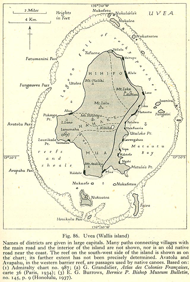
English: 1944 Map of Wallis Island (ʻUvea) Français : Carte de Wallis (ʻUvea) de 1944 |
| تاریخ | |
| منبع | http://www.lib.utexas.edu/maps/historical/pacific_islands_1943_1945/uvea_wallis_island.jpg Geographical Handbook Series, Great Britain. Admiralty. Naval Intelligence Division, 1943-1945 - Volume III : Western Pacific (Tonga to Solomon Islands), 1944. Taken from the University of Texas Library. |
| پدیدآور | Admiralty. Naval Intelligence Division. |
اجازهنامه
This work created by the United Kingdom Government is in the public domain.
This is because it is one of the following:
HMSO has declared that the expiry of Crown Copyrights applies worldwide (ref: HMSO Email Reply)
|
 |
تاریخچهٔ پرونده
روی تاریخ/زمانها کلیک کنید تا نسخهٔ مربوط به آن هنگام را ببینید.
| تاریخ/زمان | بندانگشتی | ابعاد | کاربر | توضیح | |
|---|---|---|---|---|---|
| کنونی | ۱۱ نوامبر ۲۰۰۶، ساعت ۱۷:۴۰ | | ۶۴۰ در ۹۵۲ (۱۸۴ کیلوبایت) | Ratzer |
کاربرد پرونده
صفحهٔ زیر از این تصویر استفاده میکند:
کاربرد سراسری پرونده
ویکیهای دیگر زیر از این پرونده استفاده میکنند:
- کاربرد در de.wikipedia.org
- کاربرد در en.wikipedia.org
- کاربرد در it.wikipedia.org
- کاربرد در it.wikivoyage.org
- کاربرد در la.wikipedia.org
- کاربرد در pl.wikipedia.org
- کاربرد در ru.wikipedia.org
- کاربرد در sv.wikipedia.org
- کاربرد در uk.wikipedia.org