
پرونده:Sino-Indian Geography.png
پروندهٔ اصلی (۹۱۸ × ۶۴۸ پیکسل، اندازهٔ پرونده: ۱٫۳۶ مگابایت، نوع MIME پرونده: image/png)
این پرونده در ویکیانبار موجود است. محتویات صفحهٔ توصیف آن در زیر نمایش داده میشود. |
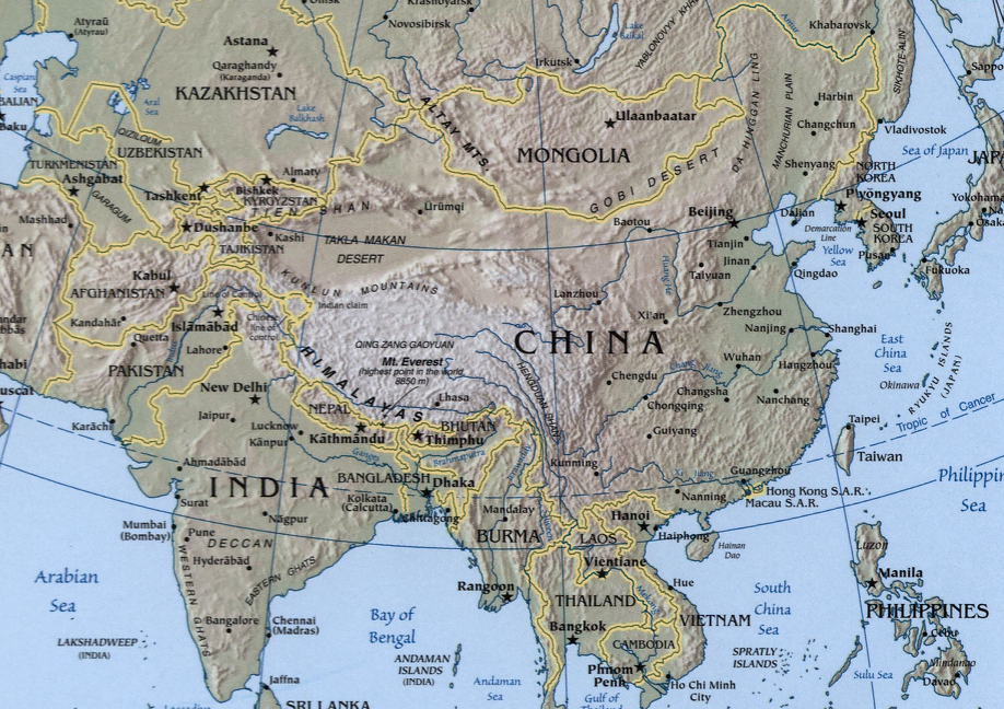
A map showing the geography of the Sino-Indian region.
A physical map with relief showing shading. Scale 1:48,000,000 ; Azimuthal equal-area projection (W 50--W 1650/N 880--S 180).
Cropped from a larger map showing Asia - which may be found on the Library of Congress website (the source image) or alternatively on the CIA World Factbook.
Image created and published by the Central Intelligence Agency of the United States of America in 2004.
Note
The land border between the China and India over Arunachal Pradesh / South Tibet reflects actual control, without dotted line showing claims
This image is in the public domain because it contains materials that originally came from the United States Central Intelligence Agency's World Factbook.
|
 |
تاریخچهٔ پرونده
روی تاریخ/زمانها کلیک کنید تا نسخهٔ مربوط به آن هنگام را ببینید.
| تاریخ/زمان | بندانگشتی | ابعاد | کاربر | توضیح | |
|---|---|---|---|---|---|
| کنونی | ۲۲ نوامبر ۲۰۰۴، ساعت ۱۹:۳۲ | | ۹۱۸ در ۶۴۸ (۱٫۳۶ مگابایت) | OldakQuill | |
| ۲۲ نوامبر ۲۰۰۴، ساعت ۰۹:۳۸ |  | ۳۵۴ در ۳۵۰ (۹۸ کیلوبایت) | OldakQuill | A map showing the geography of the Sino-Indian region. {{pd}} |
کاربرد پرونده
صفحهٔ زیر از این تصویر استفاده میکند:
کاربرد سراسری پرونده
ویکیهای دیگر زیر از این پرونده استفاده میکنند:
- کاربرد در ar.wikipedia.org
- کاربرد در bn.wikipedia.org
- کاربرد در de.wikipedia.org
- کاربرد در en.wikipedia.org
- کاربرد در fr.wikipedia.org
- کاربرد در ha.wikipedia.org
- کاربرد در hi.wikipedia.org
- کاربرد در hy.wikipedia.org
- کاربرد در id.wikipedia.org
- کاربرد در mn.wikipedia.org
- کاربرد در ms.wikipedia.org
- کاربرد در nl.wikipedia.org
- کاربرد در pnb.wikipedia.org
- کاربرد در ru.wikipedia.org
- کاربرد در sr.wikipedia.org
- کاربرد در tr.wikipedia.org
- کاربرد در uk.wikipedia.org
- کاربرد در ur.wikipedia.org
- کاربرد در uz.wikipedia.org
- کاربرد در www.wikidata.org
- کاربرد در zh.wikipedia.org