
پرونده:Minnesota Lock and Dam 1 006-062-02-1994.jpg
اندازهٔ این پیشنمایش: ۶۰۵ × ۶۰۰ پیکسل. کیفیتهای دیگر: ۲۴۲ × ۲۴۰ پیکسل | ۴۸۴ × ۴۸۰ پیکسل | ۹۲۹ × ۹۲۱ پیکسل.
پروندهٔ اصلی (۹۲۹ × ۹۲۱ پیکسل، اندازهٔ پرونده: ۲۴۶ کیلوبایت، نوع MIME پرونده: image/jpeg)
این پرونده در ویکیانبار موجود است. محتویات صفحهٔ توصیف آن در زیر نمایش داده میشود. |
خلاصه
| توضیح |
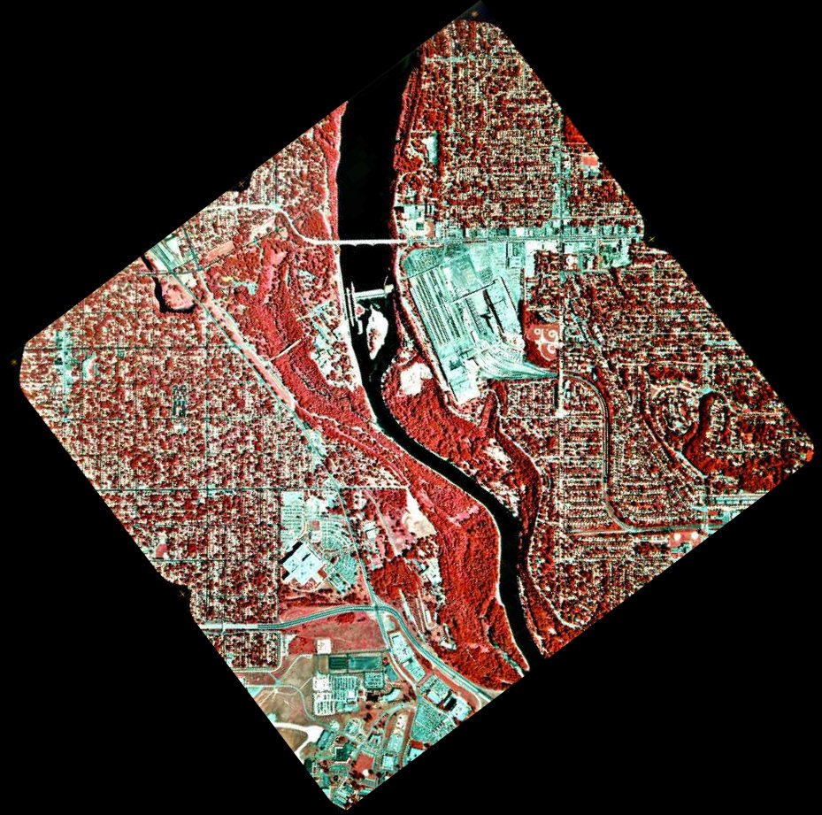
English: 1994 infrared photo of the Mississippi River between Minneapolis and Saint Paul.
Related images
|
| منبع |
Transferred from en.wikipedia to Commons by Deep silence. (original:ftp://ftp.umesc.er.usgs.gov/pub/gis_data/aerial_photos/1994_upper_mississippi_72dpi/pool_02/006-062-02-1994.jpg) |
| پدیدآور |
.jpg)

اجازهنامه
این تصویر در مالکیت عمومی است زیرا تنها پدیدآور آن سازمان زمینشناسی آمریکا است که یکی از سازمانهای وابسته به وزارت کشور ایالات متحده آمریکا به شمار میرود. برای اطلاعات بیشتر سیاستهای رسمی حق تکثیر سازمان زمینشناسی آمریکا را ببینید.
|
سیاهه بارگذاری اصلی
صفحهٔ اصلی توضیحات اینجابود. همهٔ نامهای کاربر زیر به en.wikipedia اشاره دارند.
- 2005-08-20 04:55 SEWilco 929×921× (252387 bytes) 1994 infrared photo of the [[Mississippi River]] between [[Minneapolis, Minnesota|Minneapolis]] and [[Saint Paul, Minnesota|Saint Paul]]. Ford Bridge is just north of Lock and Dam 1, between the Saint Paul Ford Assembly Plant on the right, and Minnehaha
تاریخچهٔ پرونده
روی تاریخ/زمانها کلیک کنید تا نسخهٔ مربوط به آن هنگام را ببینید.
| تاریخ/زمان | بندانگشتی | ابعاد | کاربر | توضیح | |
|---|---|---|---|---|---|
| کنونی | ۶ ژوئیهٔ ۲۰۱۰، ساعت ۱۳:۳۹ | | ۹۲۹ در ۹۲۱ (۲۴۶ کیلوبایت) | Deep silence | {{Information |Description={{en|1994 infrared photo of the en:Mississippi River between Minneapolis and Saint Paul. * North is up. * Dark red is vegetation while bluish-green is roads, as |
کاربرد پرونده
صفحههای زیر از این تصویر استفاده میکنند:
کاربرد سراسری پرونده
ویکیهای دیگر زیر از این پرونده استفاده میکنند:
- کاربرد در en.wikipedia.org
- کاربرد در fr.wikipedia.org
- کاربرد در hy.wikipedia.org
- کاربرد در te.wikipedia.org