
پرونده:Location map of Vermilion County, Illinois.svg

حجم پیشنمایش PNG این SVG file:۶۰۰ × ۶۰۰ پیکسل کیفیتهای دیگر: ۲۴۰ × ۲۴۰ پیکسل | ۴۸۰ × ۴۸۰ پیکسل | ۷۶۸ × ۷۶۸ پیکسل | ۱٬۰۲۴ × ۱٬۰۲۴ پیکسل | ۲٬۰۴۸ × ۲٬۰۴۸ پیکسل.
پروندهٔ اصلی (پروندهٔ اسویجی، با ابعاد ۷۶۸ × ۷۶۸ پیکسل، اندازهٔ پرونده: ۲۱۰ کیلوبایت)
این پرونده در ویکیانبار موجود است. محتویات صفحهٔ توصیف آن در زیر نمایش داده میشود. |
خلاصه
| توضیح |
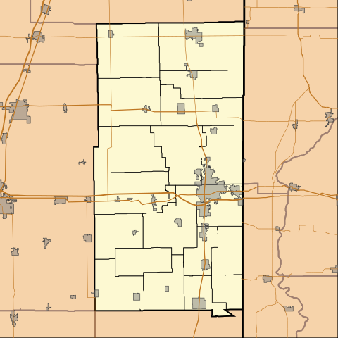
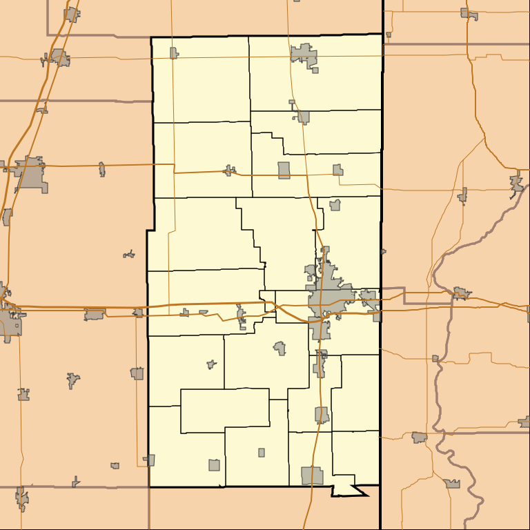
English: This is a map of Vermilion County, Illinois, USA which includes township borders. |
| تاریخ | |
| منبع | My own work, using custom-written MapScript applications with National Atlas and United States Census Bureau data |
| پدیدآور | Omnedon |
اجازهنامه
| من، دارنده حق تکثیر این اثر، این اثر را به مالکیت عمومی منتشر میکنم. این قابل اجرا در تمام نقاط جهان است. در برخی از کشورها ممکن است به صورت قانونی این امکانپذیر نباشد؛ اگر چنین است: من اجازهٔ استفاده از این اثر را برای هر مقصودی، بدون هیچگونه شرایطی میدهم، تا وقتی که این شرایط توسط قانون مستلزم نشده باشد. |
تاریخچهٔ پرونده
روی تاریخ/زمانها کلیک کنید تا نسخهٔ مربوط به آن هنگام را ببینید.
| تاریخ/زمان | بندانگشتی | ابعاد | کاربر | توضیح | |
|---|---|---|---|---|---|
| کنونی | ۲۱ اوت ۲۰۱۰، ساعت ۰۳:۵۲ | | ۷۶۸ در ۷۶۸ (۲۱۰ کیلوبایت) | Omnedon | == {{int:filedesc}} == {{Information |Description={{en|This is a map of Vermilion County, Illinois, USA which includes township borders.}} |Source=My own work, using custom-written MapScript applications with [http://www. |
کاربرد پرونده
صفحههای زیر از این تصویر استفاده میکنند:
کاربرد سراسری پرونده
ویکیهای دیگر زیر از این پرونده استفاده میکنند:
- کاربرد در ar.wikipedia.org
- کاربرد در azb.wikipedia.org
- کاربرد در ceb.wikipedia.org
- کاربرد در en.wikipedia.org
- Allerton, Illinois
- Belgium, Illinois
- Catlin, Illinois
- Fairmount, Illinois
- Fithian, Illinois
- Georgetown, Illinois
- Henning, Illinois
- Hoopeston, Illinois
- Indianola, Illinois
- Muncie, Illinois
- Oakwood, Illinois
- Potomac, Illinois
- Rankin, Illinois
- Ridge Farm, Illinois
- Rossville, Illinois
- Sidell, Illinois
- Tilton, Illinois
- Westville, Illinois
- Vermilion Regional Airport
- Illiana, Illinois
- Cheneyville, Illinois
- Armstrong, Illinois
- Hartshorn, Illinois
- Module:Location map/data/USA Illinois Vermilion County/doc
- Jamesburg, Illinois
- Module:Location map/data/USA Illinois Vermilion County
- کاربرد در fr.wikipedia.org
- کاربرد در kn.wikipedia.org
- کاربرد در sh.wikipedia.org
- کاربرد در si.wikipedia.org
- کاربرد در sr.wikipedia.org
- کاربرد در tr.wikipedia.org
- کاربرد در ur.wikipedia.org
- کاربرد در uz.wikipedia.org
- کاربرد در war.wikipedia.org
- کاربرد در zh.wikipedia.org