
پرونده:Caspian Forests (207720547).jpeg

اندازهٔ این پیشنمایش: ۸۰۰ × ۵۵۴ پیکسل. کیفیتهای دیگر: ۳۲۰ × ۲۲۱ پیکسل | ۶۴۰ × ۴۴۳ پیکسل | ۱٬۰۲۴ × ۷۰۹ پیکسل | ۱٬۲۸۰ × ۸۸۶ پیکسل | ۲٬۰۴۸ × ۱٬۴۱۷ پیکسل.
پروندهٔ اصلی (۲٬۰۴۸ × ۱٬۴۱۷ پیکسل، اندازهٔ پرونده: ۱٫۵ مگابایت، نوع MIME پرونده: image/jpeg)
این پرونده در ویکیانبار موجود است. محتویات صفحهٔ توصیف آن در زیر نمایش داده میشود. |
.jpeg?uselang=fa)
خلاصه
| Caspian Forests | |
|---|---|
| عکاس | |
| عنوان |
Caspian Forests |
| توضیح |
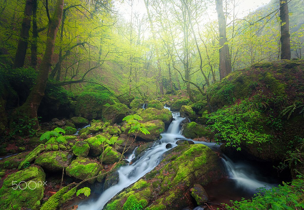
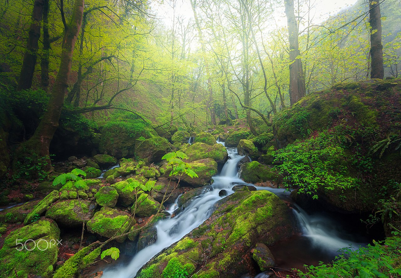
500px provided description: "Hyrcanian forests " ' Hyrcanian Forest ' contains remnants (refugia) of the broad leaf forests that once covered most of the North Temperate Zone 25 - 50 million years ago, in the early Cenozoic Era. As the climate and land forms changed, this forest disappeared from most of its former range, being replaced by shrublands, grasslands, and woodlands. During the Pleistocene ("Ice Ages"), glaciations had minimal impact on Hyrcanian Forest. North of Iran as along band has diverse natural, economic and social conditions. Hyrcanian forest contain the most important and significant natural habitats for in-situ conservation of biological diversity, including those containing threatened species of outstanding universal value from the point of view of science or conservation." The Caspian forest "(North of Iran) areas are among the most unique and splendid biomes of the world. The Caspian forests have high moisture content, so forest trees are host to many epiphytes such as mosses, ferns, lichens, mistletoes and some flowering plants. Soils are productive and rich in minerals and organic matter [#landscape ,#fog ,#forest ,#spring ,#nature ,#river ,#tree ,#long exposure ,#fine art ,#iran] |
| تاریخ | ۷ آوریل ۲۰۱۷, ۱۷:۰۹:۰۶ |
| منبع | Imported from 500px (archived version) by the Archive Team. (detail page) |
| اجازهنامه (استفادهٔ مجدد از این پرونده) |
این پرونده با اجازهنامهٔ کریتیو کامانز Attribution-Share Alike 3.0 سازگار نشده منتشر شده است.
|
| مختصات دوربین | | محل قرارگیری این نگاره و سایر نگارهها در: نقشهٔ شهری باز |
|---|
.jpeg¶ms=037.280946_N_0049.592413_E_globe:Earth_type:camera__&language=fa)
تاریخچهٔ پرونده
روی تاریخ/زمانها کلیک کنید تا نسخهٔ مربوط به آن هنگام را ببینید.
| تاریخ/زمان | بندانگشتی | ابعاد | کاربر | توضیح | |
|---|---|---|---|---|---|
| کنونی | ۱ نوامبر ۲۰۱۹، ساعت ۱۲:۰۰ | | ۲٬۰۴۸ در ۱٬۴۱۷ (۱٫۵ مگابایت) | Rodrigo.Argenton | Photo Caspian Forests imported from 500px with import-500px |
کاربرد پرونده
صفحهٔ زیر از این تصویر استفاده میکند:
کاربرد سراسری پرونده
ویکیهای دیگر زیر از این پرونده استفاده میکنند:
- کاربرد در az.wikipedia.org
- کاربرد در bn.wikipedia.org
- کاربرد در ml.wikipedia.org
- کاربرد در mt.wikipedia.org
- کاربرد در pt.wikipedia.org
- کاربرد در sh.wikipedia.org
- کاربرد در sl.wikipedia.org
.jpeg)