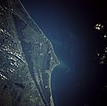
پرونده:Cape canaveral.jpg

اندازهٔ این پیشنمایش: ۶۰۶ × ۶۰۰ پیکسل. کیفیتهای دیگر: ۲۴۲ × ۲۴۰ پیکسل | ۴۸۵ × ۴۸۰ پیکسل | ۷۷۶ × ۷۶۸ پیکسل | ۱٬۰۳۵ × ۱٬۰۲۴ پیکسل | ۲٬۰۶۹ × ۲٬۰۴۸ پیکسل | ۵٬۳۲۰ × ۵٬۲۶۶ پیکسل.
پروندهٔ اصلی (۵٬۳۲۰ × ۵٬۲۶۶ پیکسل، اندازهٔ پرونده: ۷٫۷۹ مگابایت، نوع MIME پرونده: image/jpeg)
تاریخچهٔ پرونده
روی تاریخ/زمانها کلیک کنید تا نسخهٔ مربوط به آن هنگام را ببینید.
| تاریخ/زمان | بندانگشتی | ابعاد | کاربر | توضیح | |
|---|---|---|---|---|---|
| کنونی | ۲۱ مارس ۲۰۰۹، ساعت ۱۹:۳۵ |  | ۵٬۳۲۰ در ۵٬۲۶۶ (۷٫۷۹ مگابایت) | Jhf | Same image with greater resolution |
| ۱۸ ژوئن ۲۰۰۵، ساعت ۰۲:۳۹ |  | ۵۰۴ در ۶۳۳ (۹۸ کیلوبایت) | Charlitos~commonswiki | Cape Canaveral, Florida, USA - August 1991 from: http://en.wikipedia.org/wiki/Image:Cape_canaveral.jpg image description [http://eol.jsc.nasa.gov/sseop/EFS/photoinfo.pl?PHOTO=STS043-84-31 here] {{PD-USGov-NASA}} |
کاربرد پرونده
صفحههای زیر از این تصویر استفاده میکنند:
کاربرد سراسری پرونده
ویکیهای دیگر زیر از این پرونده استفاده میکنند:
- کاربرد در af.wikipedia.org
- کاربرد در ang.wikipedia.org
- کاربرد در ar.wikipedia.org
- کاربرد در ast.wikipedia.org
- کاربرد در az.wikipedia.org
- کاربرد در be.wikipedia.org
- کاربرد در bg.wikipedia.org
- کاربرد در bn.wikipedia.org
- کاربرد در bs.wikipedia.org
- کاربرد در ca.wikipedia.org
- کاربرد در ceb.wikipedia.org
- کاربرد در ckb.wikipedia.org
- کاربرد در cs.wikipedia.org
- کاربرد در da.wikipedia.org
- کاربرد در de.wikipedia.org
- کاربرد در de.wikinews.org
- کاربرد در de.wikivoyage.org
- کاربرد در el.wikipedia.org
- کاربرد در en.wikipedia.org
- کاربرد در en.wikiversity.org
- کاربرد در eo.wikipedia.org
- کاربرد در es.wikipedia.org
- کاربرد در et.wikipedia.org
- کاربرد در eu.wikipedia.org
- کاربرد در fi.wikipedia.org
- کاربرد در fr.wikipedia.org
- کاربرد در gl.wikipedia.org
- کاربرد در he.wikipedia.org
- کاربرد در he.wikivoyage.org
- کاربرد در hr.wikipedia.org
- کاربرد در hu.wikipedia.org
- کاربرد در hy.wikipedia.org
- کاربرد در id.wikipedia.org
نمایش استفادههای سراسری از این پرونده.
