
پرونده:Aden map War Office 1948.jpg
اندازهٔ این پیشنمایش: ۸۰۰ × ۴۲۱ پیکسل. کیفیتهای دیگر: ۳۲۰ × ۱۶۸ پیکسل | ۶۴۰ × ۳۳۷ پیکسل | ۱٬۰۰۰ × ۵۲۶ پیکسل.
پروندهٔ اصلی (۱٬۰۰۰ × ۵۲۶ پیکسل، اندازهٔ پرونده: ۱۳۶ کیلوبایت، نوع MIME پرونده: image/jpeg)
این پرونده در ویکیانبار موجود است. محتویات صفحهٔ توصیف آن در زیر نمایش داده میشود. |
خلاصه
| توضیح |
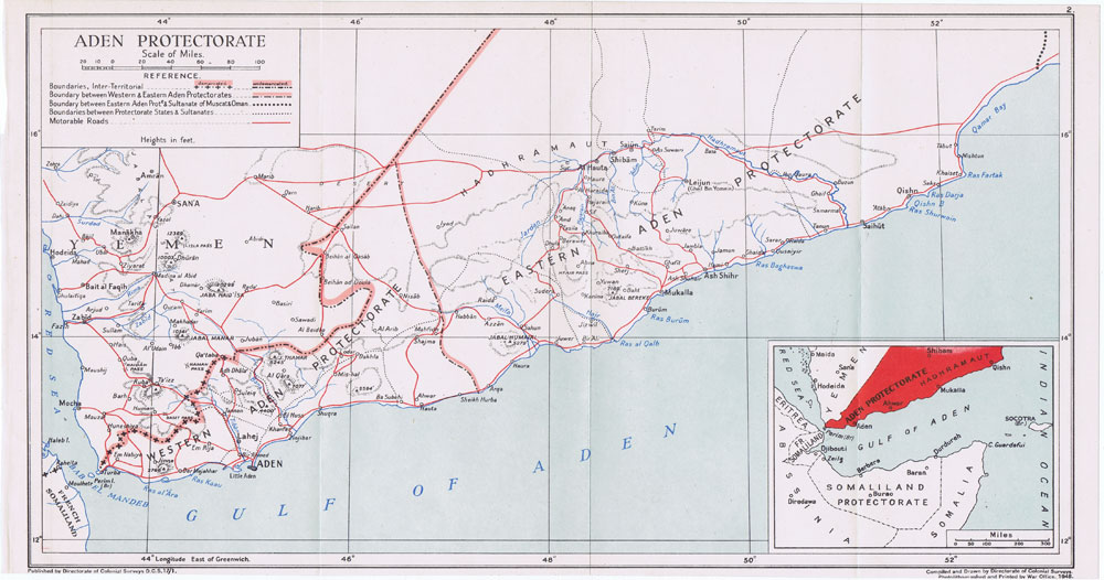
English: Map of the Aden Protectorate showing the Western and the Eastern Protectorates. Directorate of colonial surveys, 1948 |
| تاریخ | |
| منبع | http://www.pennymead.com/results.php?ct=4&sub=9&m=s |
| پدیدآور | Directorate of colonial surveys. Printed by the War Office, UK, 1948 |
اجازهنامه
This work created by the United Kingdom Government is in the public domain.
This is because it is one of the following:
HMSO has declared that the expiry of Crown Copyrights applies worldwide (ref: HMSO Email Reply)
|
 |
تاریخچهٔ پرونده
روی تاریخ/زمانها کلیک کنید تا نسخهٔ مربوط به آن هنگام را ببینید.
| تاریخ/زمان | بندانگشتی | ابعاد | کاربر | توضیح | |
|---|---|---|---|---|---|
| کنونی | ۲۲ اوت ۲۰۱۴، ساعت ۲۱:۱۵ | | ۱٬۰۰۰ در ۵۲۶ (۱۳۶ کیلوبایت) | Lubiesque | User created page with UploadWizard |
کاربرد پرونده
صفحهٔ زیر از این تصویر استفاده میکند:
کاربرد سراسری پرونده
ویکیهای دیگر زیر از این پرونده استفاده میکنند:
- کاربرد در ar.wikipedia.org
- کاربرد در en.wikipedia.org
- کاربرد در fi.wikipedia.org
- کاربرد در it.wikipedia.org
- کاربرد در mk.wikipedia.org
- کاربرد در no.wikipedia.org
- کاربرد در zh.wikipedia.org