
پرونده:Los Alamos aerial view.jpeg

پروندهٔ اصلی (۱٬۴۳۵ × ۱٬۱۵۳ پیکسل، اندازهٔ پرونده: ۷۵۷ کیلوبایت، نوع MIME پرونده: image/jpeg)
این پرونده در ویکیانبار موجود است. محتویات صفحهٔ توصیف آن در زیر نمایش داده میشود. |
خلاصه
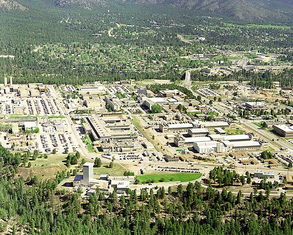
| توضیح | Aerial view of Los Alamos National Laboratory, "1995 aerial TA-3 south to north". |
| منبع | http://www.lanl.gov/worldview/news/photos/aerials.shtml |
| پدیدآور | Los Alamos National Laboratory |
| مختصات شیء | | محل قرارگیری این نگاره و سایر نگارهها در: نقشهٔ شهری باز |
|---|
|
This is an image of a place or building that is listed on the National Register of Historic Places in the United States of America. Its reference number is 66000893. |

|
اطلاعات منتسب، مثل نام مولف، ایمیل، وبگاه، یا امضا، که زمانی در خود تصویر مشهود بودهاست، «به متادیتای تصویر و/یا صفحه اطلاعات تصویر منتقل شدهاست.» این امر استفاده از تصویر را آسانتر و از نظر زبانی خنثی میسازد. ویکیانبار استفاده واضح از اطلاعات مولف را روی تصویر توصیه نمیکند.
|
اجازهنامه

|
This image comes from Los Alamos National Laboratory, a national laboratory privately operated under contract from the United States Department of Energy by Los Alamos National Security, LLC between October 1, 2007 and October 31, 2018. LANL allowed anyone to use it for any purpose, provided that the copyright holder is properly attributed. Redistribution, derivative work, commercial use, and all other use is permitted. LANL requires the following text be used when crediting images to it: (link)
Unless otherwise indicated, this information has been authored by an employee or employees of the Los Alamos National Security, LLC (LANS), operator of the Los Alamos National Laboratory under Contract No. DE-AC52-06NA25396 with the U.S. Department of Energy. The U.S. Government has rights to use, reproduce, and distribute this information. The public may copy and use this information without charge, provided that this Notice and any statement of authorship are reproduced on all copies. Neither the Government nor LANS makes any warranty, express or implied, or assumes any liability or responsibility for the use of this information. |
|
تاریخچهٔ پرونده
روی تاریخ/زمانها کلیک کنید تا نسخهٔ مربوط به آن هنگام را ببینید.
| تاریخ/زمان | بندانگشتی | ابعاد | کاربر | توضیح | |
|---|---|---|---|---|---|
| کنونی | ۲۶ ژوئن ۲۰۱۱، ساعت ۱۴:۲۲ | | ۱٬۴۳۵ در ۱٬۱۵۳ (۷۵۷ کیلوبایت) | Keraunoscopia | removed watermark |
| ۸ مهٔ ۲۰۰۵، ساعت ۰۹:۱۸ |  | ۱٬۴۳۵ در ۱٬۱۵۳ (۷۵۰ کیلوبایت) | Floriang | Aerial view of Los Alamos National Laboratory, "1995 aerial TA-3 south to north", from http://www.lanl.gov/worldview/news/photos/aerials.shtml ''Source:'' en.wikipedia.org, upload by Fastfission {{PD-USGov}} [[Category:Bi |
کاربرد پرونده
صفحههای زیر از این تصویر استفاده میکنند:
کاربرد سراسری پرونده
ویکیهای دیگر زیر از این پرونده استفاده میکنند:
- کاربرد در ar.wikipedia.org
- کاربرد در bg.wikipedia.org
- کاربرد در bn.wikipedia.org
- کاربرد در bo.wikipedia.org
- کاربرد در br.wikipedia.org
- کاربرد در ca.wikipedia.org
- کاربرد در cs.wikipedia.org
- کاربرد در da.wikipedia.org
- کاربرد در de.wikipedia.org
- کاربرد در en.wikipedia.org
- Fermi paradox
- Los Alamos National Laboratory
- Theodore Hall
- Bechtel
- Albuquerque–Santa Fe–Los Alamos combined statistical area
- List of National Historic Landmarks in New Mexico
- National Register of Historic Places listings in Los Alamos County, New Mexico
- User:CM at Bechtel/Major projects table
- Draft:Triad National Security
- کاربرد در en.wikiversity.org
- کاربرد در eo.wikipedia.org
- کاربرد در es.wikipedia.org
- کاربرد در et.wikipedia.org
- کاربرد در eu.wikipedia.org
- کاربرد در fi.wikipedia.org
- کاربرد در fr.wikipedia.org
- کاربرد در gl.wikipedia.org
- کاربرد در ha.wikipedia.org
- کاربرد در he.wikipedia.org
- کاربرد در hy.wikipedia.org
- کاربرد در id.wikipedia.org
نمایش استفادههای سراسری از این پرونده.