
پرونده:Koninkrijk der Nederlanden.png

اندازهٔ این پیشنمایش: ۶۲۴ × ۵۹۹ پیکسل. کیفیتهای دیگر: ۲۵۰ × ۲۴۰ پیکسل | ۵۰۰ × ۴۸۰ پیکسل | ۷۹۹ × ۷۶۸ پیکسل | ۱٬۱۷۱ × ۱٬۱۲۵ پیکسل.
پروندهٔ اصلی (۱٬۱۷۱ × ۱٬۱۲۵ پیکسل، اندازهٔ پرونده: ۲۴۱ کیلوبایت، نوع MIME پرونده: image/png)
این پرونده در ویکیانبار موجود است. محتویات صفحهٔ توصیف آن در زیر نمایش داده میشود. |
خلاصه
| توضیح |
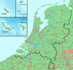
Deutsch: Karte des Königreichs der Niederlande. Das Festland und die Inseln befinden sich auf derselben Ebene.
English: Map of the Kingdom of the Netherlands. The mainland and all the islands are on the same scale.
Nederlands: Kaart van het Koninkrijk der Nederlanden. Het vasteland (Nederland) en de eilanden worden getoond op dezelfde schaal. |
||||
| تاریخ | |||||
| منبع | Gebaseerd op/Based on http://www.demis.nl/wms/mapclip.htm (free software based on a free database/vrije software gebaseerd op een vrije database) | ||||
| پدیدآور | Bewerkt door/Edited by Maarten van der Bent | ||||
| اجازهنامه (استفادهٔ مجدد از این پرونده) |
|
تاریخچهٔ پرونده
روی تاریخ/زمانها کلیک کنید تا نسخهٔ مربوط به آن هنگام را ببینید.
| تاریخ/زمان | بندانگشتی | ابعاد | کاربر | توضیح | |
|---|---|---|---|---|---|
| کنونی | ۵ اوت ۲۰۱۰، ساعت ۲۳:۱۳ | | ۱٬۱۷۱ در ۱٬۱۲۵ (۲۴۱ کیلوبایت) | Ras67 | cropped and squeezed |
| ۳۰ اکتبر ۲۰۰۸، ساعت ۲۲:۳۱ |  | ۱٬۱۸۰ در ۱٬۱۳۵ (۳۹۸ کیلوبایت) | Pbech | Fixed some glaring errors/anachronisms concerning railways. Situation is now (as far as I can see) updated to 2008 | |
| ۲۴ آوریل ۲۰۰۷، ساعت ۲۰:۰۱ |  | ۱٬۱۸۰ در ۱٬۱۳۵ (۴۰۰ کیلوبایت) | Maartenvdbent~commonswiki | bigger names | |
| ۲۴ آوریل ۲۰۰۷، ساعت ۱۸:۱۹ |  | ۱٬۱۷۹ در ۱٬۱۳۵ (۳۹۴ کیلوبایت) | Maartenvdbent~commonswiki | without hand | |
| ۲۴ آوریل ۲۰۰۷، ساعت ۱۷:۰۸ |  | ۱٬۱۷۹ در ۱٬۱۳۵ (۳۹۴ کیلوبایت) | Maartenvdbent~commonswiki | {{Information |Description=Map of the Kingdom of the Netherlands |Source=Based on http://www.demis.nl/wms/mapclip.htm (free software based on free database) |Date=2007-04-24 |Author=Edited by Maarten van der Bent |Permissi |
کاربرد پرونده
صفحههای زیر از این تصویر استفاده میکنند:
کاربرد سراسری پرونده
ویکیهای دیگر زیر از این پرونده استفاده میکنند:
- کاربرد در af.wikipedia.org
- کاربرد در ar.wikipedia.org
- کاربرد در bn.wikipedia.org
- کاربرد در ca.wikipedia.org
- کاربرد در chy.wikipedia.org
- کاربرد در da.wikipedia.org
- کاربرد در de.wikipedia.org
- کاربرد در el.wikipedia.org
- کاربرد در en.wikipedia.org
- کاربرد در eo.wikipedia.org
- کاربرد در es.wikipedia.org
- کاربرد در eu.wikipedia.org
- کاربرد در fy.wikipedia.org
- کاربرد در hr.wikipedia.org
- کاربرد در id.wikipedia.org
- کاربرد در it.wikipedia.org
- کاربرد در ja.wikipedia.org
- کاربرد در ko.wikipedia.org
- کاربرد در ml.wikipedia.org
- کاربرد در nl.wikipedia.org
- کاربرد در no.wikipedia.org
- کاربرد در pl.wikipedia.org
- کاربرد در pt.wikipedia.org
- کاربرد در ro.wikipedia.org
- کاربرد در sv.wikipedia.org
- کاربرد در tl.wikipedia.org
- کاربرد در uk.wikipedia.org
- کاربرد در zh-classical.wikipedia.org
- کاربرد در zh.wikipedia.org