
پرونده:Detailed map of Goddard, Kansas.png
تفکیکپذیری بالاتری در دسترس نیست.
Detailed_map_of_Goddard,_Kansas.png (۵۷۵ × ۴۲۵ پیکسل، اندازهٔ پرونده: ۳۰ کیلوبایت، نوع MIME پرونده: image/png)
این پرونده در ویکیانبار موجود است. محتویات صفحهٔ توصیف آن در زیر نمایش داده میشود. |
| توضیح |
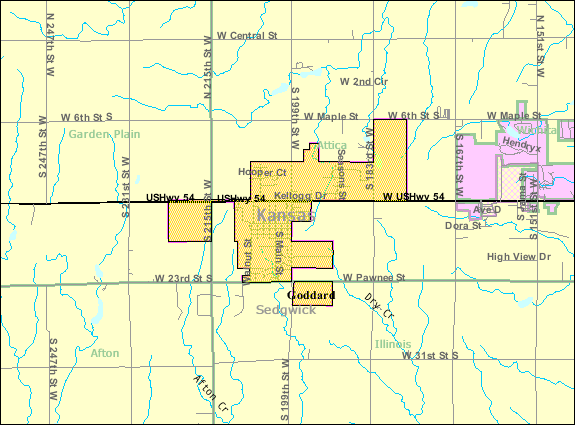
English: Map of Goddard, Kansas |
|||
| تاریخ | تاریخ نامعلوم; downloaded 7 August 2010 | |||
| منبع | http://factfinder.census.gov/servlet/MapItDrawServlet?geo_id=16000US2026725&_bucket_id=50&tree_id=420&context=saff&_lang=en&_sse=on, from http://factfinder.census.gov | |||
| پدیدآور | United States Census Bureau | |||
| اجازهنامه (استفادهٔ مجدد از این پرونده) |
|

سیاهه بارگذاری اصلی
| تاریخ/زمان | ابعاد | کاربر | توضیح |
|---|---|---|---|
| ۷ اوت ۲۰۱۰, ۱۴:۴۵:۱۳ | 575 × 425 (33736 bytes) | FUBAR007 (بحث · مشارکتها) | {{Information |Description={{en|1=Map of {{w|Goddard, Kansas}}}} |Source=http://factfinder.census.gov/servlet/MapItDrawServlet?geo_id=16000US2026725&_bucket_id=50&tree_id=420&context=saff&_lang=en&_sse=on, from http://factfinder.census.gov |Author={{w|Uni |
تاریخچهٔ پرونده
روی تاریخ/زمانها کلیک کنید تا نسخهٔ مربوط به آن هنگام را ببینید.
| تاریخ/زمان | بندانگشتی | ابعاد | کاربر | توضیح | |
|---|---|---|---|---|---|
| کنونی | ۱۱ دسامبر ۲۰۱۴، ساعت ۰۴:۴۴ | | ۵۷۵ در ۴۲۵ (۳۰ کیلوبایت) | GifTagger | Bot: Converting file to superior PNG file. (Source: Detailed_map_of_Goddard,_Kansas.gif). This GIF was problematic due to non-greyscale color table. |
کاربرد پرونده
صفحهٔ زیر از این تصویر استفاده میکند:
کاربرد سراسری پرونده
ویکیهای دیگر زیر از این پرونده استفاده میکنند:
- کاربرد در sh.wikipedia.org